St. Louis

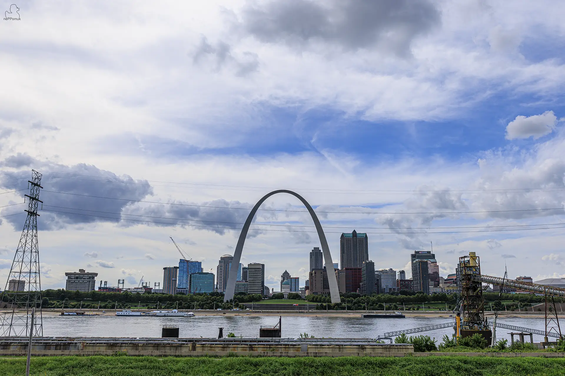
St. Louis is located in the U.S. state of Missouri on the western bank of the Mississippiand is one of the most historically significant cities in the American Midwest. Founded in 1764, the city developed from a French trading post into an important economic and transportation center. Its location near the confluence of the Missouri and Mississippi made it an important starting point for trade, migration, and the development of the American West. It is no coincidence that St. Louis bears the nickname “Gateway to the West” – Gateway to the West.
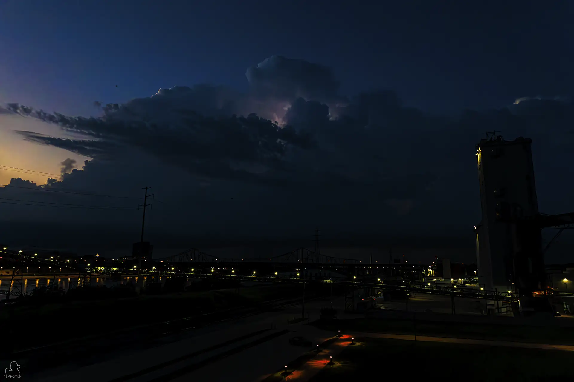
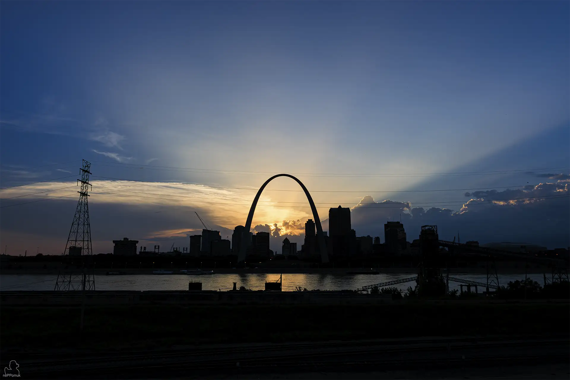
To this day, this history shapes the cityscape. Historic brick buildings, monumental public buildings, expansive railway facilities, and modern skyscrapers are often found in the immediate vicinity of one another. With the Gateway ArchSt. Louis has one of the USA’s best-known landmarks. Along the Mississippi, historic steel bridges, freight trains, and industrial port facilities recall the city’s economic foundations.
But St. Louis offers far more than the Gateway Arch and its famous skyline. Public art, a diverse music history, long-established restaurants, and distinctly shaped neighborhoods make the metropolis a varied travel destination. The combination of historic architecture, industrial heritage, and everyday city life in particular opens up interesting photographic perspectives. St. Louis is an American major city whose history is visible not only in museums, but also in its streets, buildings, and transportation routes.
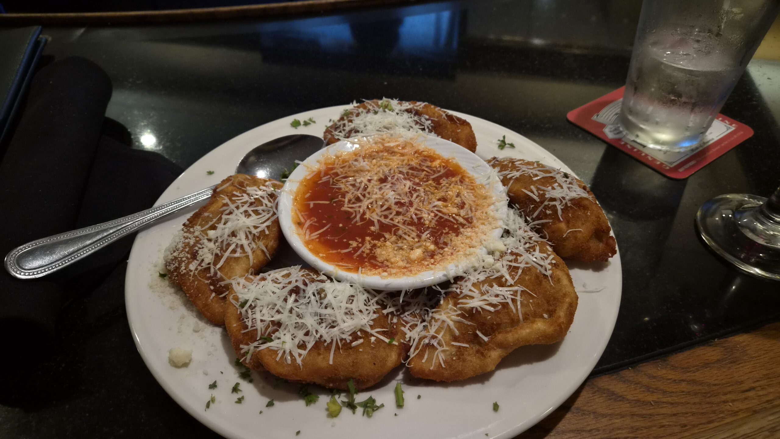
The crispy stuffed pasta pockets reflect the Italian influence on the regional cuisine.

Breaded and fried brain in a bun recalls the region’s historic working-class and slaughterhouse culture.
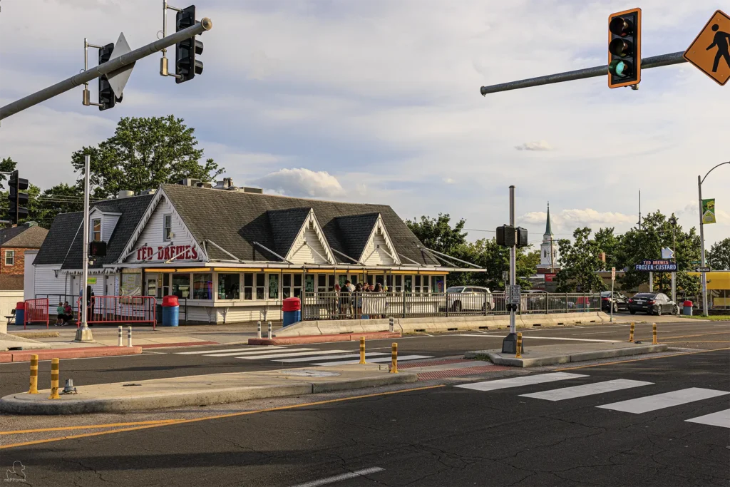
- Architektur, Brain Sandwich, Cathedral Basilica of Saint Louis, Citygarden St. Louis, Eads Bridge, East St. Louis, Gateway Arch, Mississippi River, Old Courthouse St. Louis, Route 66, Scott Joplin, Soldiers Memorial St. Louis, St. Louis, St. Louis Sehenswürdigkeiten, Ted Drewes Frozen Custard, Toasted Ravioli, Union Station St. Louis
St. Louis on the Mississippi
History, trade and historic bridges
The history of St. Louisis inseparably linked to the Mississippi. The mighty river not only determined the location of the original settlement, but also influenced its economic, social and urban development over centuries. As a natural transportation route, it connected the region with the trade centers in the southern United States. Together with the nearby Missouri River, it also opened access to large parts of the North American interior.
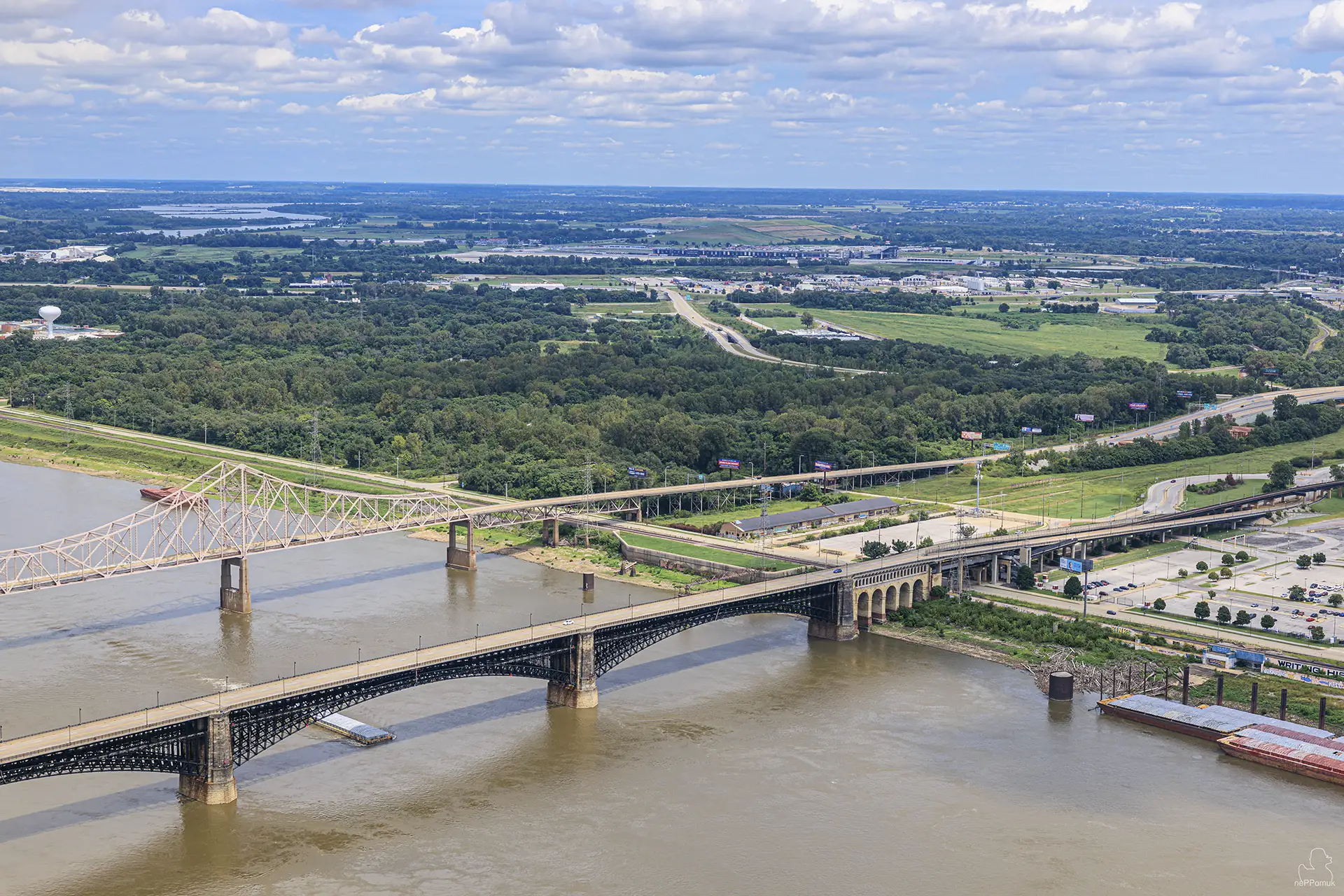
A major port city first emerged from a French trading post and later a center for industry, rail traffic and interstate goods trade. The historic waterfront zone, numerous bridges and extensive rail facilities document this transformation to the present day. At the same time, the Mississippi makes the region’s different faces visible: on the western side lies the urban center of St. Louis in Missouri, while on the opposite bank the transport and industrial facilities of East St. Louis in Illinoisextend.
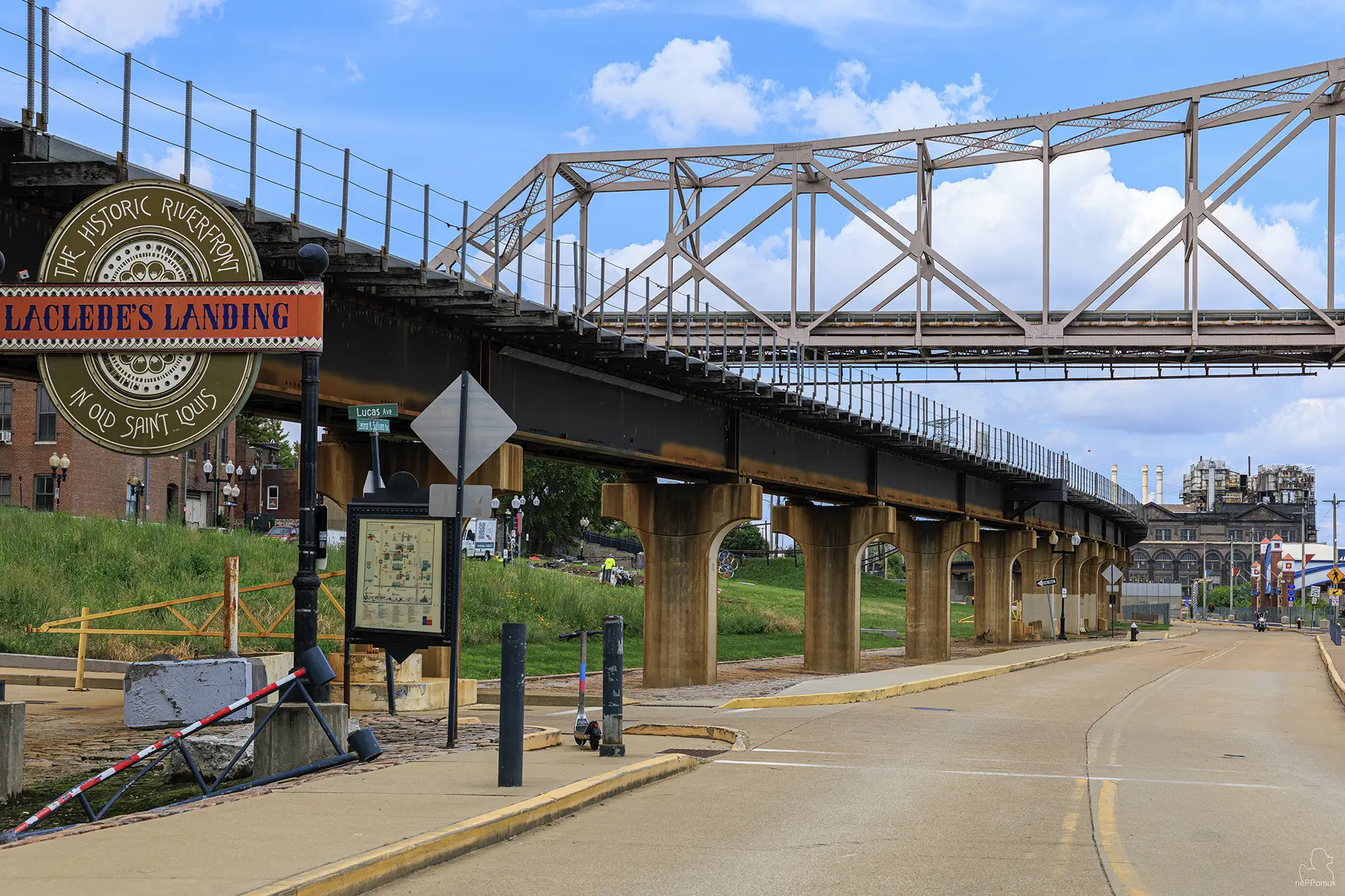
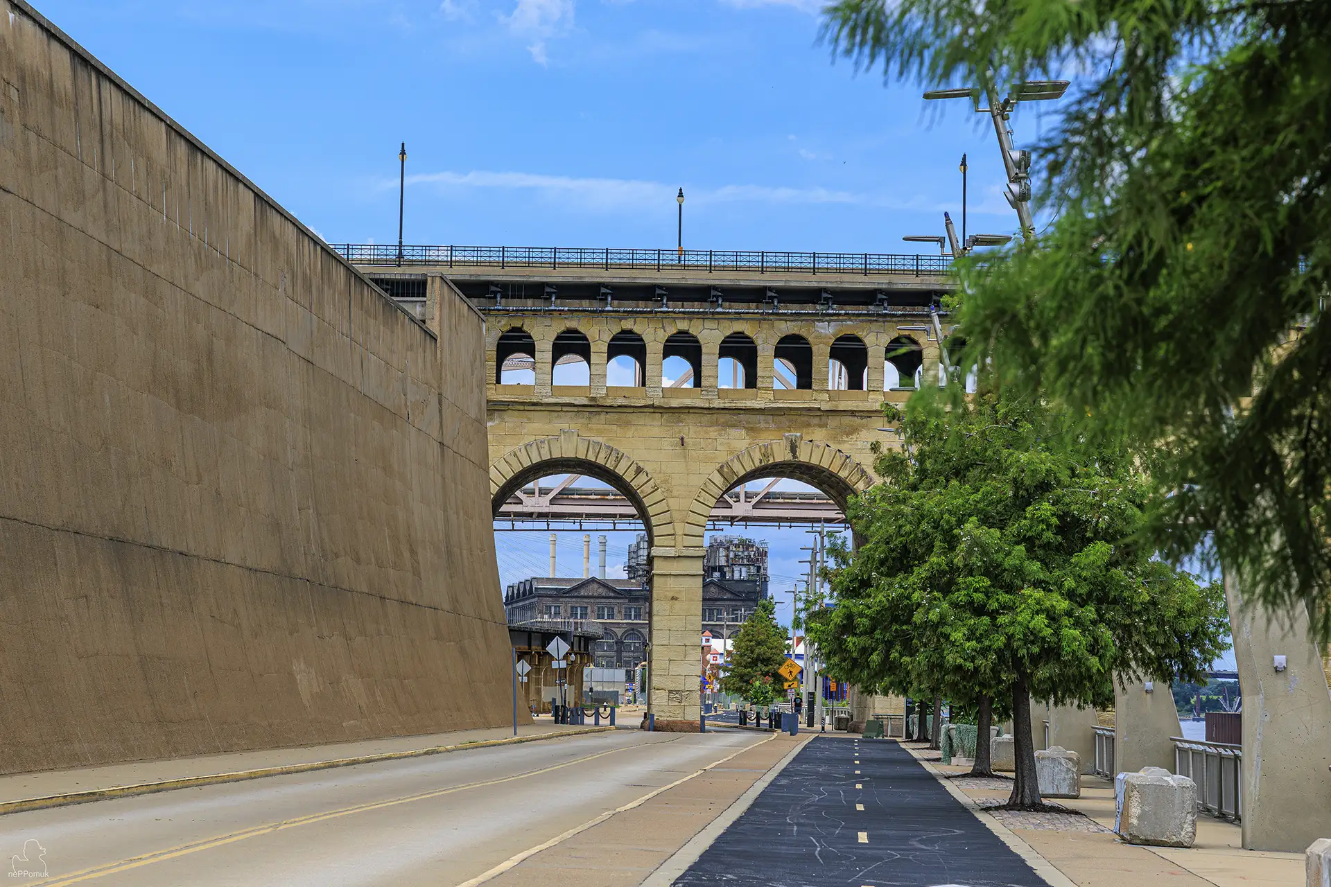
Among the historically most significant sights on the Mississippi are the Eads Bridgeand the old harbor district Laclede’s Landing. Here, one can trace both the beginnings of the commercial metropolis and the development of modern transport infrastructure. Historic brick architecture, monumental steel structures and still-used industrial facilities form a varied urban landscape whose distinctive structure is also reflected in the numerous photographic perspectives.
Read more
The history of St. Louis – From French founding to Gateway to the West
The European settlement history of St. Louis began in 1764, when the French fur trader Pierre Laclède and Auguste Chouteaufounded a trading post on the western bank of the Mississippi. They had already chosen the location in the autumn of the previous year. An elevated stretch of terrain offered comparatively good protection from the river’s regular flooding, while the proximity to the confluence of the Missouri and Mississippi created favorable conditions for trade with the indigenous communities and the French settlements of North America. The new settlement was named in honor of the French King Louis IX.
However, the region had been inhabited long before the arrival of European traders. Indigenous cultures had shaped the Mississippi Valley for millenniaand established far-reaching trade relations. This is especially evident in the pre-Columbian city of Cahokia on the present-day Illinois side of the river. The monumental earthworks preserved there recall one of the most important urban centers in North America before European colonization. The history of St. Louis therefore reaches far beyond the French founding of the city and is part of a much older cultural landscape.
During the European colonial period, political power relations changed several times. Although St. Louis was founded by French-speaking settlers, the city was under Spanish administration for decades. A fundamental change was brought by the Louisiana Purchase of 1803, through which the United States acquired a vast territory west of the Mississippi from France. In 1804, St. Louis was officially placed under American administration. The city subsequently developed increasingly into a starting point for traders, expeditions, and settlers moving westward.
St. Louis gained particular importance in connection with the Lewis and Clark Expedition, which set out in 1804 to explore the newly acquired territory. The expedition expanded the United States’ geographical knowledge of western North America and helped trigger further trade and settlement movements. St. Louis became an important place for outfitting such ventures. Traders, trappers, craftsmen, and travelers used the city as a supply center before continuing their journeys along the Missouri River or overland.
The economic rise was closely linked to the expansion of the United States, the consequences of which for Indigenous populations were often marked by displacement, violence, and the loss of ancestral homelands. Also slavery and African American historyare inextricably linked to the development of St. Louis. Enslaved people worked, among other places, in construction, in private households, at the port facilities, and later on the Mississippi steamboats. The city’s history thus encompasses both economic progress and social conflicts, the effects of which reached far beyond the 19th century.
From the original trading post emerged an American metropolis whose economic and cultural significance extended far beyond Missouri. The byname still in use today, “Gateway to the West”recalls St. Louis’s role as a starting point for westward expansion. This history is visible not only in the Gateway Arch, but also in the historic architecture, transport routes, and old commercial districts of the city.
Mississippi River – trade, steamboat travel, and industrial development
The economic development of St. Louis would not have been possible without the Mississippi Riverhardly imaginable. Together with the Missouri River and the Ohio River flowing into it farther south, it forms one of the most important inland waterway systems in North America. Even during the French colonial period, merchants used the waterways to transport furs, agricultural products, and goods between the settlements of the interior and the markets in the South. The Mississippi enabled exchange over great distances long before efficient roads or railroad connections existed.
A decisive boost to development came in the early 19th century with steamboat traffic on the Mississippi. With the arrival of the steamboat Zebulon M. Pikein 1817, a new era of river transport began for St. Louis. Steamboats could carry larger quantities of goods and move far more reliably against the current than the keelboats used previously. Extensive landing stages, warehouses, workshops, and trading businesses were established along the riverbank to organize the growing flow of goods.
In the middle of the 19th century, St. Louis among the most important inland ports of the United States. Steamboats connected the city with New Orleans and the commercial centers along the Ohio River. Via the Missouri River, transport and trade links extended far into the American West. Agricultural products, raw materials, and furs were transported along the rivers, while manufactured goods, machinery, and everyday necessities found their way into the growing settlement areas. The Mississippi riverbank developed into the economic center of a city whose prosperity was based largely on trade and transport.
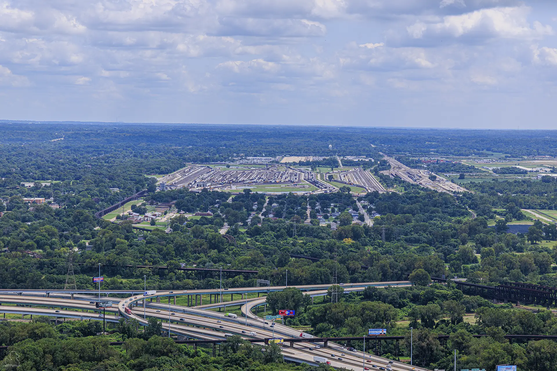
With the expansion of the American railway network, the role of the waterways changed. While steamboats continued to transport large volumes of bulk goods, railroads increasingly took over fast, long-distance freight and passenger traffic. In St. Louis, both modes of transport met directly.Port facilities, railway bridges, freight yards, and industrial areasformed a closely interconnected infrastructure network that determined the city’s economic development for decades.
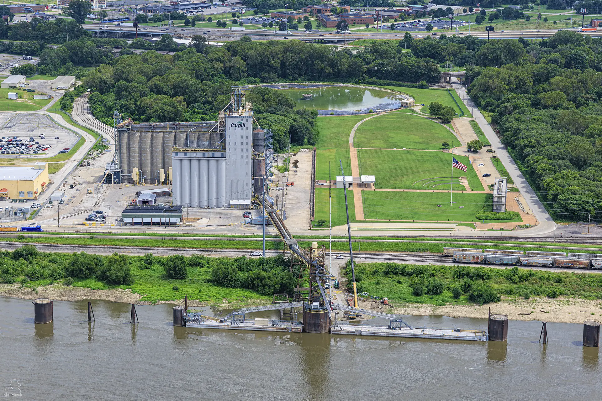
Industrialization also led to a growing spatial expansion of commercial and transport areas. Especially along the Mississippi, transshipment points emerged for grain, coal, building materials, and other bulk goods. Rail connections made direct onward transport into the interior possible. The proximity of port facilities and industrial companies created favorable conditions for businesses that processed large quantities of raw materials or shipped their products over long distances.
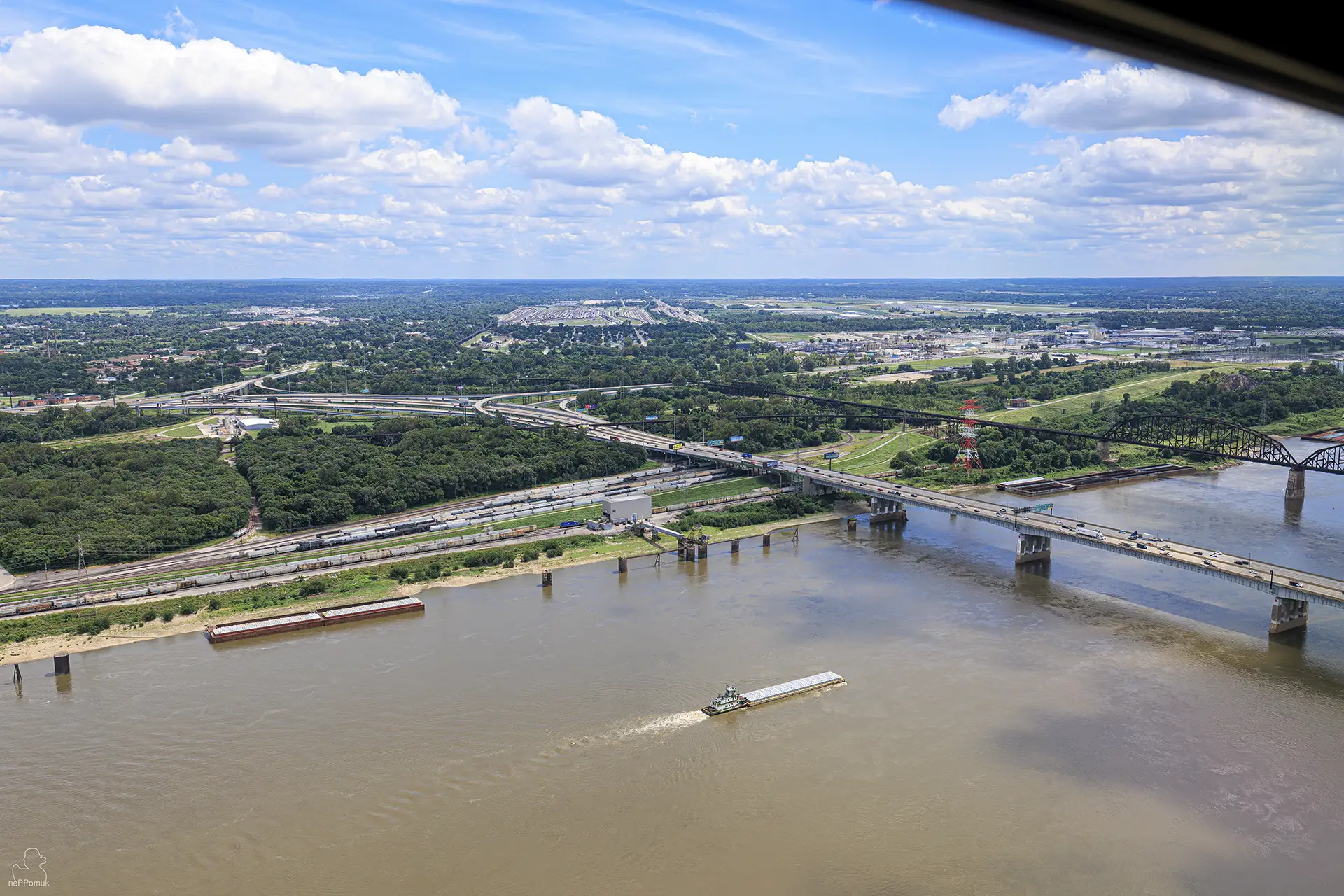
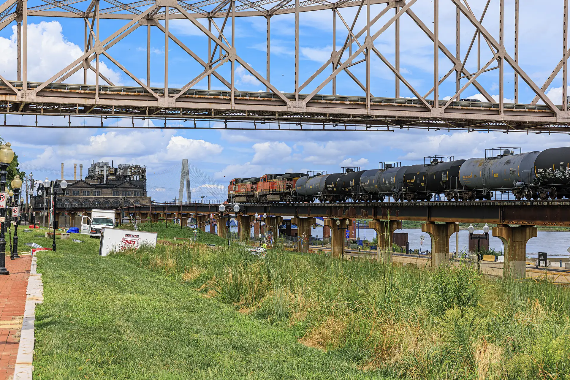
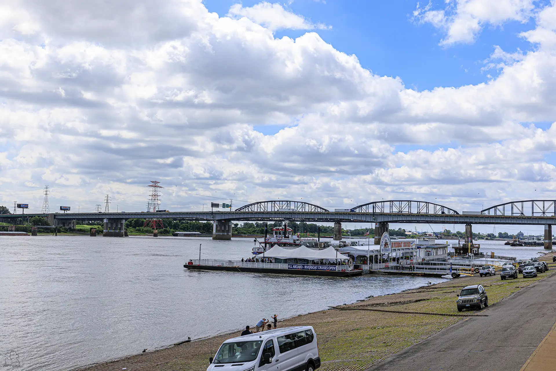
To this day, the Mississippi remains an important economic and transport corridor.Towing convoys transport goods on the river, while grain silos, loading facilities, and railway infrastructure shape the riverside landscape. Between historic bridges and modern transport routes, views of the skyline of Downtown St. Louis open up again and again. The river is far more than a scenic backdrop. It remains part of the infrastructure on which the economic development of the entire region is based.
It is precisely the juxtaposition of historic building fabric, functioning industry and modern urban architecture that makes the Mississippi in St. Louisa special photographic setting. Heavy freight trains, broad steel bridges, ships and the buildings of downtown form an urban landscape in which the various phases of development stand directly opposite one another.
Eads Bridge – Historic steel bridge and milestone of American bridge building
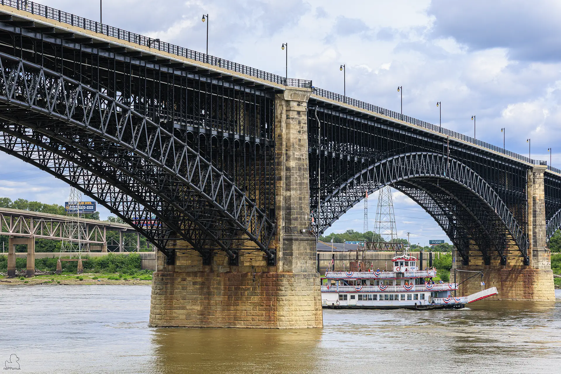
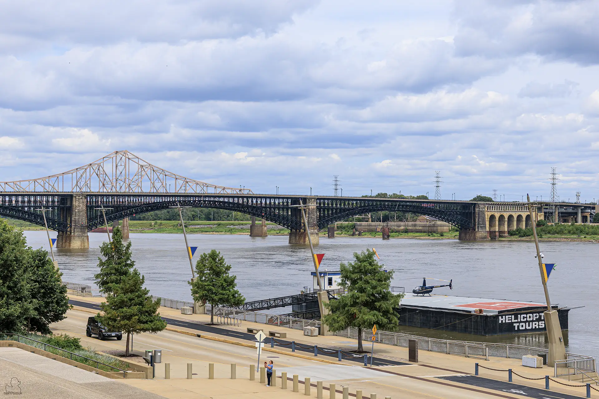
Few structures illustrate the connection between technical innovation and the economic development of St. Louis as clearly as the Eads Bridge over the Mississippi. The bridge, named after its designer James Buchanan EadsThe bridge, named after Eads, was ceremoniously opened on July 4, 1874. It was the first fixed bridge crossing over the Mississippi near St. Louis and represented a milestone in American engineering. As the first major bridge to use steel as an essential load-bearing building material, it influenced the further development of modern bridge construction.
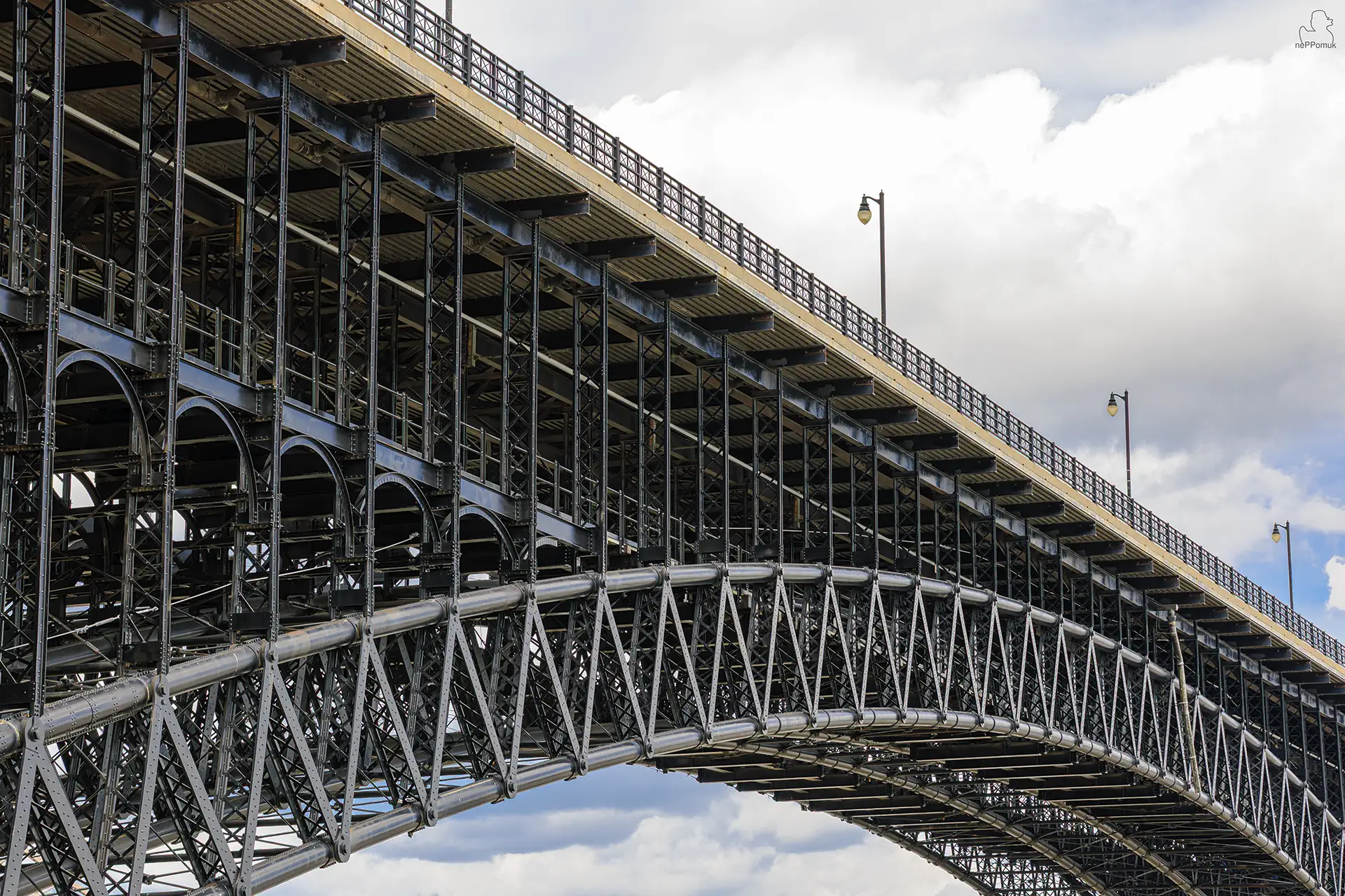
The structure consists of three massive steel arches, which span the Mississippi between Missouri and Illinois. Its load-bearing elements rest on massive stone piers clad in granite, whose foundations are anchored deep in the riverbed. From the outset, the bridge was designed for different modes of transport. While the upper level served road traffic, the lower level was intended for rail traffic. This arrangement illustrates the aim of channeling as many different traffic flows as possible across a single fixed river crossing.
The construction of the Eads Bridge presented the engineers with considerable technical challenges. The strong current of the Mississippi, changing water levels, and difficult ground conditions required extraordinary solutions. For the foundations, pneumatic caissons, known as caissons, were used. With them, the workers were able to carry out the necessary foundation work below the waterline. The construction method was technically advanced, but due to the work under high air pressure it also brought significant health risks.
The erection of the large steel arches was equally demanding. Instead of building continuous wooden falsework in the river, the structural components were assembled section by section from the piers and supported during construction by a system of guy cables. This construction method, exceptional for its time, made it possible to realize large spans and turned the Eads Bridge into an engineering landmark recognized internationally.
Its significance, however, was not limited to technical innovations. Before it opened, railroad cars and goods had to be transported by ferry across the Mississippi between St. Louis and East St. Louis. The new bridge made a direct connection between the rail networks on both sides of the river possible and thus greatly improved the conditions for long-distance freight transport. It strengthened St. Louis as a central trade and transportation hub between the eastern and western United States.
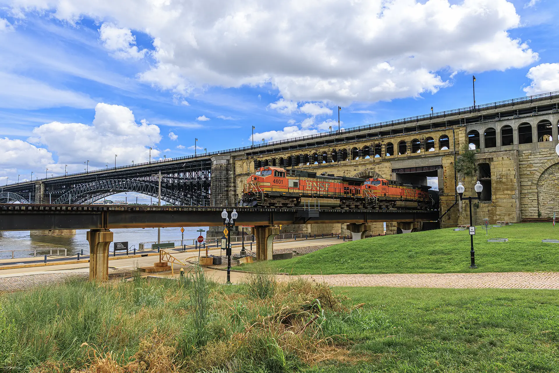
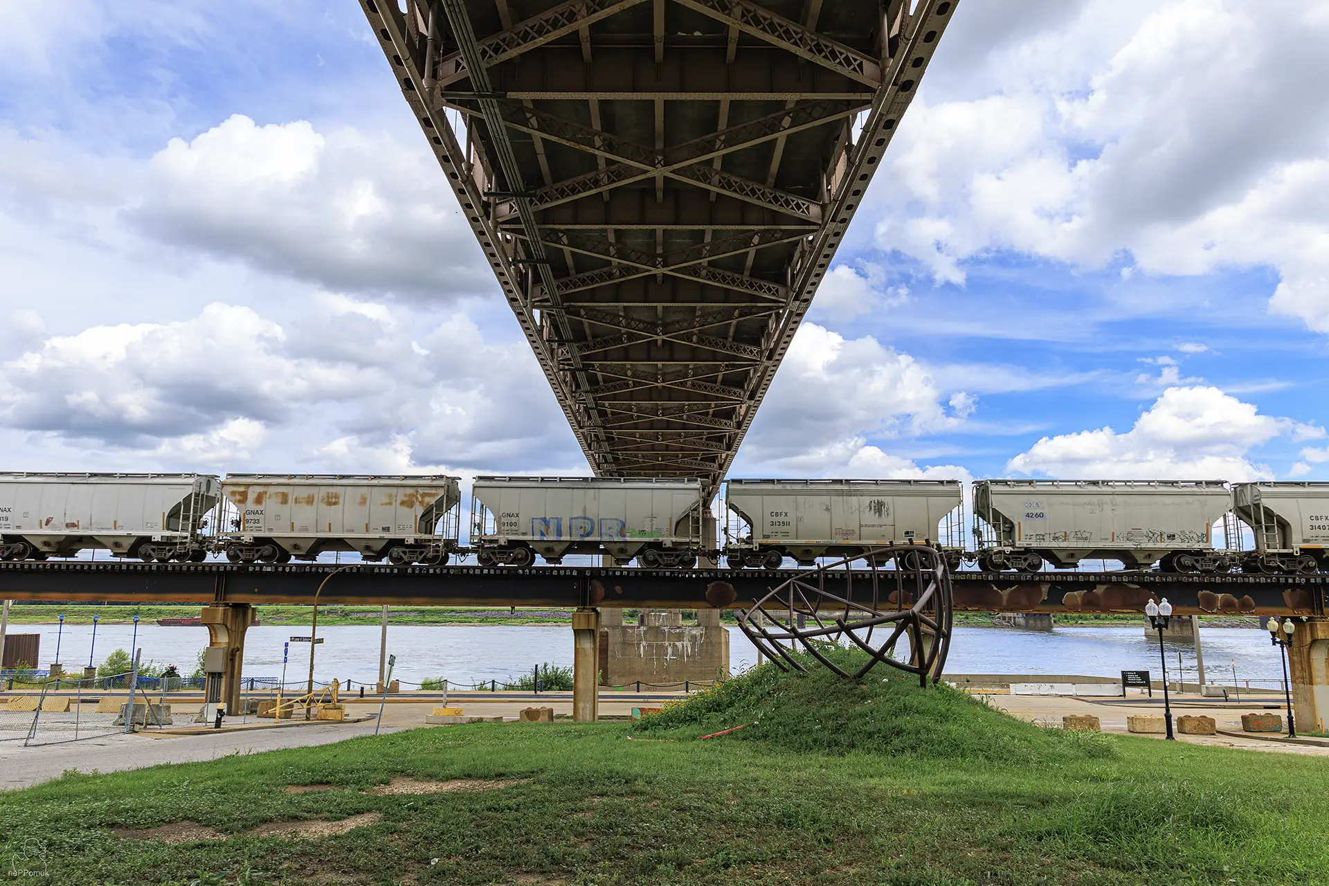
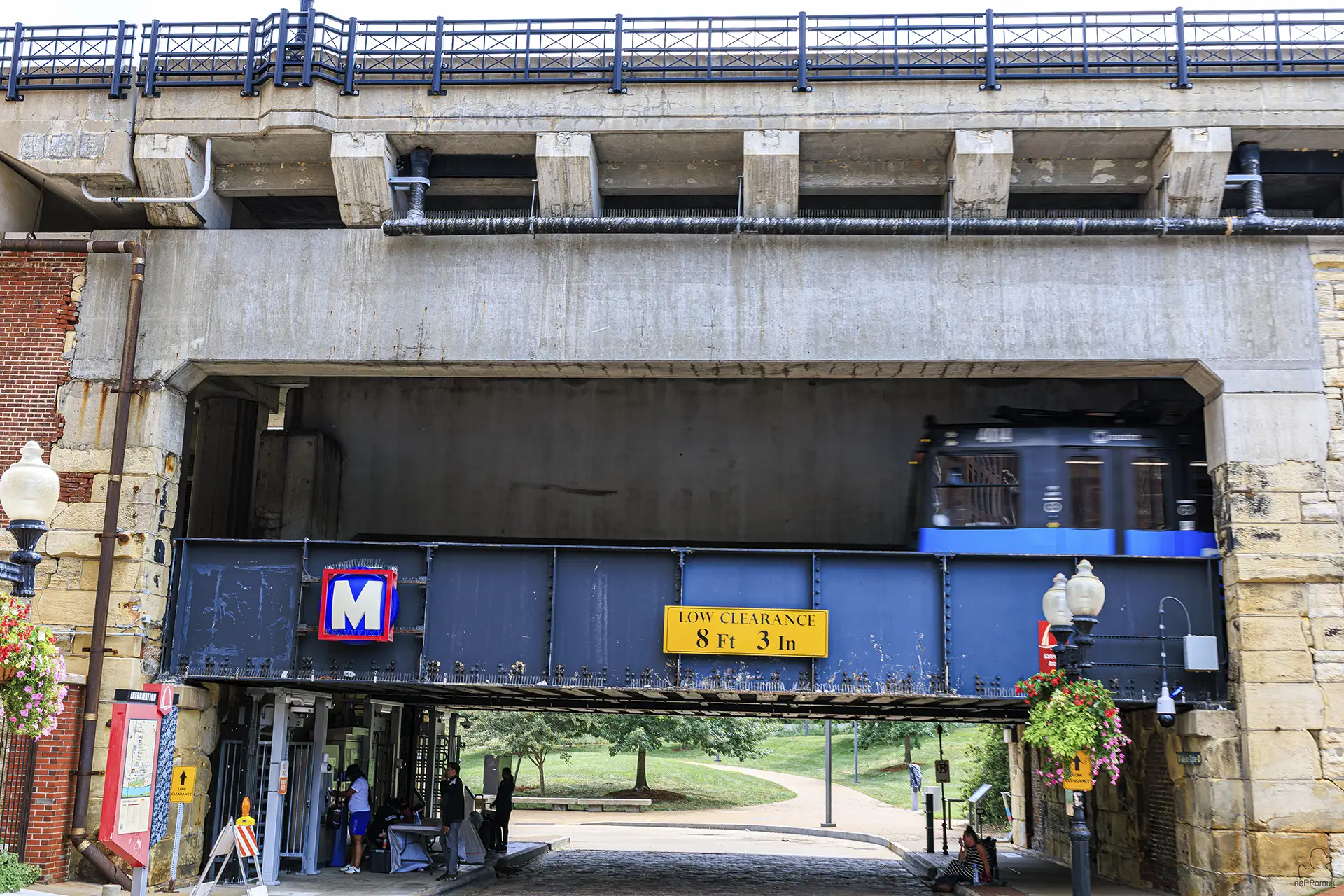
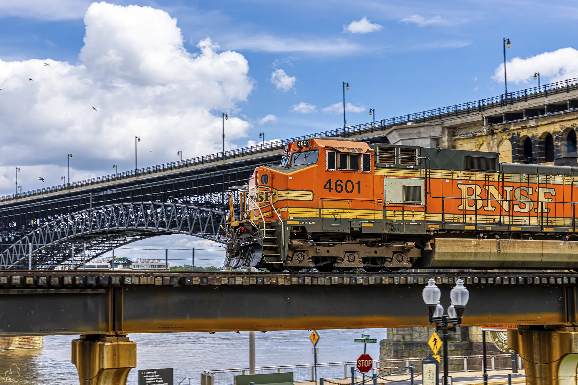
Today, the Eads Bridge is one of the most important historic bridges in the USA. On its lower level runs the MetroLink light rail, which connects St. Louis with the eastern bank. The characteristic steel arches and their elaborate structural details document more than 150 years of engineering history. Especially along the northern Riverfront, the different structural elements, the large stone piers and the massive steel constructions can be viewed from unusual angles.
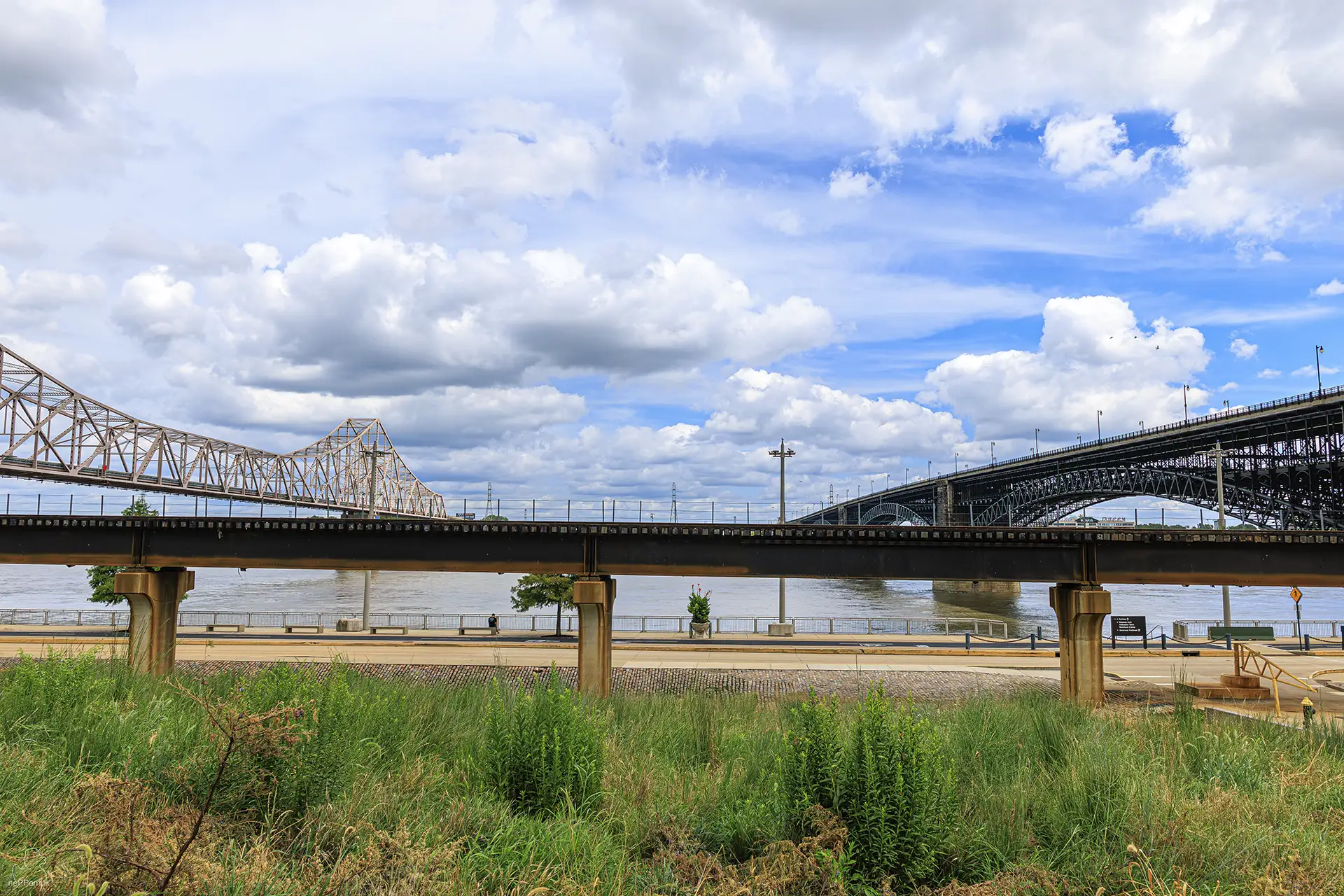
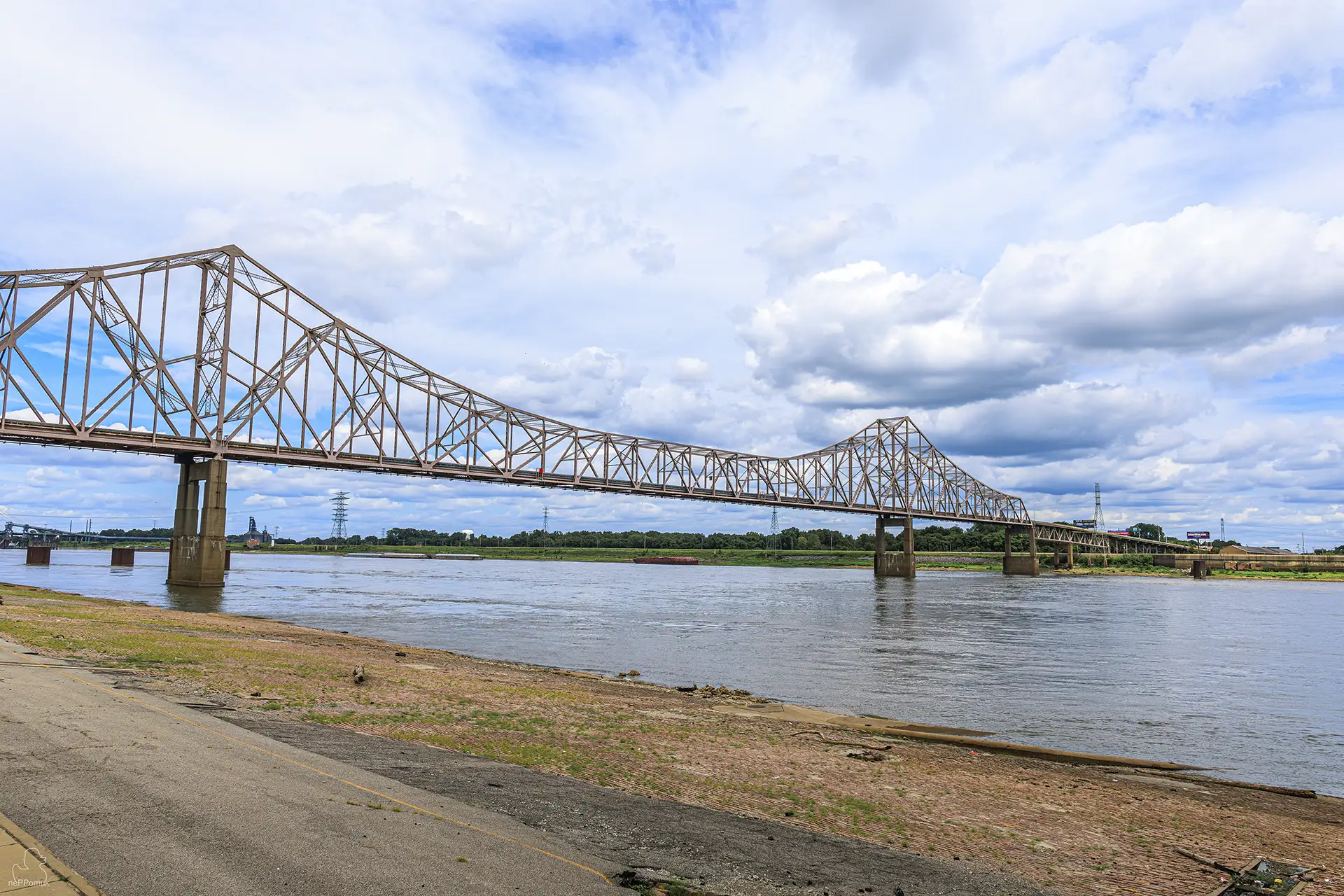
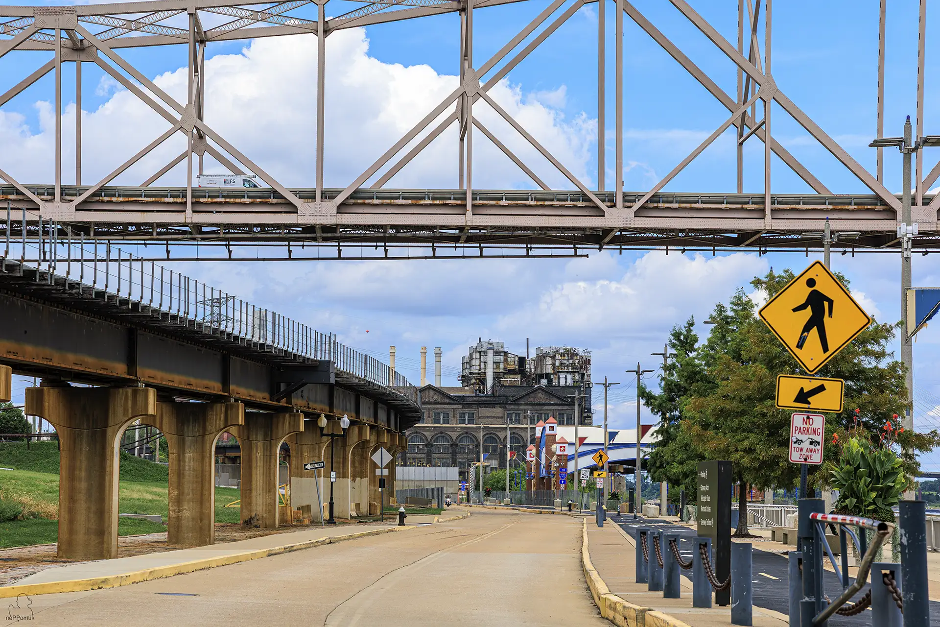
In addition to the Eads Bridge, other historic and modern Mississippi bridges shape the cityscape. The Martin Luther King Bridge, formerly known as the Veterans Memorial Bridge, connects the downtowns of St. Louis and East St. Louis. South of it, among others, the MacArthur Bridgeand the Poplar Street Bridgethe transport network. Their different structural designs show the technical development of American bridge building and the growing demands of road and rail traffic.
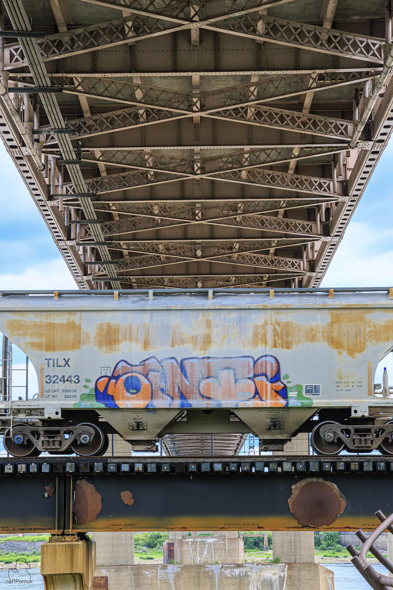
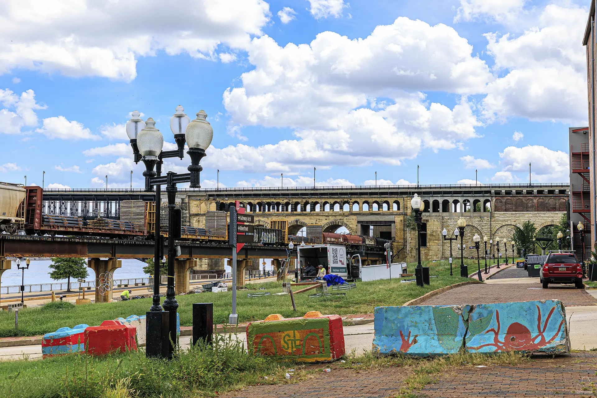
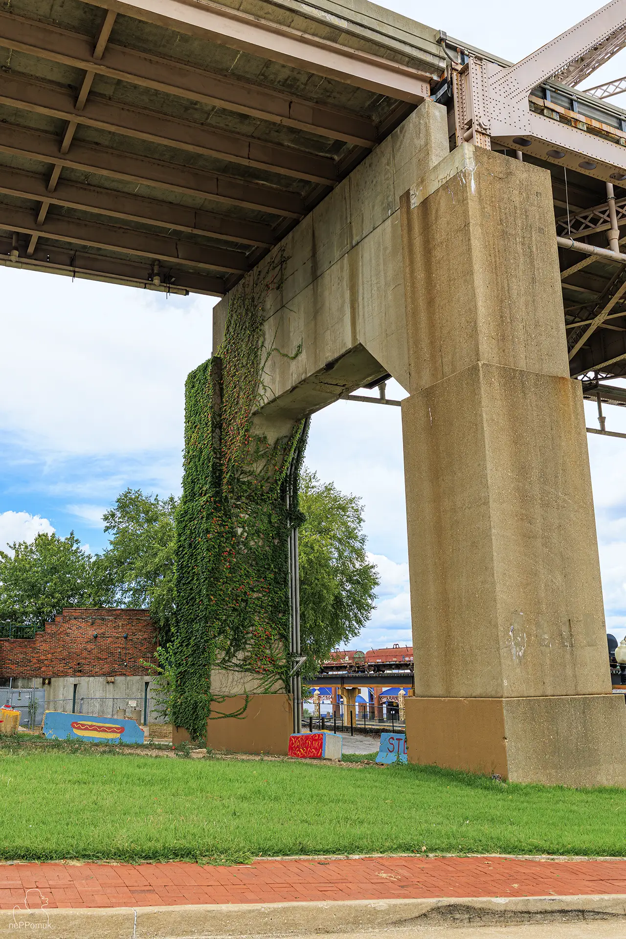
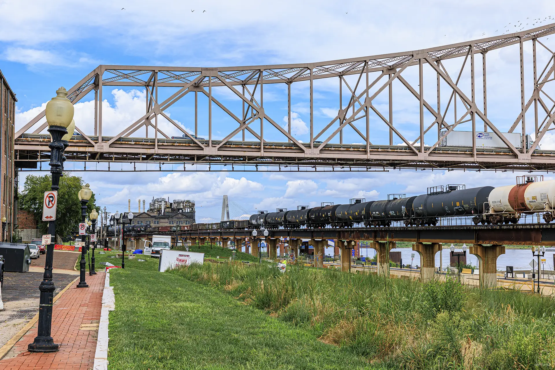
What is particularly impressive is the spatial concentration of the various transport routes. Historic stone viaducts, steel trusses, and massive concrete pillars stand immediately beside freight tracks, roads, and former warehouses. Long freight trains pass the bridge structures, while push convoys and excursion boats travel on the Mississippi. This combination of industrial architecture, transport engineering, and riverside landscapeshapes one of the most distinctive areas of St. Louis.
Laclede’s Landing – The historic harbor district of St. Louis
Immediately north of the Gateway Arch lies Laclede’s Landing, one of the oldest surviving districts of St. Louis. This historic port quarter stretches between the Mississippi and the approaches to the Eads Bridge and the Martin Luther King Bridge. Its street layout in part still dates back to the original urban planning of the 18th century. Unlike much of the modernized downtown, historic streetscapes and numerous 19th-century commercial and warehouse buildings have been preserved here.
The development of Laclede’s Landingwas closely tied for a long time to trade on the Mississippi. The buildings near the river housed warehouses, trading offices, workshops, and other businesses that benefited from the flow of goods through the port city. Goods were delivered by ship, stored temporarily, and transported onward via the adjoining streets. The district formed an essential part of the commercial infrastructure that made St. Louis a major American economic center in the 19th century.
A major turning point was the great fire of 1849. The fire started on a steamboat on the Mississippi riverbank and quickly spread through the densely built-up dock and business districts. Large parts of the downtown area of that time were destroyed. During the subsequent reconstruction, greater emphasis was placed on more resilient materials such as brick and iron. Many of the buildings still preserved today in Laclede’s Landing date from this period of economic recovery and from the following decades.
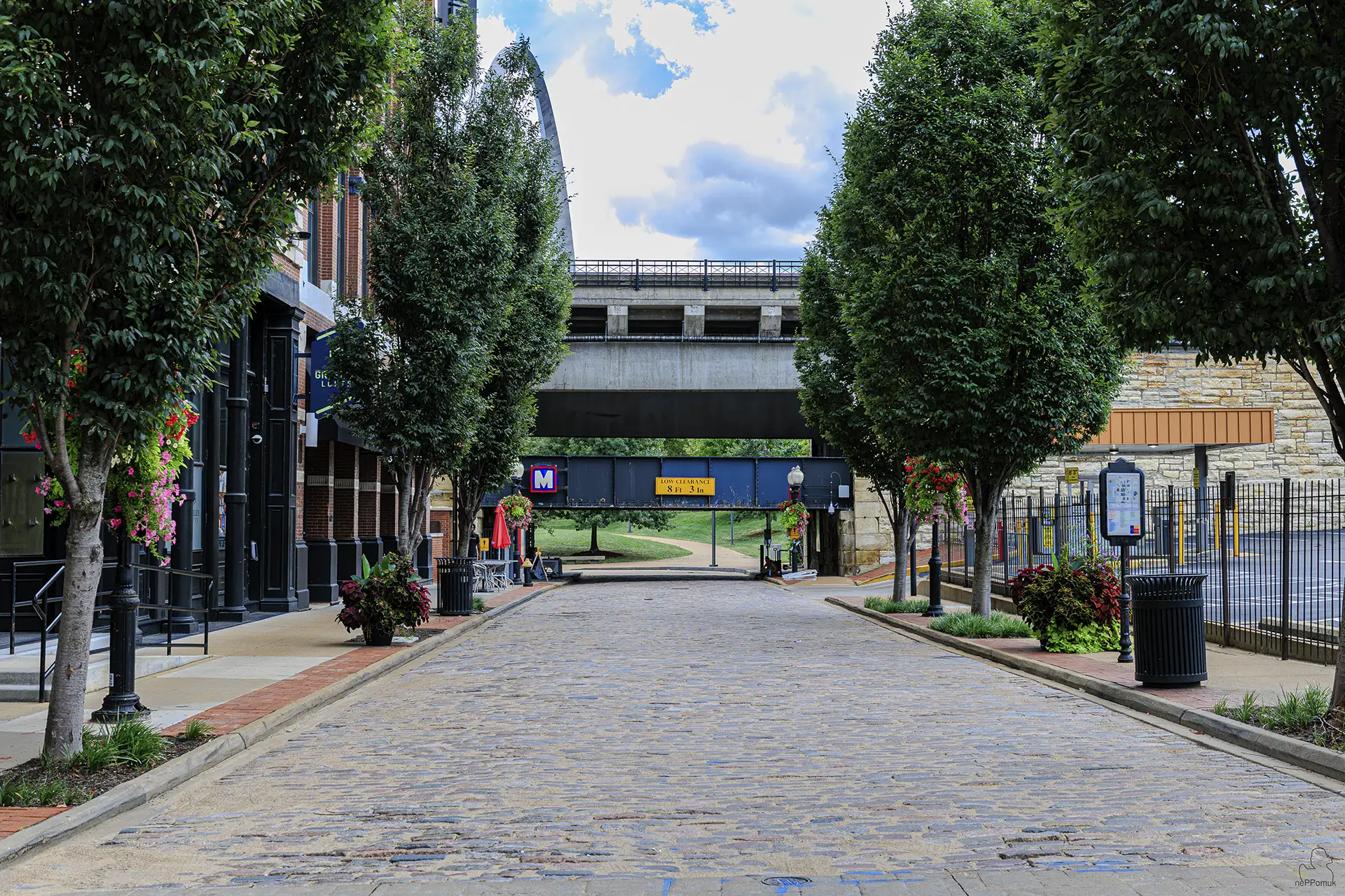
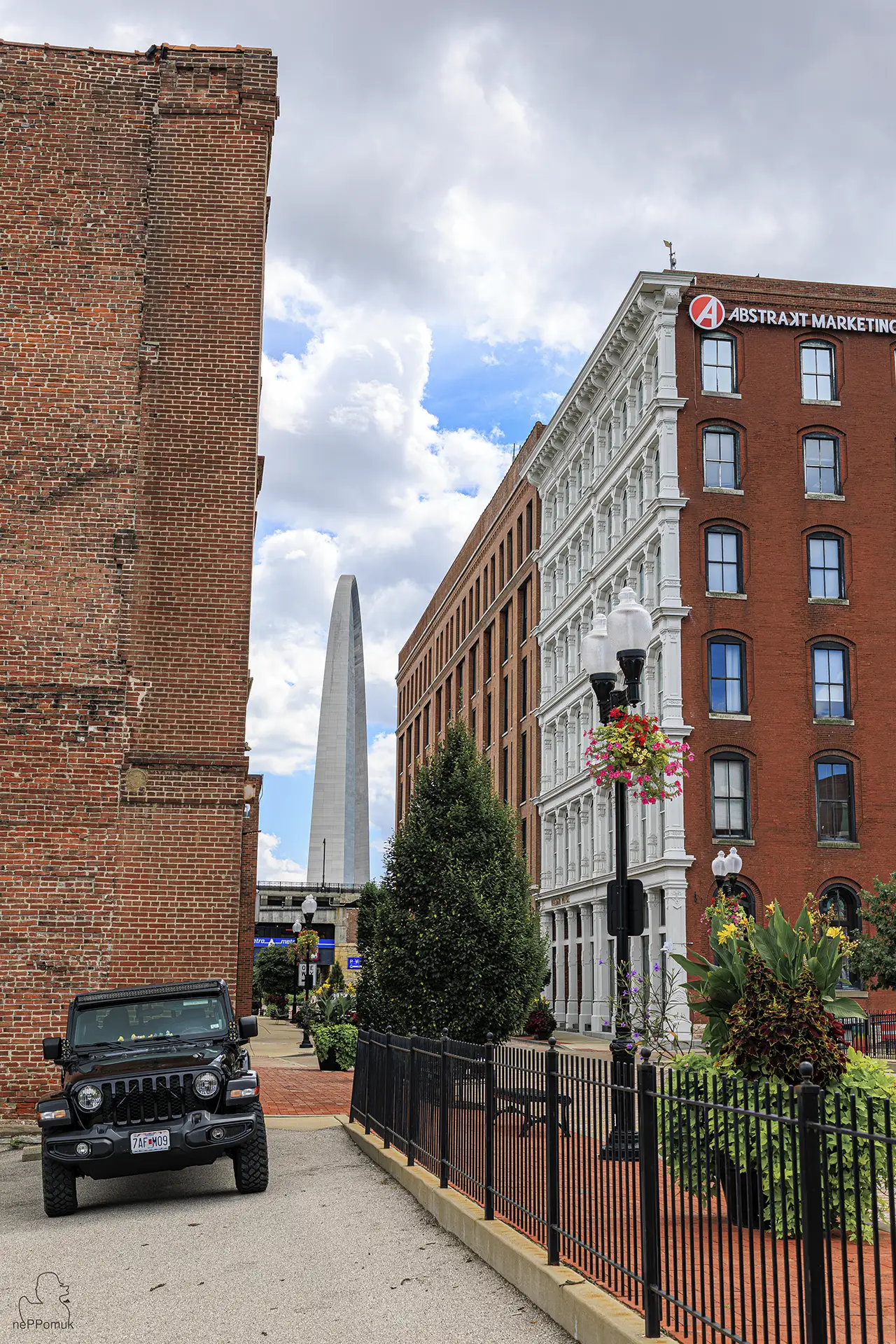
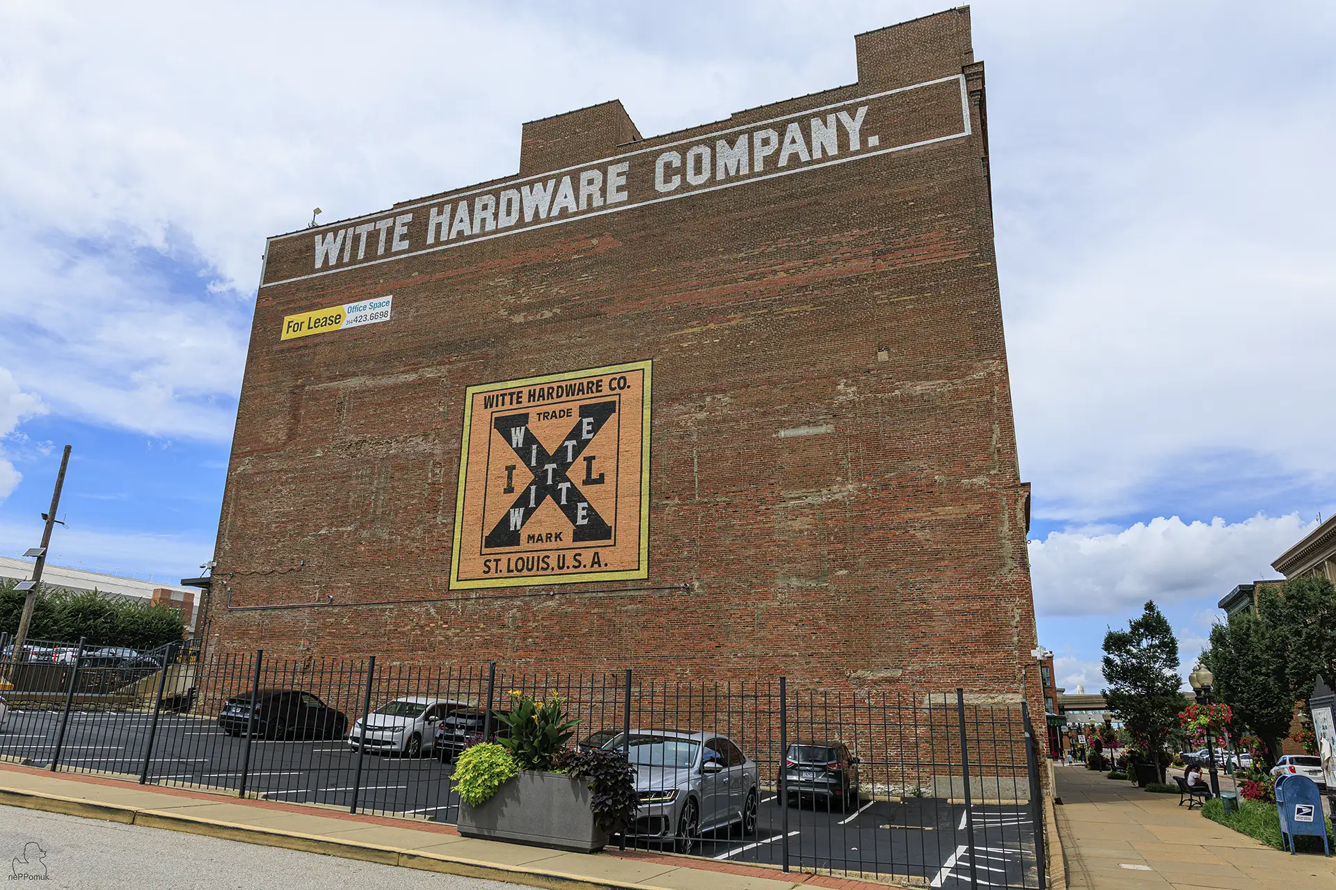
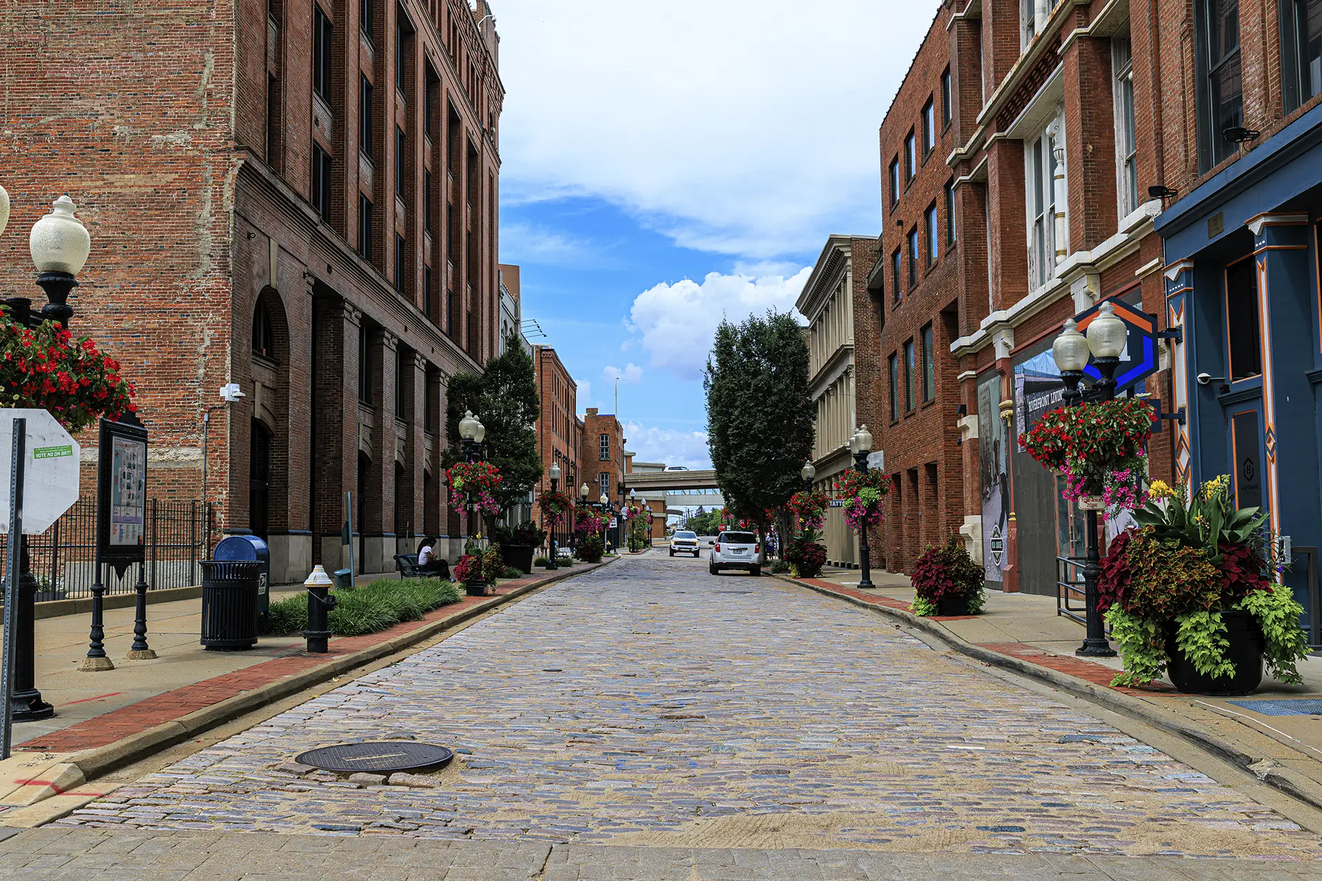
Characteristic of the district are the historic brick façades, cobblestone streets, and cast-iron architectural elements. Many buildings feature large window openings, decorative cornices, and the multi-story construction typical of commercial and warehouse buildings. Partly preserved wall advertisements recall earlier companies and the commercial use of the buildings. Especially along North Second Streetit becomes clear how closely trade, commerce, and transport were linked in the original port city.
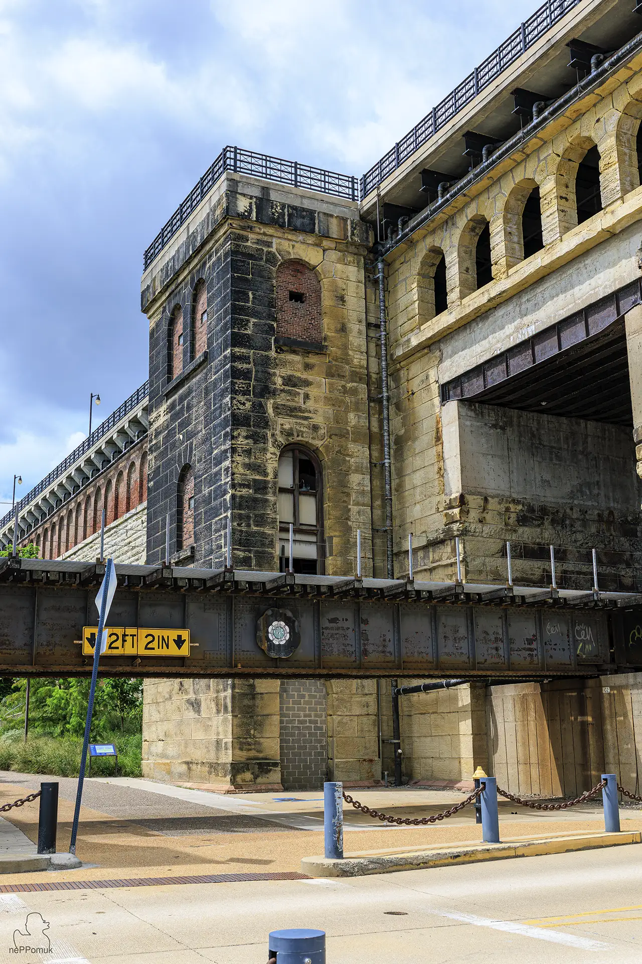
The historic street spaces stand in striking contrast to the large bridge structures that border the district and in some places rise above it. The massive stone arches of the approach viaducts, the steel structures of the bridges, and the railway facilities still in use recall the profound transformation of the urban infrastructure. At the same time, the relatively narrow streets and their closed rows of houses convey an impression of the spatial dimensions of the 19th-century trading city.
With the economic structural change of the 20th century, Laclede’s Landing lost a large part of its original significance as a warehouse and commercial location. Modern freight traffic increasingly shifted to larger industrial and transshipment areas outside the historic city center. Since the 1970s, the district has been gradually opened up for new uses. Former warehouses were converted into restaurants, offices, and event spaces, among other things. In the year In 1976, Laclede’s Landing was added to the National Register of Historic Places, officially recognizing the district’s historic and architectural significance.
Today, Laclede’s Landing is one of the few areas of Downtown St. Louiswhere the history of the former trading and port city can still be seen directly in the streetscape. Between the brick façades, the cobblestone streets, and the imposing bridge structures, there is a striking contrast to the modern skyline. The perspectives along Second Street, with views of the Eads Bridge, in particular illustrate the coexistence of historic building fabric and large-scale transport infrastructure.
For photography, the district offers an unusually versatile combination of historic architecture, urban details, and industrially shaped perspectives. Old façades, street lamps, wall advertisements, and bridge structures form a cohesive urban scene that makes St. Louis’s development understandable. Laclede’s Landing thus conveys an impression of the city whose economic rise once began directly on the banks of the Mississippi.

Gateway Arch in St. Louis
Architecture, history and the gateway to the West
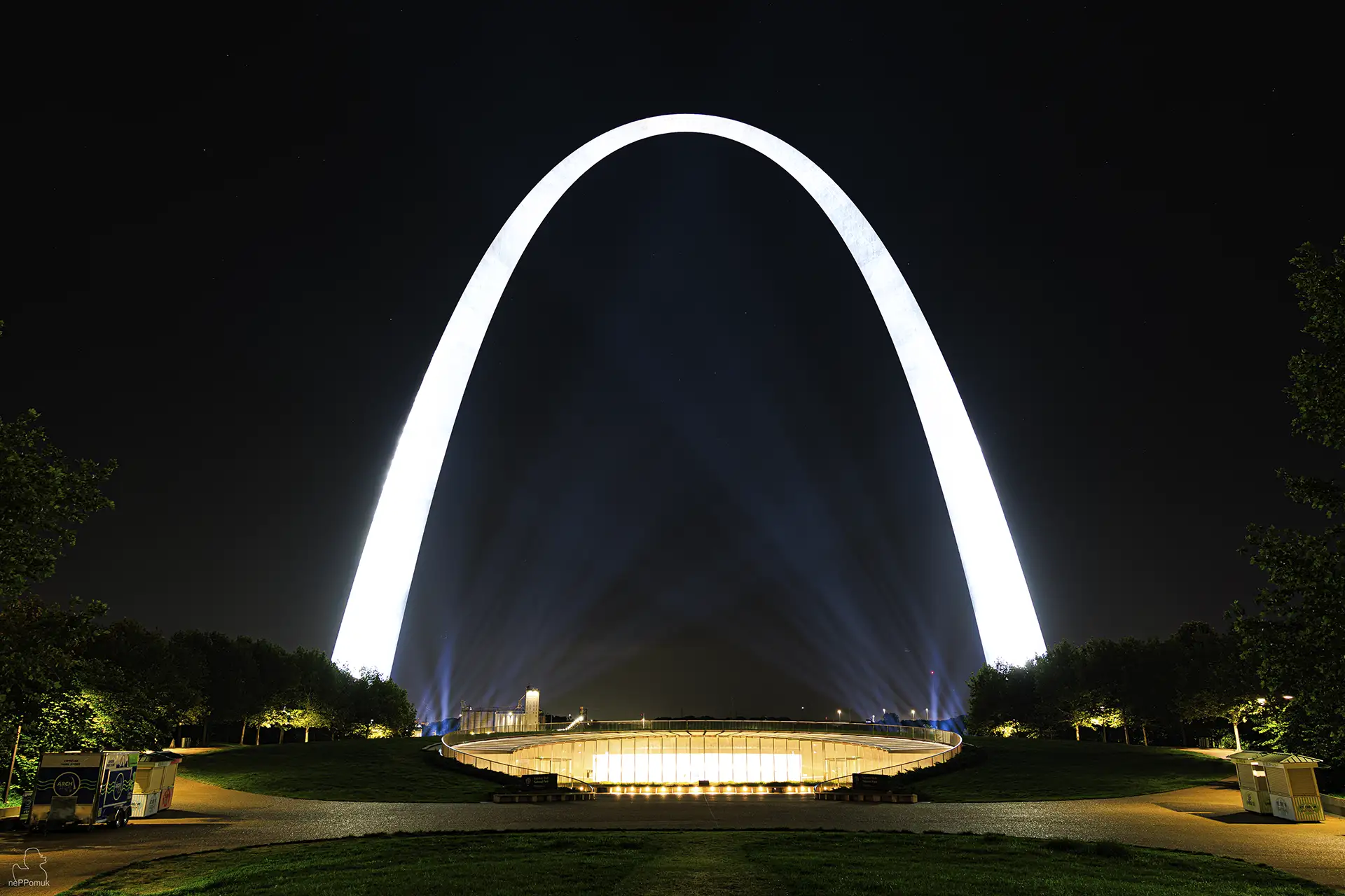
The Gateway Arch in St. Louisis one of the best-known landmarks in the United States and, with its monumental steel structure, defines the skyline of the city on the Mississippi. The 192-meter-high arch was completed in 1965 and recalls St. Louis’s historic role as the starting point of American westward expansion. Its extraordinary shape, the gleaming stainless-steel surface, and its immediate location on the river make it one of the most distinctive architectural monuments in North America.
The Gateway Arch was designed by the Finnish-American architect Eero Saarinen, whose design prevailed in a nationwide architecture competition in 1947/1948. The structure combines the symbolic meaning of an open gate with the technical possibilities of modern engineering. Two powerful legs tapering upward form a closed arch that rises far above the Mississippi river landscape.
Today the monument forms the centerpiece of the Gateway Arch National Park, which also includes an underground museum and the historic Old Courthouse. An extraordinary transportation system takes visitors inside the arch to an observation deck, offering sweeping views of downtown St. Louis, the Mississippi River, and neighboring Illinois. At the same time, the Gateway Arch offers a variety of unusual photographic subjects through its geometric architecture and the changing effects of light and perspective.
Read more
Gateway Arch – A Monument to American Westward Expansion
The idea for a monumental memorial on the Mississippi arose in the 1930s, when St. Louis was looking for ways to highlight its historical significance while also upgrading the economically weakened downtown area. In particular, the lawyer and urban planner Luther Ely Smithadvocated for the establishment of a national memorial. It was intended to commemorate the city’s role in the territorial expansion of the United States and transform the historic riverfront into a representative public space.
In the year 1935, the Jefferson National Expansion Memorial was establisheddedicated to the American president Thomas Jefferson and the opening up of the West. With the Louisiana Purchase of 1803, Jefferson had made the acquisition of a vast territory west of the Mississippi possible. The subsequent Lewis and Clark Expedition, which set out from the St. Louis region in 1804, made a major contribution to the geographical exploration of these areas. In the following decades, St. Louis developed into an important starting point for traders, travelers, and settlers heading west.
The creation of the memorial was at the same time part of a comprehensive urban redevelopment project. In the area of the historic riverfront, numerous older commercial and warehouse buildings were demolished. In total, the project encompassed around 40 blocks of the former downtown area. The extensive clearing was intended to make room for a monumental park and to reshape the connection between the city center and the Mississippi. This fundamentally changed the appearance of the historic riverfront.
After the Second World War, a nationwide competition was announced for the architectural design of the site. The goal was a structure that would symbolize the historical significance of westward expansion and at the same time serve as a widely visible landmark of the city. The design by the architect Eero Saarinenprevailed in 1948 against numerous competing proposals. Instead of a classic monument with columns, statues, or monumental building facades, Saarinen proposed a huge, freestanding steel arch.
The symbolic effect of his design was deliberately simple. The Gateway Arch as the “Gateway to the West”was intended to represent a gateway through which the view opens from the Mississippi toward the west. In this way, Saarinen took up St. Louis’s historical role as a starting point of American expansion without resorting to a traditional monumental visual language. At the same time, the technical modernity of the structure was meant to embody the spirit of progress of the 20th century.
The memory of westward expansion is viewed more differently today than at the time the monument was created. The territorial expansion of the United States brought economic development, new transport routes, and numerous settlements. At the same time, for many Indigenous communities it led to displacement, violence, and the loss of their ancestral living spaces. The spread of slavery into the western territories also belongs to this history. The Gateway Arch therefore stands for a historical process whose economic and political consequences are just as significant as its social contradictions.
These different perspectives are addressed in the Museum at the Gateway Arch. The underground museum covers the history of St. Louis from the French founding of the city in 1764 to the completion of the monument in 1965. Its exhibitions deal with the Indigenous cultures of the region, American expansion, the history of the Mississippi, and the creation of the Gateway Arch.
Since 2018, the former Jefferson National Expansion Memorial has officially borne the name Gateway Arch National Park. The renaming underlines the importance of the entire site as a historic memorial and public urban space. The Gateway Arch is not only St. Louis’s architectural landmark, but also an expression of an important chapter in American history.
Eero Saarinen and the architecture of the Gateway Arch – 192 meters of stainless steel
The Gateway Archis considered one of the most significant works of the Finnish-American architect Eero Saarinen. Its design differs fundamentally from classical monuments and skyscrapers. Instead of a massive building structure, Saarinen developed a curved form tapering upward, whose external appearance is entirely determined by its geometric construction. The monument is also 192 meters high and 192 meters wideand is one of the most extraordinary engineering structures in the United States.
The characteristic silhouette is based on a mathematically defined inverted, weighted catenary curve, known in English as weighted catenary curve. A conventional catenary curve is formed when a uniformly weighted chain hangs freely between two suspension points. When this shape is inverted and the load distribution adjusted accordingly, an arch structure favorable for compressive forces results. At the Gateway Arch, this mathematical principle was transferred to the cross-sections tapering upward.
The two legs have an equilateral triangular cross-section, whose side length at the base is around 16.5 meters. Toward the top, this value decreases to about 5.2 meters. This makes the structure appear remarkably slender despite its enormous dimensions. The triangular geometry is not only a design element, but an essential part of the structural concept.
Another special feature lies in the load-bearing structure. Unlike many skyscrapers, the Gateway Arch does not have a conventional internal steel frame. Its stability is largely created by the interconnected inner and outer steel walls. The outer shell is made of stainless steel, while carbon steel was used for the inner load-bearing shell. In the lower sections, the space between is additionally filled with reinforced concrete. The structure thus combines the outer form directly with its structural function.
The gleaming stainless-steel surface shapes the appearance of the structure. Its effect changes significantly depending on the weather, the position of the sun, and the viewing angle. In direct sunlight, the surfaces reflect the light particularly intensely, while on overcast days they appear noticeably duller. The slightly altered angles of the individual structural elements create a differentiated interplay of light and dark reflections. The seemingly simple surface thus reveals a surprisingly complex structure.
Construction work actually began 1963, after extensive planning and structural calculations had been completed. First, the massive foundations had to be built, extending about 18 meters into the ground and in part anchored directly in bedrock. The two legs were then assembled from prefabricated steel segments. The individual sections were lifted into position with special cranes and joined together.
The construction of the upper arch segments was particularly demanding. As the height increased, the two legs moved closer together, while the loads from their own weight, wind, and temperature fluctuations had to be precisely taken into account. Temporarily, a massive steel crossbeam connected the two arch legs and stabilized the structure during the final construction phase. The exact alignment of the closing segments required extensive measurements and careful coordination of the assembly work.
On October 28, 1965, the last component was installedand the Gateway Arch was thus externally completed. Saarinen himself did not live to see his design completed, as he had already died in 1961. Completion was carried out by the team of architects and engineers involved, who had technically implemented his design specifications.
The result was a structure whose exterior simplicity conceals an enormous amount of engineering effort. The clear arch shape, the reflective stainless-steel surface, and the monumental dimensions give the Gateway Arch a unique place within modern American architecture. At the same time, the structure is designed to withstand significant wind loads and other external influences. Even in strong gusts, the top can move within the structurally intended limits without impairing the monument’s stability.
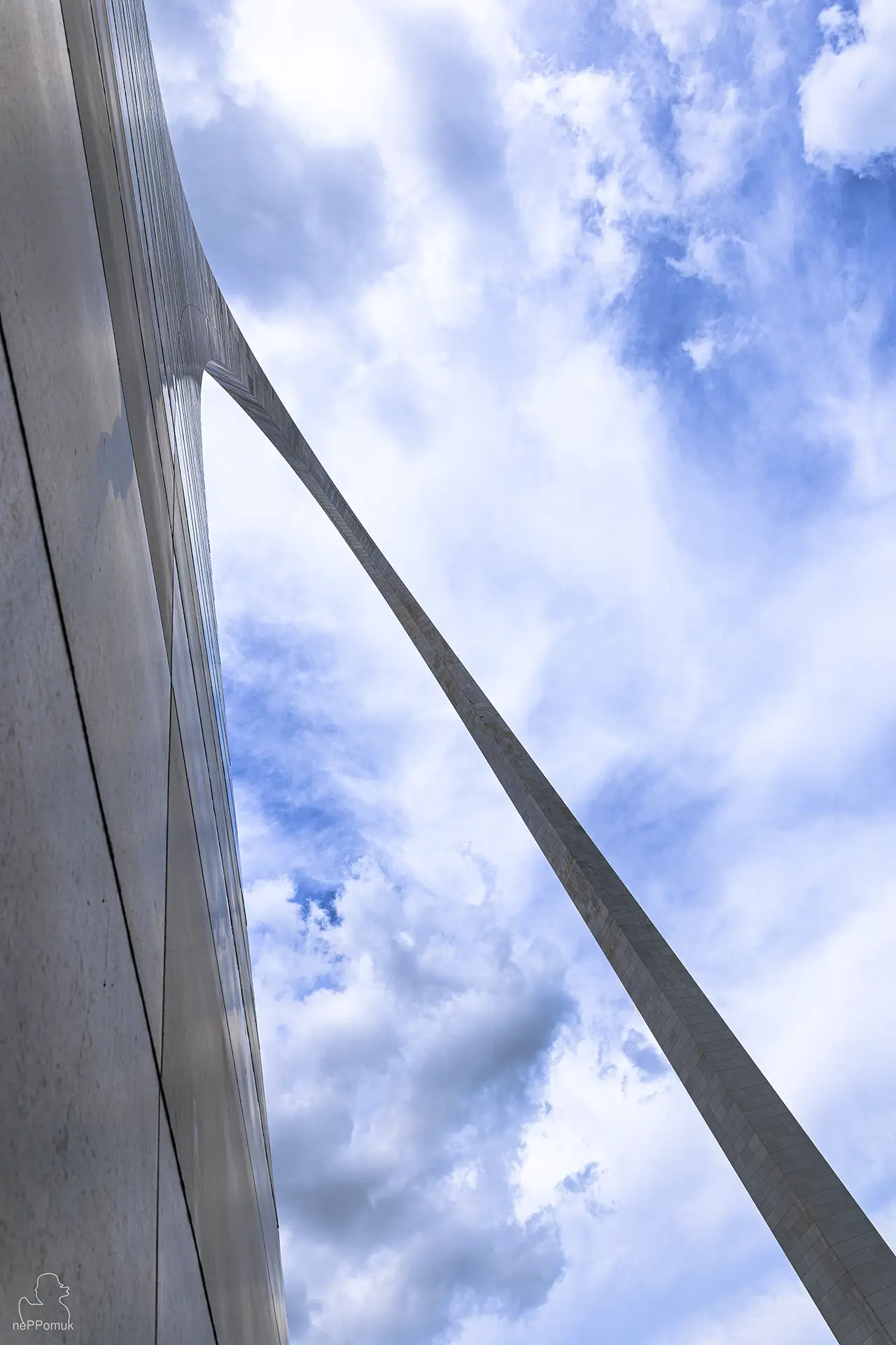
The Gateway Arch thus combines modern architecture, mathematical precision, and extraordinary engineering skill. Especially from very close up, it becomes clear how strongly its effect changes with perspective. While the arch appears as a closed geometric form from a greater distance, the immense dimensions of the steel legs and the unusual curvature of the structure dominate beneath it.
Gateway Arch Tram – With the capsule to the observation platform above St. Louis
Among the most unusual features of the Gateway Arch is the transport system that carries visitors inside the two legs of the arch up to the observation deck. Because the steel structure has no straight vertical shafts and its cross-section narrows sharply toward the top, conventional elevators could not be used. The designers therefore needed a technical solution that follows the curve of the arch while also enabling safe transport.
The system was developed by engineer Richard “Dick” Bowser, who combined various technical approaches. His design combines the basic characteristics of an elevator with the principle of suspended gondolas, as used on a Ferris wheel. Instead of a single large passenger car, small, interconnected capsules travel on a rail system inside the legs of the arch.
Each of the two systems consists of eight capsules with five seats each. This means a complete capsule train can carry up to 40 people. The cylindrical cabins are relatively compact and move upward along the curved track. During the ride, the capsules are gradually rotated by a mechanism so that the passengers’ seating position remains largely upright despite the changing incline of the arch.
The The ride to the top of the Gateway Arch takes about four minutes, and the descent about three minutes. The transport system was put into operation in 1967 and remains an essential attraction of the monument to this day. Through the transparent cabin doors, visitors can see parts of the internal steel structure and the technical equipment during the ride. The journey thus conveys an unusual impression of the interior of a structure that appears almost completely enclosed from the outside.
At the highest point of the arch is a long, slightly curved observation platform. The Observation Deck of the Gateway Archis located about 192 meters above the ground and has a total of 32 narrow windows on both sides. Their arrangement provides views to the west of downtown St. Louis and to the east of the Mississippi and the state of Illinois.
The view to the west shows the spatial structure of Downtown St. Louisparticularly clearly. Directly beneath the arch lies the expansive parkland of Gateway Arch National Park. Beyond that rises the historic Old Courthousewith its distinctive dome. The building forms a striking contrast to the modern high-rises and the large-scale street grid of the downtown area.
Further to the southwest, one can also make out the Busch Stadium, public buildings and the traffic arteries of Downtown. To the west and northwest, the view extends over office buildings, streets and extensive neighborhoods far into the surrounding region. The view makes clear how strongly St. Louis has expanded since its founding on the Mississippi and what significance the historic transportation routes have for the city’s development.
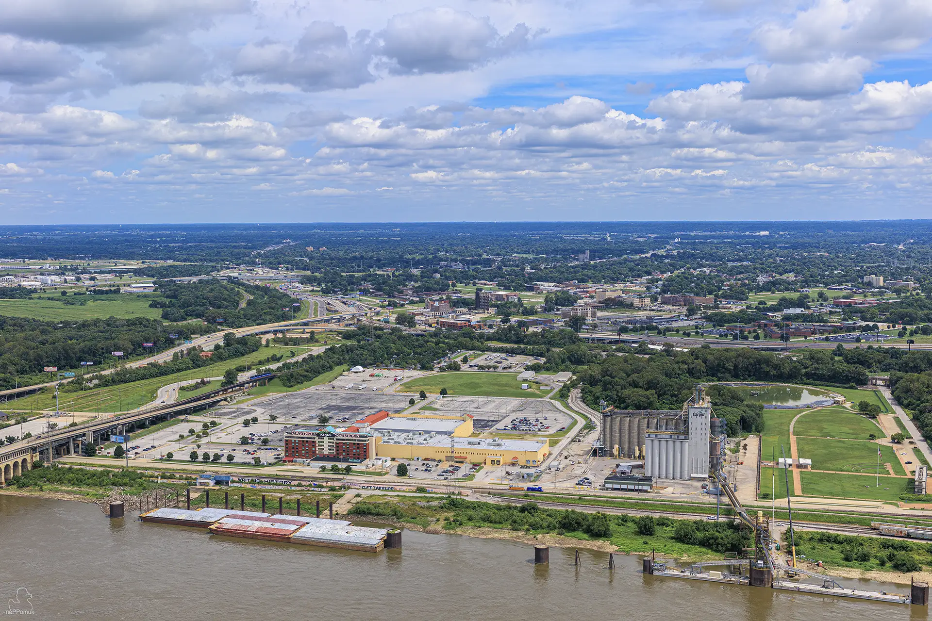
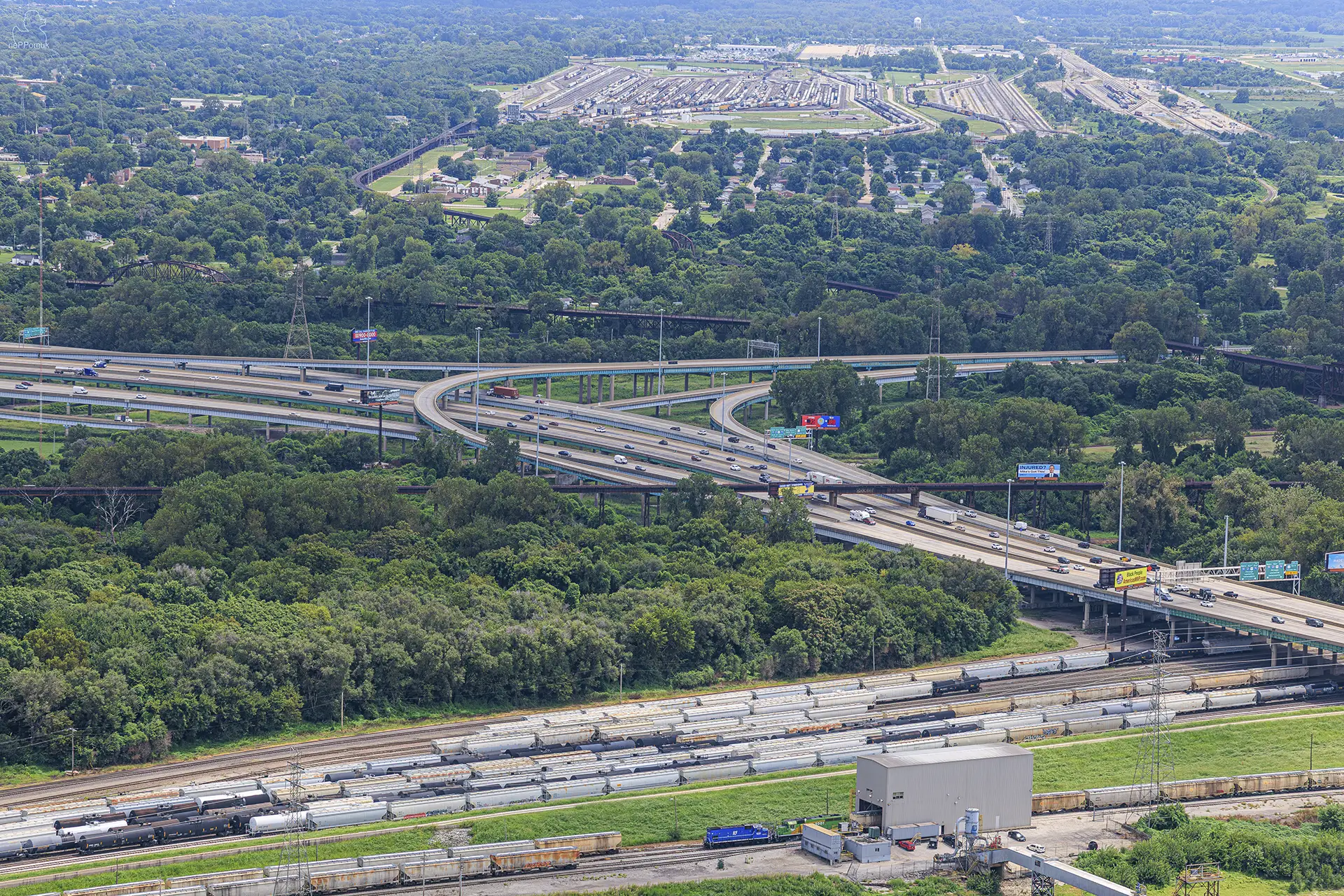
On the opposite side, a completely different scene opens up. The Mississippi Riverforms the border between Missouri and Illinois and is spanned by numerous road and railway bridges. On the eastern bank lie the industrial and transport areas of East St. Louis. Freight yards, grain silos, port facilities and extensive highway interchanges shape the landscape. Especially striking is the juxtaposition of river, rail and modern transport infrastructure.
The view from the Gateway Arch offers more than an overview of well-known sights. It makes the economic and geographic development of the entire region understandable. On one side stretches the historic and modern center of St. Louis; on the other, industrial facilities and transport routes dominate. In between flows the Mississippi, which for centuries formed the foundation for the city’s rise.
Below the monument is the Museum at the Gateway Arch, which is accessible via the underground visitor area. The exhibitions complement the ride to the observation deck with the historical background of the city’s founding, American westward expansion and the construction of the monument. Above all, the combination of museum, historic parkland and view allows a comprehensive understanding of the significance of the Gateway Arch for St. Louis.
Photographing the Gateway Arch – architecture, light and exceptional perspectives
The Gateway Arch in St. Louisis one of the most interesting architectural subjects in the American Midwest. Its clear geometric form, monumental dimensions, and reflective stainless-steel surface offer numerous possibilities for depicting the structure from different perspectives. Its effect changes significantly depending on the viewer’s position, the distance from the monument, and the prevailing lighting conditions.
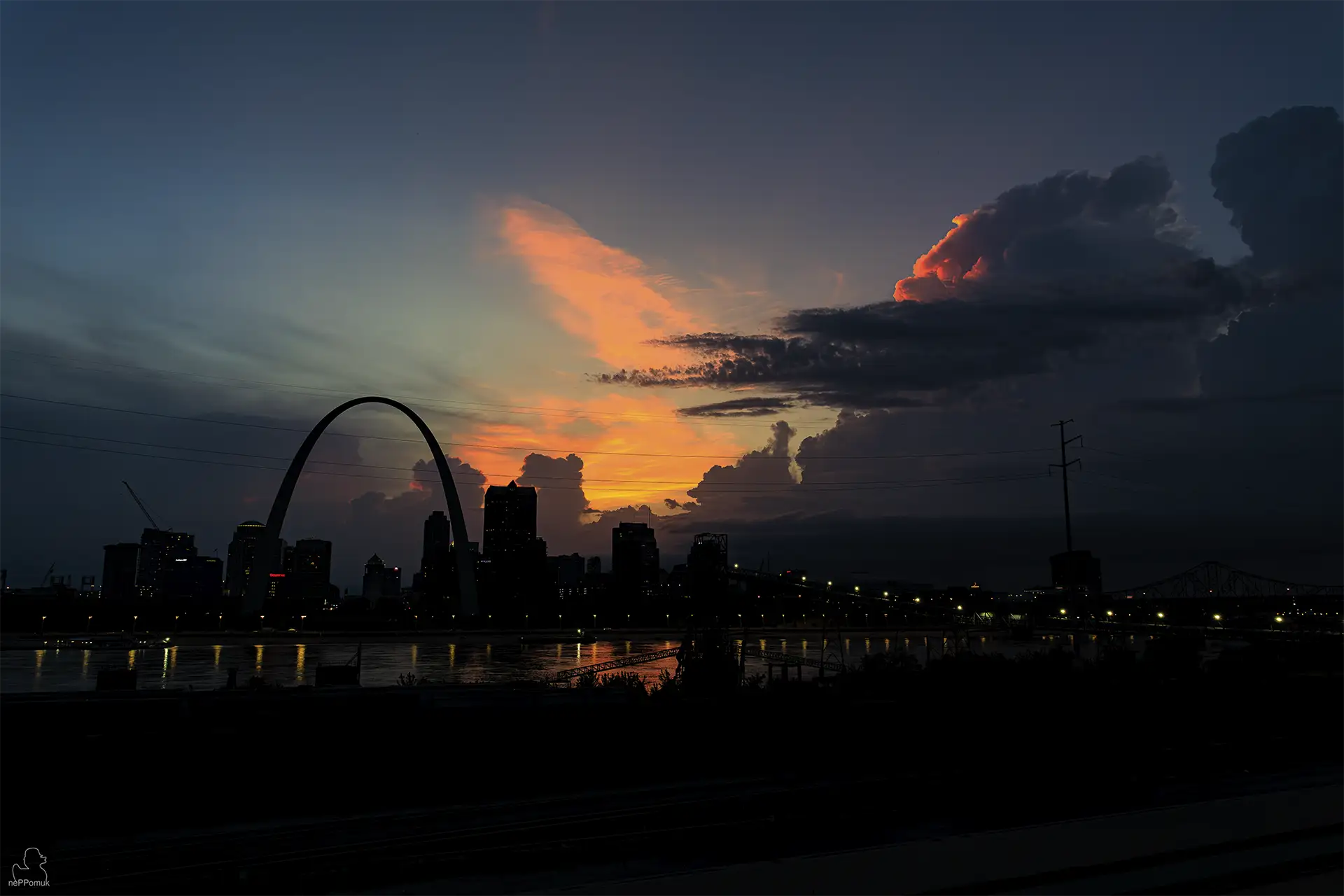
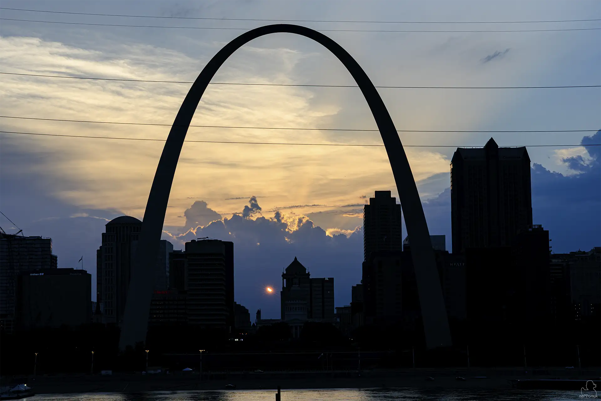
From a greater distance, the arch appears as a closed, almost graphic form that stands out clearly from the surrounding urban landscape. Especially from the opposite riverfront areas in East St. Louisthe Gateway Arch can be photographed together with the downtown skyline. The Mississippi forms the foreground and illustrates the geographic relationship between the monument, the city, and its historic transportation route.
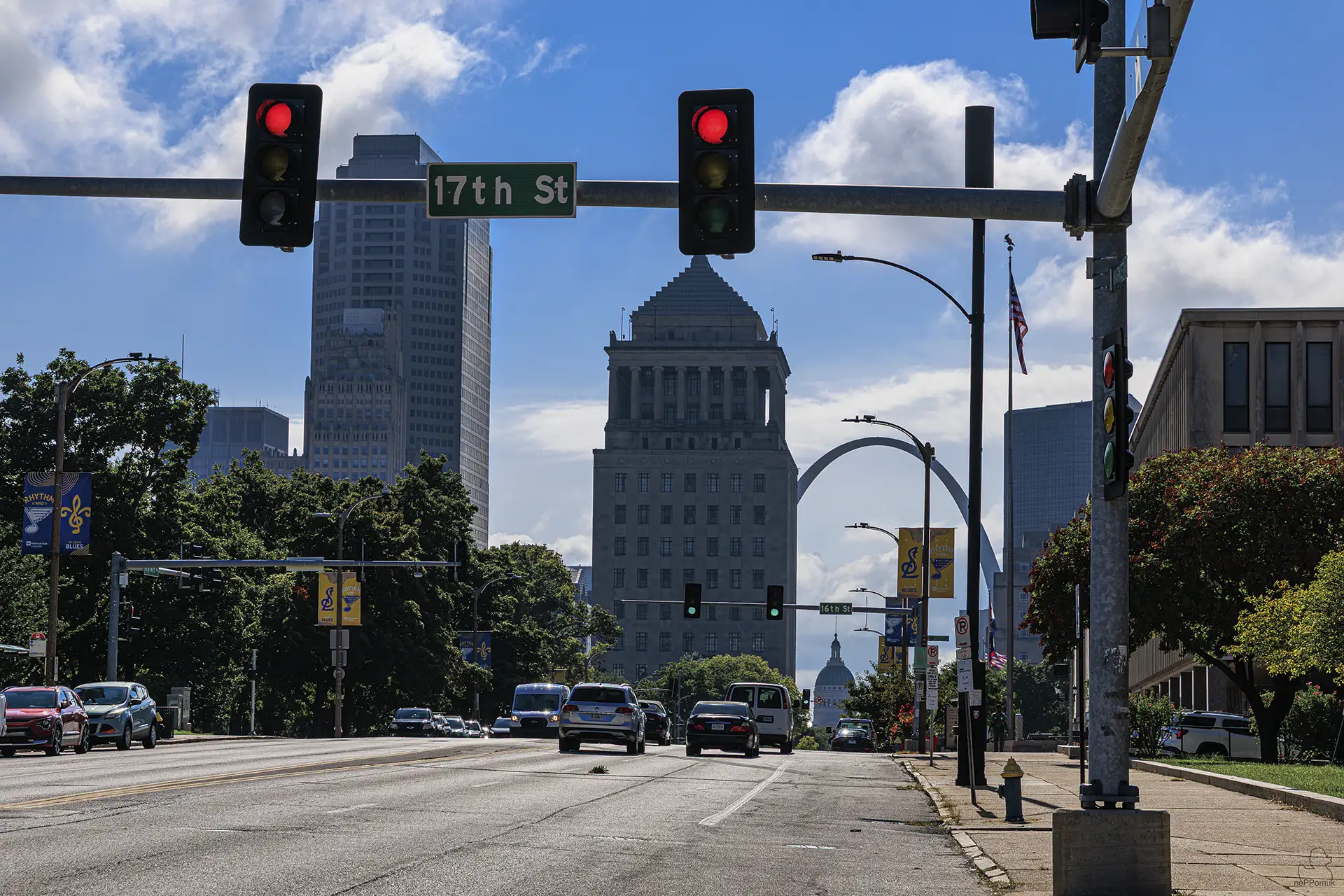
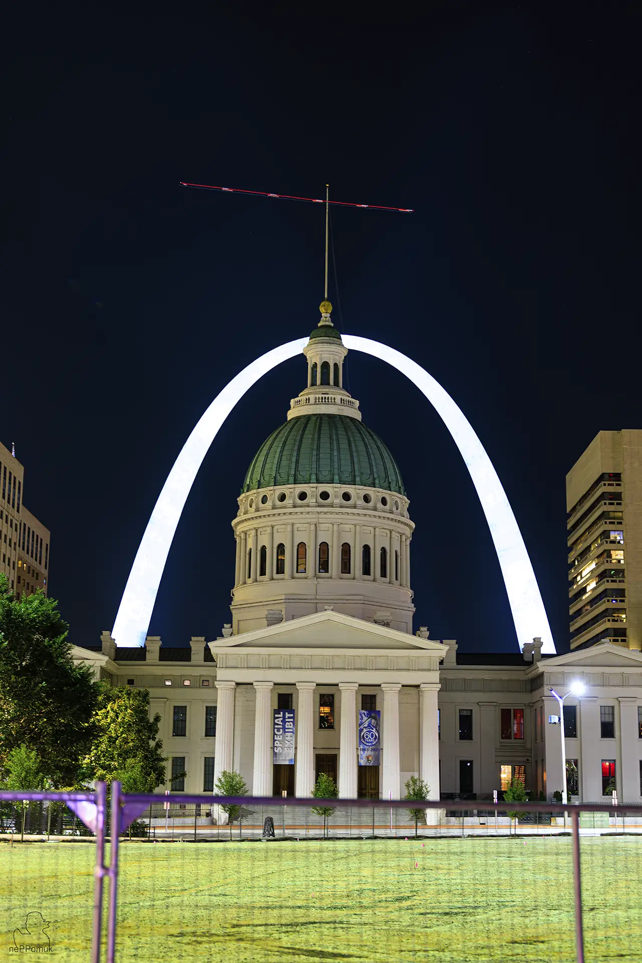
The streets of the downtown area also offer characteristic perspectives. Between the high-rises and along the major traffic arteries, the Gateway Arch repeatedly appears as a striking part of the cityscape. The varying building heights and facade structures create a contrast to the curved steel construction. Especially in combination with the Old Courthouseit creates a juxtaposition of historic and modern architecture that is characteristic of downtown St. Louis.
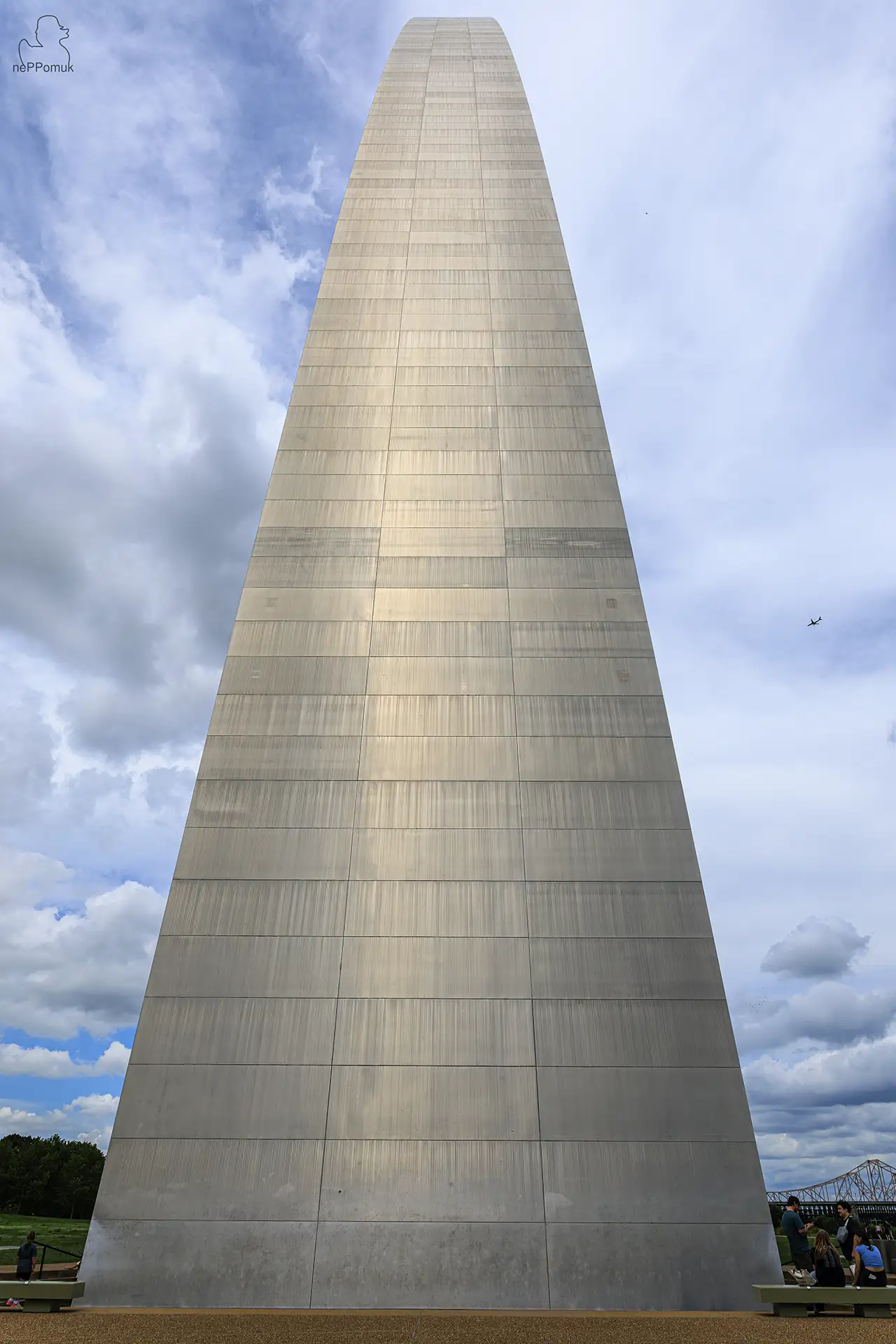
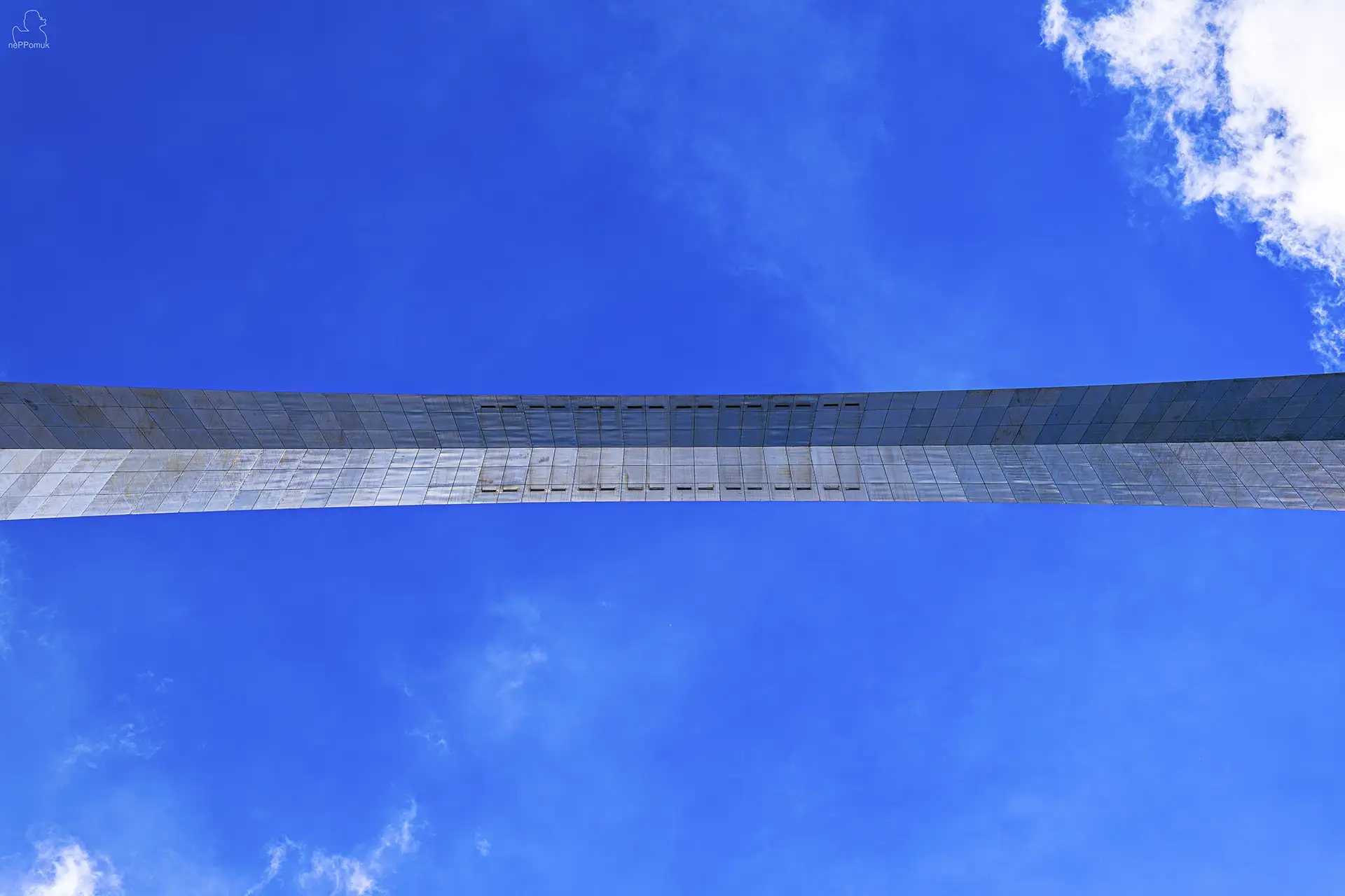
From very close up, the perception of the structure changes fundamentally. The individual arch legs appear significantly more massive, while the upper curve increasingly escapes the familiar perspective because of the steep viewing angle. Photographs taken directly beneath the Gateway Arch therefore emphasize less its function as an urban landmark and instead its unusual geometric properties. The steel surfaces converging toward one another, the tapering cross-sections, and the almost abstract lines create distinct architectural compositions.
A special role is played by the stainless-steel surface of the Gateway Arch. Depending on the position of the sun, strong reflections of light occur, making individual sections of the arch appear almost white. Other surfaces, by contrast, take on the colors of the sky or recede clearly due to their lower contrast. As a result, the monument’s appearance changes continuously over the course of a day.
When the sun is low, the Gateway Arch can appear as a gleaming outline against the sky. The warm colors of the evening light then contrast with the cool effect of the stainless steel. Especially appealing is the interplay with the modern high-rises of downtown, whose glass facades also reflect the sunlight. In this way, the arch becomes part of a multilayered cityscape made up of different materials, forms, and lighting moods.
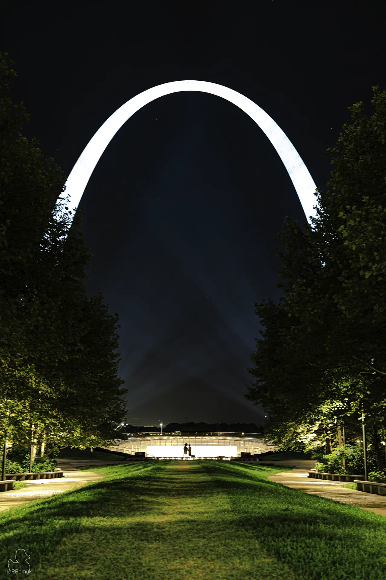
The blue hour and night photographyalso open up interesting creative possibilities. As darkness increases, the reflective surface loses its connection to the colors of the sky, while the artificial lighting emphasizes the arch’s characteristic shape. The Gateway Arch then appears as a bright, closed outline against the dark background. Especially from the west, the illuminated structure forms a striking focal point within the expansive park area.
The nighttime illumination emphasizes the symmetry of the structure and makes its architectural form stand out particularly clearly. At the same time, the lighting installations within and beneath the arch create additional structures that become visible depending on the perspective. The relationship between the monumental steel construction and the comparatively small visitors, paths, and buildings in its surroundings highlights the true dimensions of the monument.
In addition to the classic overall views, architectural details also offer independent photographic motifs. The regular lines of the stainless-steel cladding, the narrow window openings of the observation deck, and the changes in the cross-section can be observed from different viewpoints. In the process, the structure can appear increasingly abstract without its original form having to remain fully recognizable.
The special photographic appeal of the Gateway Arch therefore lies not only in its function as a landmark of St. Louis. Rather, it combines extraordinary geometric architecture with the changing effect of natural and artificial light. Whether as part of the skyline, as a monumental structure from below, or as an illuminated arch against the night sky, the Gateway Arch offers diverse opportunities to capture the architecture and character of the city from different perspectives.

Historic Downtown St. Louis
Architecture, urban history and American heritage
The Downtown St. Louis in Missouricombines more than two centuries of American urban and architectural history. Between modern skyscrapers, historic administrative buildings, and former commercial buildings, it is possible to trace the different phases of development of a city that was among the most important economic centers of the United States in the 19th century. The monumental public buildings around Market Street in particular recall a time when St. Louis expressed its economic rise through representative architecture as well.
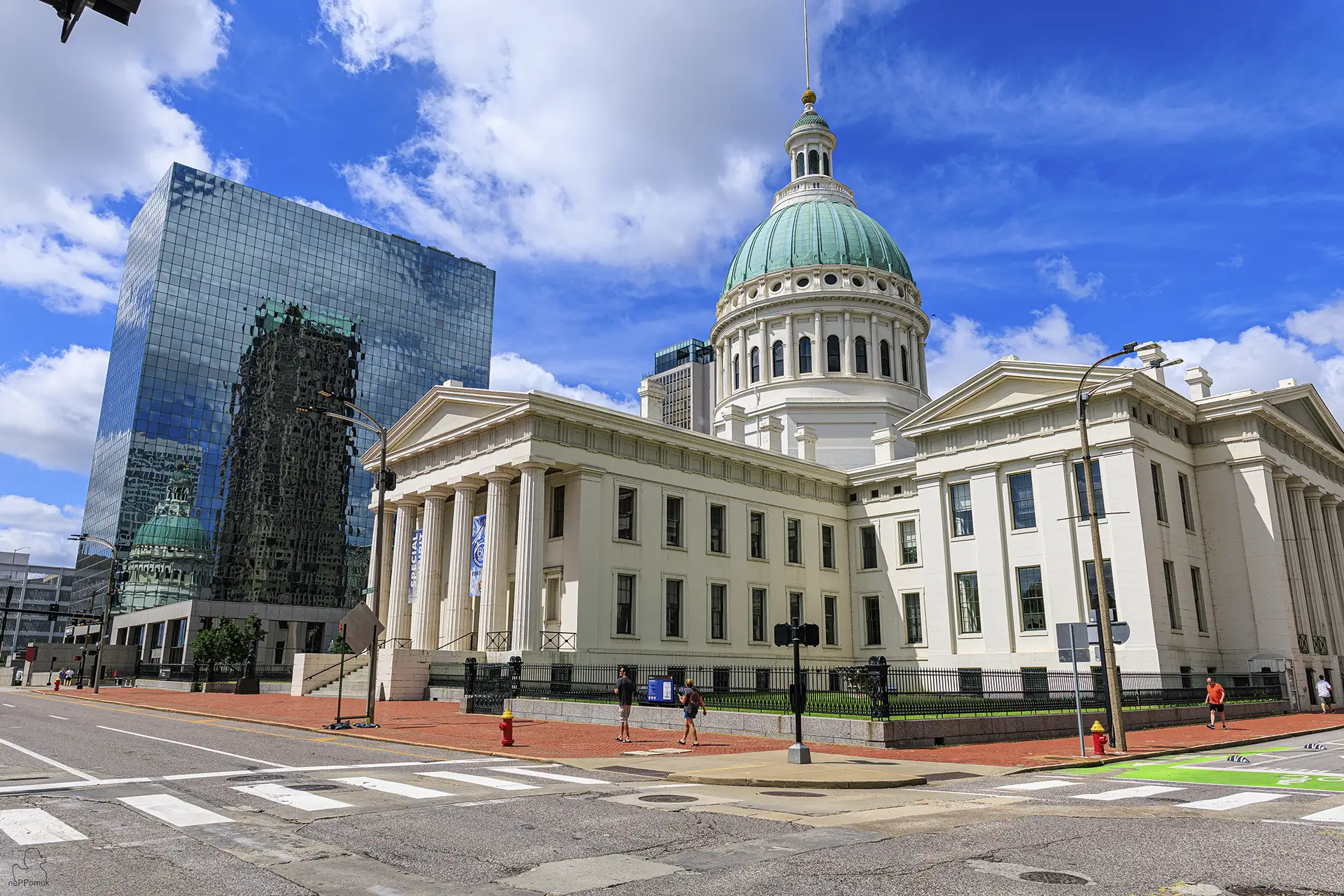
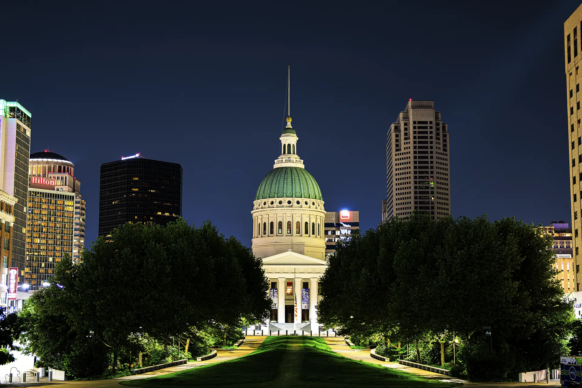
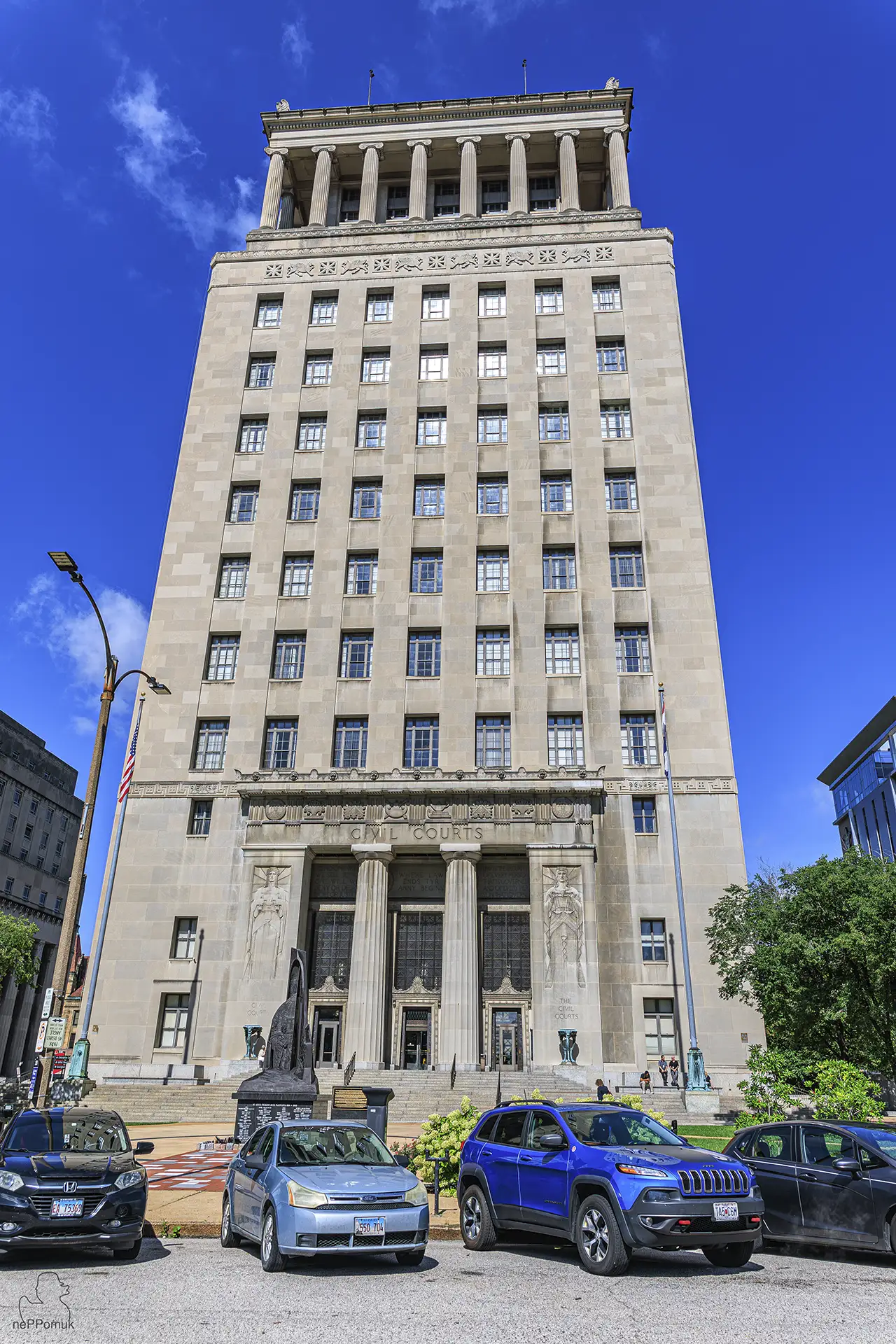
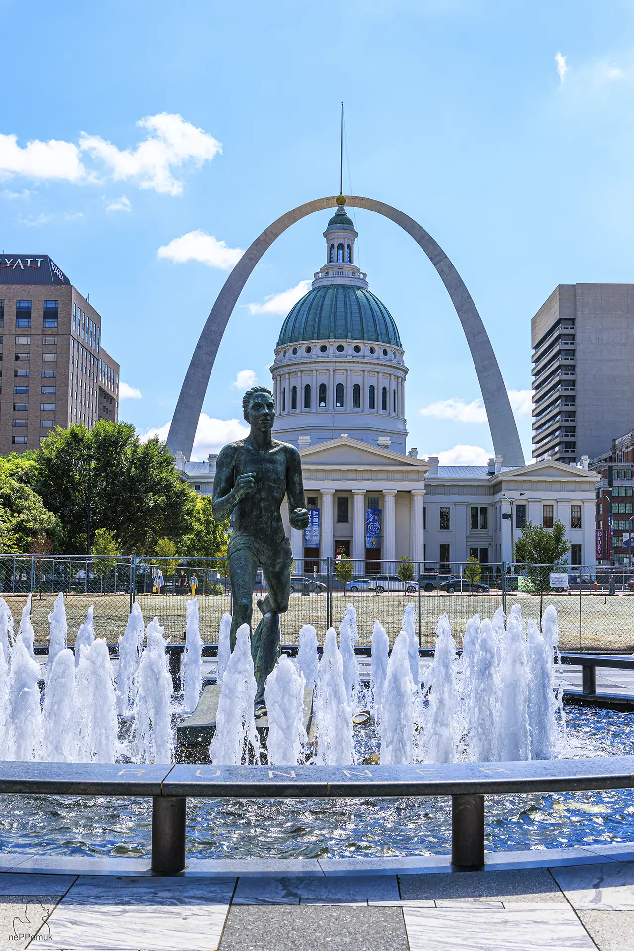
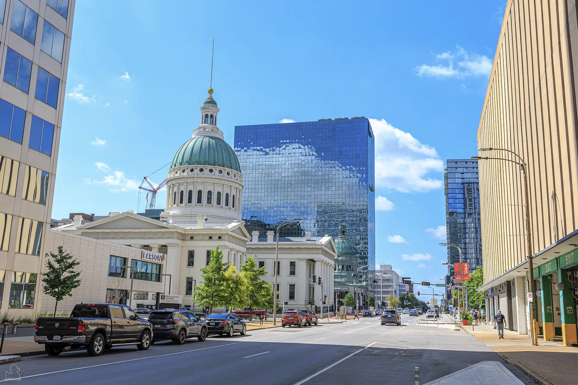
Among the most important historical sights of Downtown St. Louisis the Old Courthouse. With its widely visible dome, it is one of the most distinctive buildings downtown and was the site of important court cases involving slavery and civil rights. In addition, City Hall, the Old Post Office, and the Civil Courts Building document the development of public administration and the architectural ideas of different eras.
The historic cityscape is complemented by numerous other buildings. Theaters, former commercial buildings, richly decorated facades, and modern office buildings often stand right next to one another. Particularly along Market Street, Washington Avenue, and the adjacent streets, a varied juxtaposition of historic building fabric, modern architecture, and urban everyday life. Downtown St. Louis thus conveys a multifaceted impression of the economic, social, and cultural development of the American metropolis.
Read more
Old Courthouse – Historic Landmark and Center of American Legal History
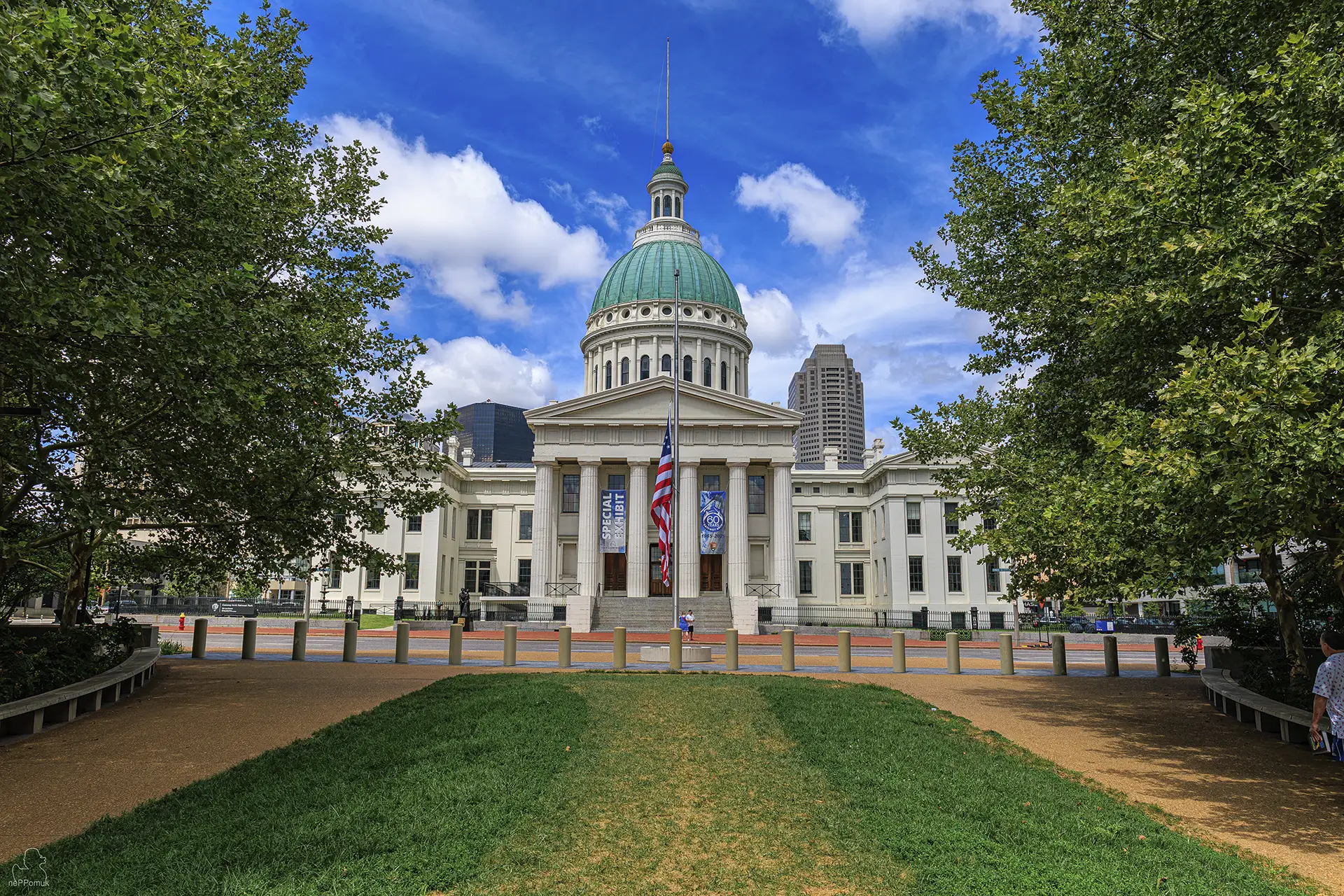
The Old Courthouse in St. Louisis one of the city’s most important historic buildings and, with its distinctive dome, forms a clearly visible landmark in Downtown. Located immediately west of the Gateway Arch, the former courthouse stands at a place where the representative architecture of the 19th century and the modern cityscape meet directly. Its neoclassical design, monumental colonnade architecture, and central dome give it a special place among the historic sights of St. Louis.
The creation of the present building goes back to the rapid growth of the city during the first half of the 19th century. The original courthouse of 1828 soon proved too small for the increasing administrative and judicial tasks. Therefore, construction of a larger courthouse began in 1839, designed by architect Henry Singleton. The new complex followed a cruciform floor plan with a central rotunda. While some parts of the building were already in use from 1845, the expansion and remodeling work continued for many years.
The Old Courthouse acquired its final form with the completion of its large dome in 1862. Architect William Rumbold designed an elaborate iron structure that made the building stand clearly above the surrounding development. At a height of around 59 meters, the courthouse was among the tallest structures in the city for decades. The combination of classical façade design and a monumental dome was modeled on the representative government buildings of the United States and reflected the growing self-confidence of the economically rising metropolis.
The architectural structure of the exterior façades is particularly striking. Monumental columns, generous front steps, and clearly articulated window axes emphasize the public character of the building. The central dome unites the different wings into a coherent overall composition. Inside is a multi-story rotunda, whose galleries and historical wall paintings are among the courthouse’s significant architectural elements. The design was intended not only to meet the requirements of a courthouse, but also to make the authority and importance of public institutions visible.
The Old Courthouse was, however, much more than a representative administrative building. For decades, it formed a central place in the political and social life of St. Louis. Public assemblies were held in its rooms, economic and political issues were discussed, and court cases were heard whose significance extended far beyond the city limits. In particular, the disputes over slavery, personal freedom, and civil rightsmade the building an important site in American legal history.
Until 1930, the Old Courthouse was used as a courthouse. It subsequently lost its original function and was later incorporated into the national memorial on the Mississippi. Today it belongs to Gateway Arch National Park and, with restored historic rooms and museum exhibits, offers insight into the legal and social history of the United States. After extensive renovation, the building reopened to visitors in May 2025.
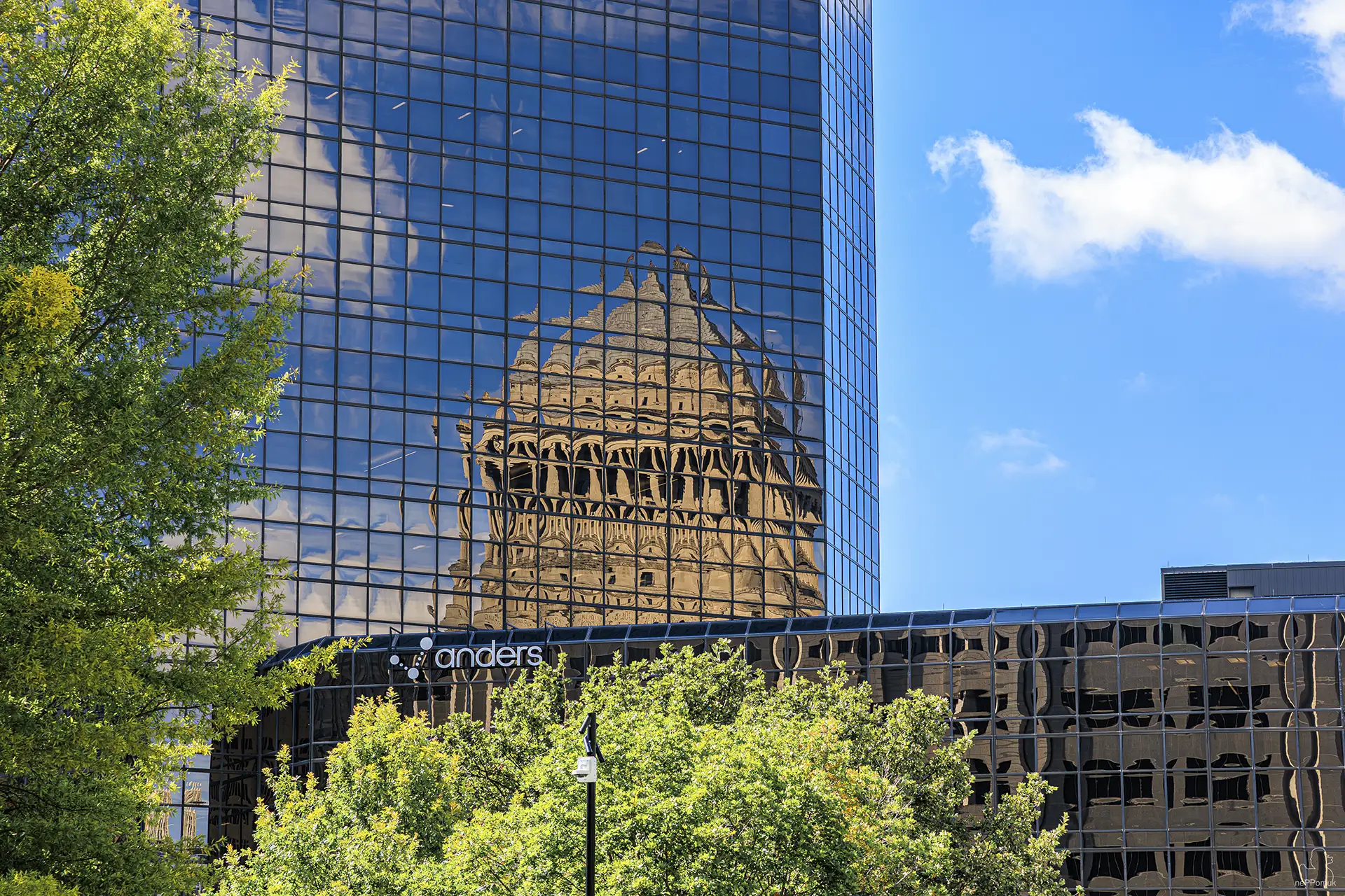
The special standing of the Old Courthouse is also evident from its location within the city. Seen from the east, the historic dome rises directly in front of the modern buildings of downtown. From other viewpoints, it appears in combination with the Gateway Arch, whose monumental steel structure forms a strong architectural contrast. It is precisely this juxtaposition of classical architecture and modern urban developmentthat makes the Old Courthouse one of the most characteristic buildings in St. Louis.
Dred Scott, Freedom Suits and the Struggle for Civil Rights
The historical significance of the Old Courthouse is inextricably linked to one of the most consequential court cases in American history. In 1846, Dred and Harriet Scott filed suits in St. Louis seeking their freedom from slavery. The case developed through several levels of jurisdiction into a fundamental dispute over the legal status of enslaved people and the spread of slavery in the United States.
Dred Scott was an enslaved African American who had lived for a time with his former owner in areas where slavery was prohibited. Together with his wife Harriet, he invoked the legal practice of the time, according to which a longer stay in a free state or territory could under certain conditions establish a claim to freedom. The two hoped to assert their personal freedom through the courts.
The case was initially heard in the courts in St. Louis. After an initial trial in 1847 and further proceedings, the couple was initially granted a favorable ruling in 1850 by a court in Missouri. However, the decision was appealed. The Supreme Court of Missouri overturned the ruling in 1852 and thereby rejected the previous case law that had led to the release of enslaved people in comparable cases. The legal dispute was then continued at the federal level and ultimately reached the Supreme Court of the United States.
With the Dred Scott decision of 1857, the Supreme Court issued a ruling that is among the most controversial in American legal history. Among other things, the Court declared that people of African descent whose ancestors had been brought to the United States as slaves could not, under its then interpretation of the Constitution, be American citizens. At the same time, the decision called into question Congress’s authority to prohibit slavery in certain federal territories.
The ruling significantly intensified the political tensions between the northern and southern states. It strengthened the interests of slaveholders while also provoking fierce criticism from opponents of slavery. The disputes over the legal and political future of slavery were among the central conflicts that would lead to the American Civil War a few years later. Dred and Harriet Scott ultimately received their personal freedom later in 1857 through manumission, regardless of the Supreme Court’s negative ruling.
The Scott spouses’ case was by no means the only freedom lawsuit in St. Louis. Between 1814 and 1860, more than 300 so-called Freedom Suitswere documented in the city. These were lawsuits brought by enslaved people who sought to obtain their freedom or the freedom of their relatives through legal means. The surviving court records today form an important historical source on the living conditions of enslaved people, the legal situation in Missouri, and the social conflicts before the Civil War.
Today, this history is commemorated by the Freedom Suits Memorialin the Civil Courts Building area. The bronze sculpture Freedom’s Homeby artist Preston Jackson, unveiled in 2022, honors the courage of those people who, despite their social and legal disadvantage, sought their way to court. The depiction combines historical scenes with the memory of the plaintiffs, some of whose names are inscribed on the memorial. The memorial thus complements the historical significance of the Old Courthouse with a modern public place of remembrance.
The history of the American women’s movement is also linked to the Old Courthouse. In the 1870s, Virginia Minorfought in court for women’s suffrage. After she was denied voter registration, she pursued a legal case that also went all the way to the Supreme Court. In 1875, it ruled that American citizenship did not automatically confer voting rights on women. It was not until the 19th Amendment of 1920 that women’s suffrage was constitutionally protected at the federal level.
The Old Courthouse thus stands for different stages of the American struggle for freedom, equality, and political participation. Its history makes clear that the development of civil rights was shaped not only by political decisions, but also by individual personal destinies and lengthy legal disputes. This historical dimension gives the building a significance that extends far beyond its architectural appearance.
City Hall, Old Post Office and Civil Courts Building – Representative architecture of St. Louis
The economic importance of St. Louis in the 19th and early 20th centuries was especially clearly reflected in its public buildings. As the city grew, so did the demands on administration, courts, and state institutions. At the same time, representative buildings were constructed whose architecture was intended to express the prosperity and self-image of a rising American metropolis. To this day, the St. Louis City Hall, the Old Post Office and the Civil Courts Buildingthe appearance of Downtown.
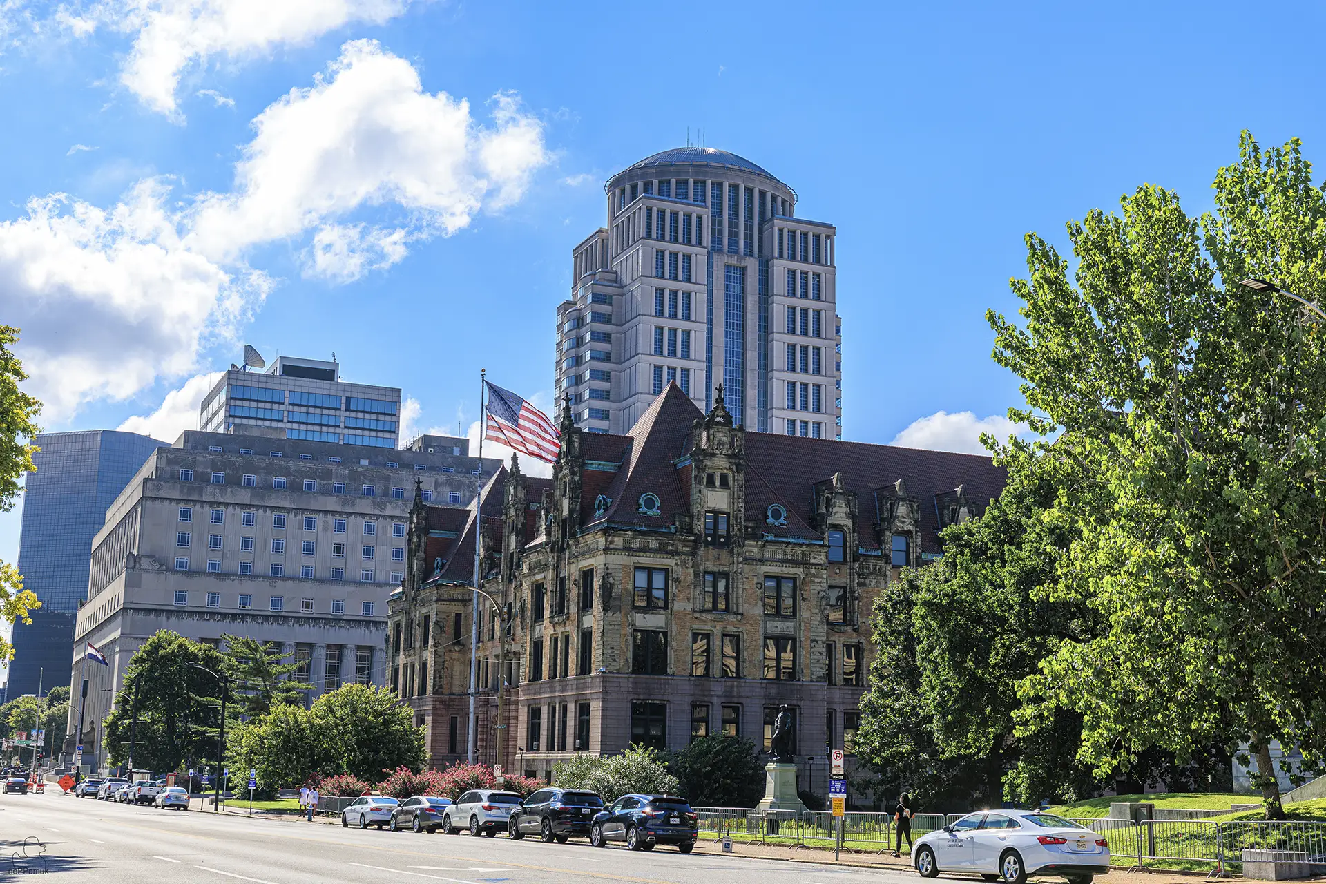
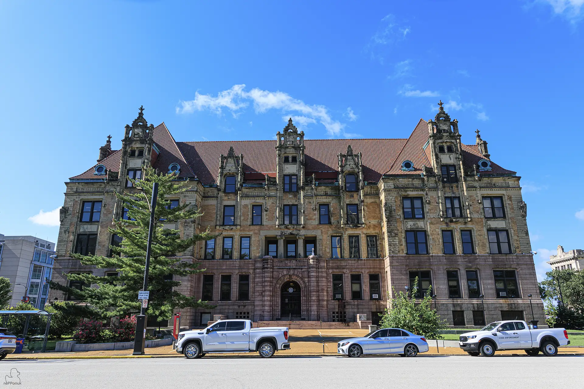
The St. Louis City Hall on Market Streetis one of the city’s most striking historic administrative buildings. After the existing city government offices had become too small for the growing metropolis, an architectural competition was announced for a new city hall. The commission was awarded to the architectural firm Eckel and Mann, whose design was inspired by the French Renaissance and, in particular, the Paris Hôtel de Ville. Construction began in 1891, and in 1898 the city government moved into the new building.
The architecture of the City Hall differs markedly from the neoclassical courthouses in downtown. Elaborately designed facades, steep roof surfaces, decorative window forms and rich sculptural ornament give the building a distinctly European character. The combination of granite, sandstone and brick underscores its representative character. Originally, the town hall had additional towers and roof structures, some of which were removed in the 1930s for structural reasons.
Another significant administrative building is the Old Post Office on Olive Street. The monumental building was constructed between 1875 and 1884 according to plans by the government architect Alfred B. Mullett. In terms of design, it follows the French-influenced Second Empire style, which was particularly widespread in the United States in the second half of the 19th century for representative public buildings. Its massive granite facades, richly decorated windows, and characteristic mansard roof give the building an almost fortress-like impression.
Originally, the Old Post Office housed not only the postal administration but also other federal agencies and judicial offices. The elaborate building documents the economic rise of St. Louis and the growing importance of the city for the administration of the American interior. At the same time, its location showed that the economic center of the city was increasingly shifting westward away from the immediate Mississippi riverfront. Today, the building is considered one of the most important surviving examples of American government architecture from the late 19th century.
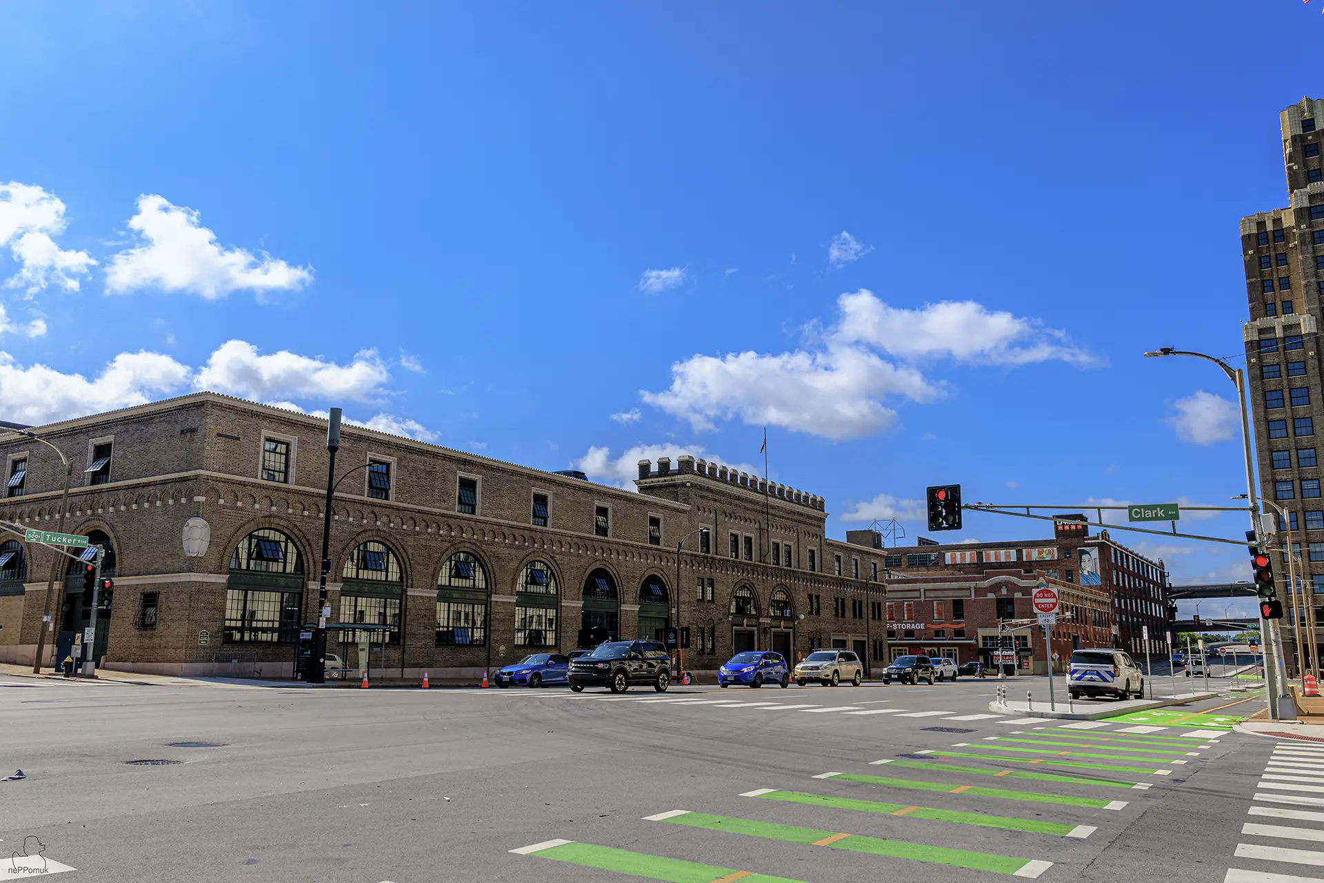
A clearly different architectural language is shown by the Civil Courts Building on Tucker Boulevard. Completed in 1930, the courthouse combines historical models with Art Deco elements. Particularly striking is its stepped roof structure, which is inspired by the form of the ancient Mausoleum of Halicarnassus. Above the massive main building rises a temple-like structure with columns and a distinctive stepped pyramid. Two monumental sculptures form the crowning top.
The Civil Courts Building was created in connection with extensive urban planning efforts to reorganize the public center of St. Louis. The aim was to connect several important administrative and cultural institutions along representative streets and squares. Its design therefore follows not only functional requirements but is also part of a larger urban concept intended to make the importance of public institutions visible in the cityscape.
In interaction with the surrounding buildings, these three structures illustrate the different architectural ideas of the periods in which they were created. While City Hall draws on European Renaissance architecture and the Old Post Office displays the monumental design language of the Second Empire, the Civil Courts Building combines ancient models with modern skyscraper architecture. It is precisely these The diversity of historic architectural styles in Downtown St. Louismakes the downtown area an interesting example of American urban development.
Stifel Theatre and Orpheum Theatre – Historic cultural buildings in Downtown
In addition to the representative administrative buildings, Downtown St. Louis has a number of important historic theaters. They recall the city’s cultural development during the late 19th and early 20th centuries, when St. Louis developed into an important center for music, stage performance, and public events. In particular, the Stifel Theatre and the former Orpheum Theatredocument different phases of this theater history.
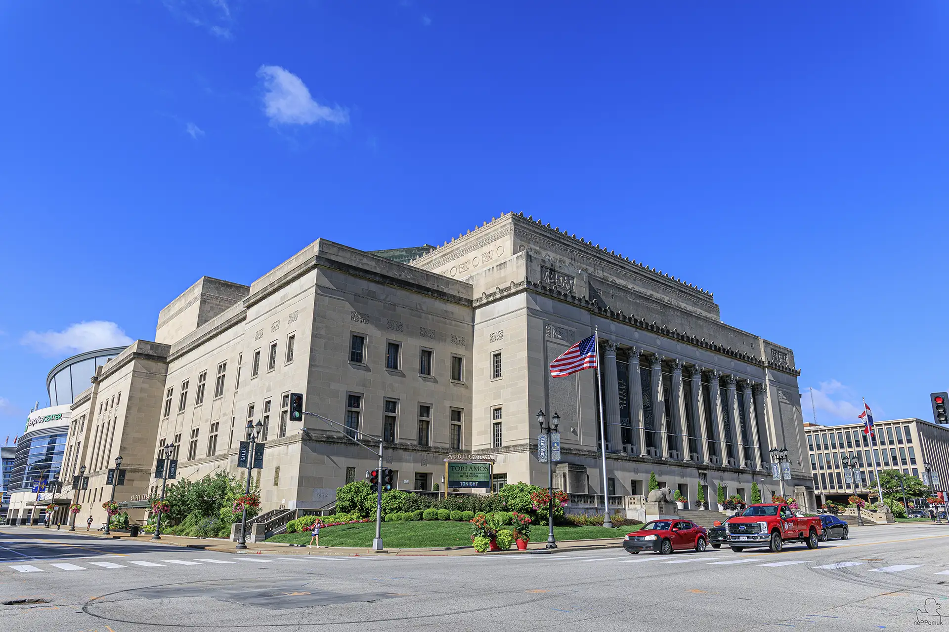
The present-day Stifel Theatre on Market Streetwas originally built as part of the Municipal Auditorium and in 1934 opened. The building was created as part of a comprehensive redesign of St. Louis’s civic center. Its architecture is based on classical models and is closely associated with the American City Beautiful movement. This urban-planning movement aimed to enhance the appearance of American cities through monumental architecture, generous open spaces, and representative public buildings.
The facade of the Stifel Theatre is characterized by a strictly symmetrical design and monumental Corinthian columns. Large wall sections are complemented by decorative reliefs and inscriptions that emphasize the building’s public and cultural purpose. Also characteristic are the large bear sculptures flanking the entrance area. With its broad street frontage, the theater fits into the representative architecture along Market Street and Memorial Plaza.
Inside, the theater was designed for large opera, concert, and stage productions. Even at its opening on April 21, 1934was Giuseppe Verdi’s Aidaan elaborate opera production was on the program. In the following decades, the house developed into an important venue for classical music, theater and entertainment. From 1934 to 1968, it served among other things as the performance venue for the St. Louis Symphony Orchestra, which is one of the oldest symphony orchestras in the United States.
After various phases of use and extensive renovation work, the historic theater was reestablished as an important venue. Today, the preserved architecture combines modern event technology with the representative appearance of the 1930s. The monumental exterior façade in particular makes the Stifel Theatre a striking part of the historic downtown.
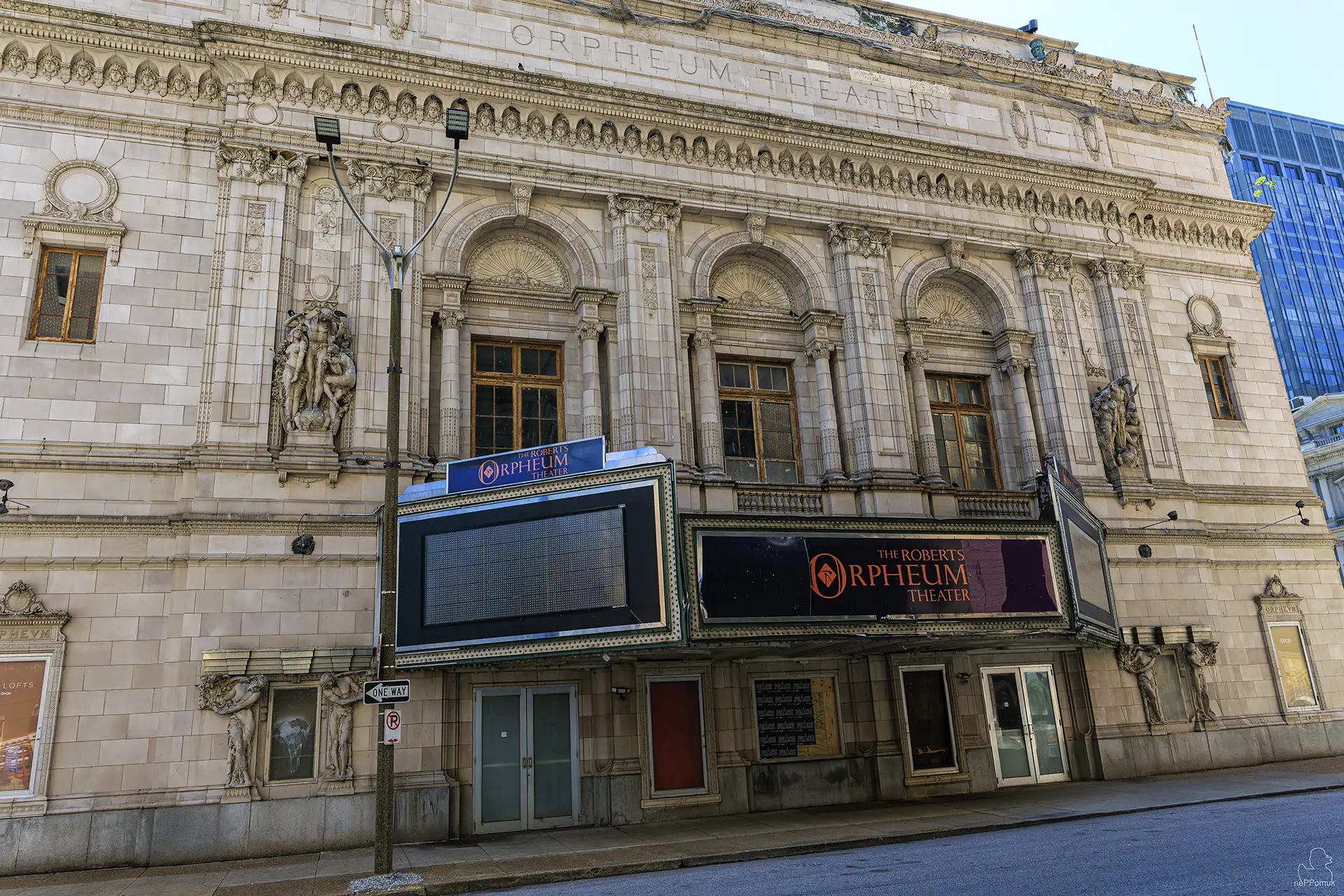
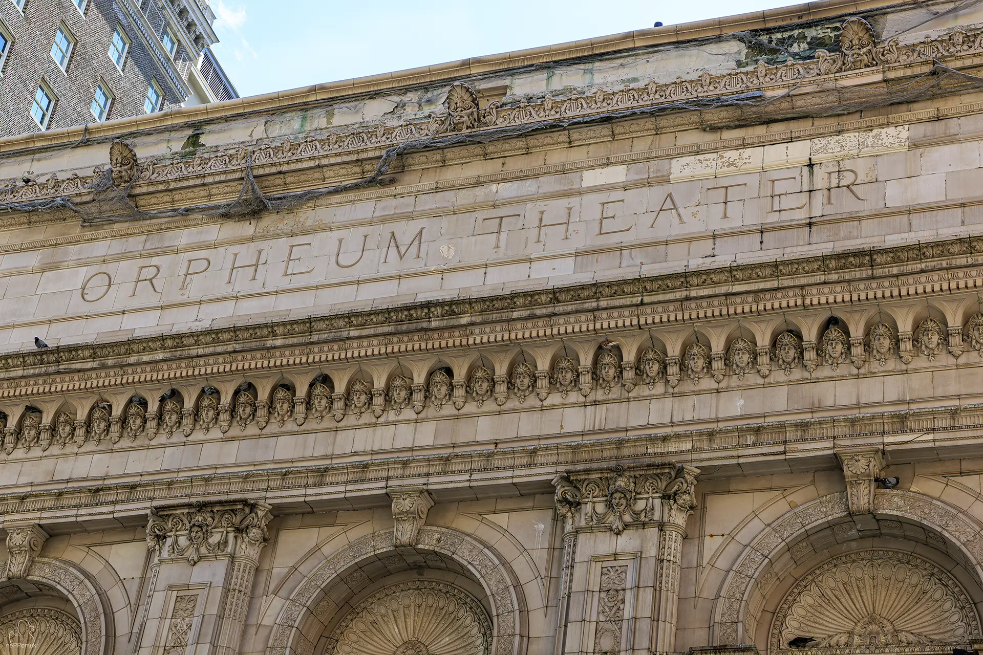
Another era of American entertainment history is embodied by the Orpheum Theatre on North Ninth Street. The historic theater building was designed by architect G. Albert Lansburgh and opened in 1917. Its design is based on Beaux-Arts architecture, which was frequently used in the early 20th century for representative theaters, train stations and public buildings. Elaborate façade details, decorative sculptures and monumental architectural elements were intended to make the building’s cultural significance visible from the outside.
The Orpheum originally belonged to an American theater network that focused on Vaudeville eventsspecialized in this. This popular form of entertainment combined music, dance, comedy, acrobatics, and other stage performances into varied programs. Vaudeville theaters were important social meeting places in many American cities and shaped the entertainment culture before the widespread advent of sound film, radio, and television.
With the rise of cinema, the use of the Orpheum also changed. The building was at times operated as a movie theater and underwent several alterations and changes of management. Under the name American Theatre and later Roberts Orpheum, it remained part of the theater history of Downtown St. Louis. Its historic façade still recalls a time when grand theater houses were central places of cultural and social life.
The two buildings illustrate different developments in American theater architecture. While the Stifel Theatre was created as a representative municipal cultural building, the Orpheum documents the history of commercial entertainment and private theater companies. Together, they show the significance of music, theater, and performing arts in the cultural development of St. Louisheld.
Between Market Street and Washington Avenue – Historic facades and modern city life
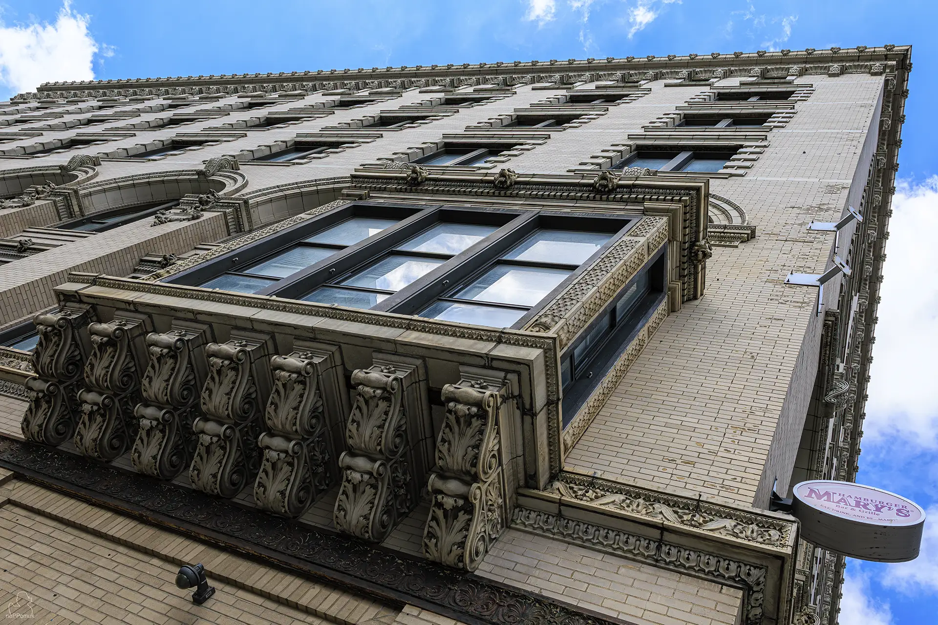
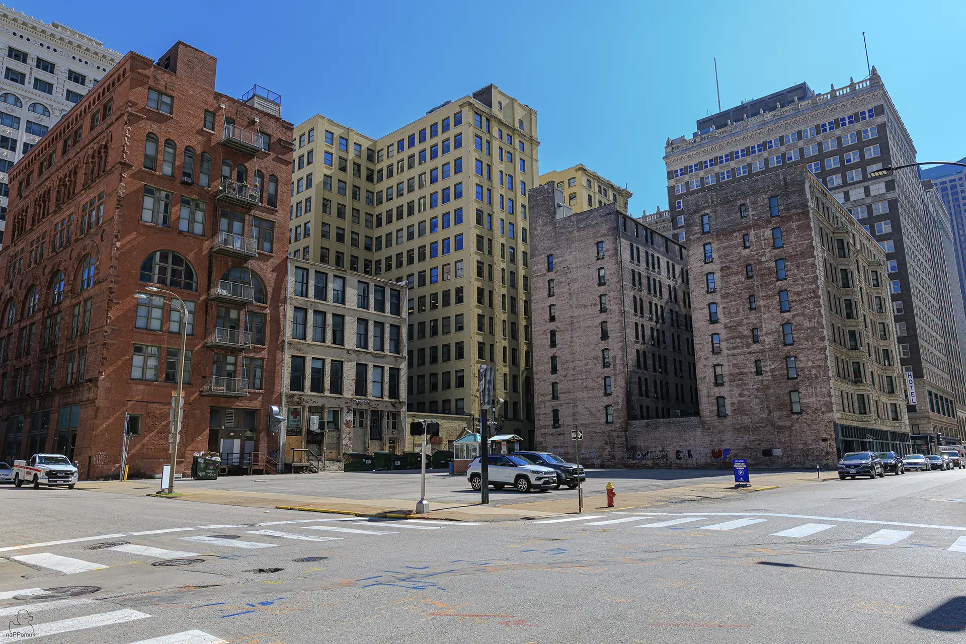
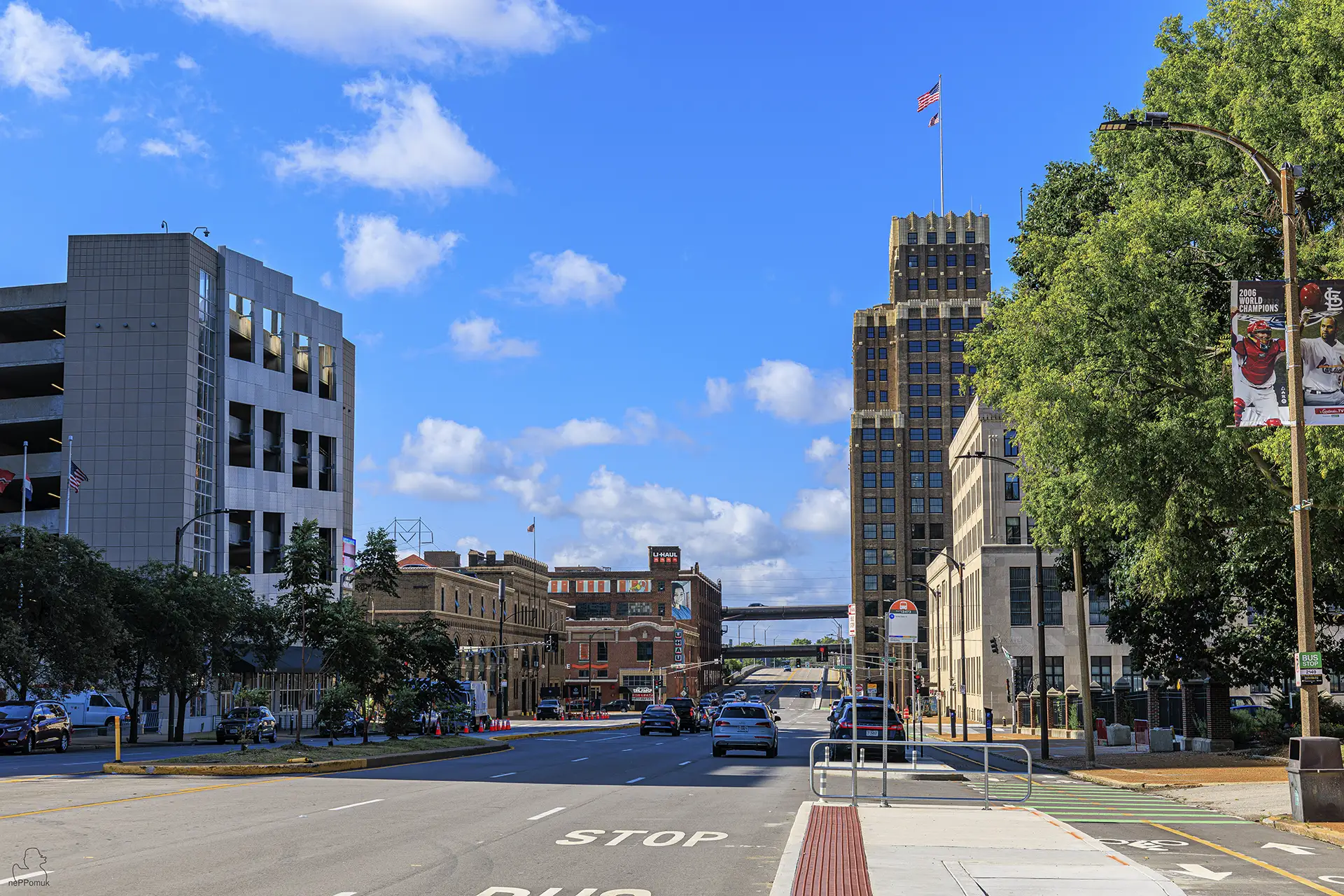
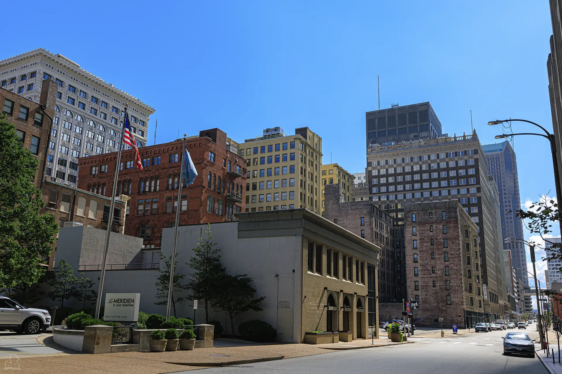
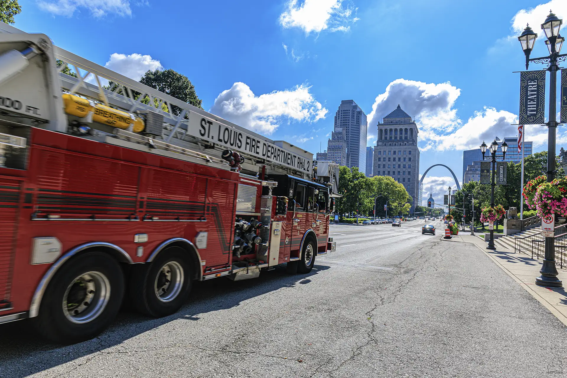
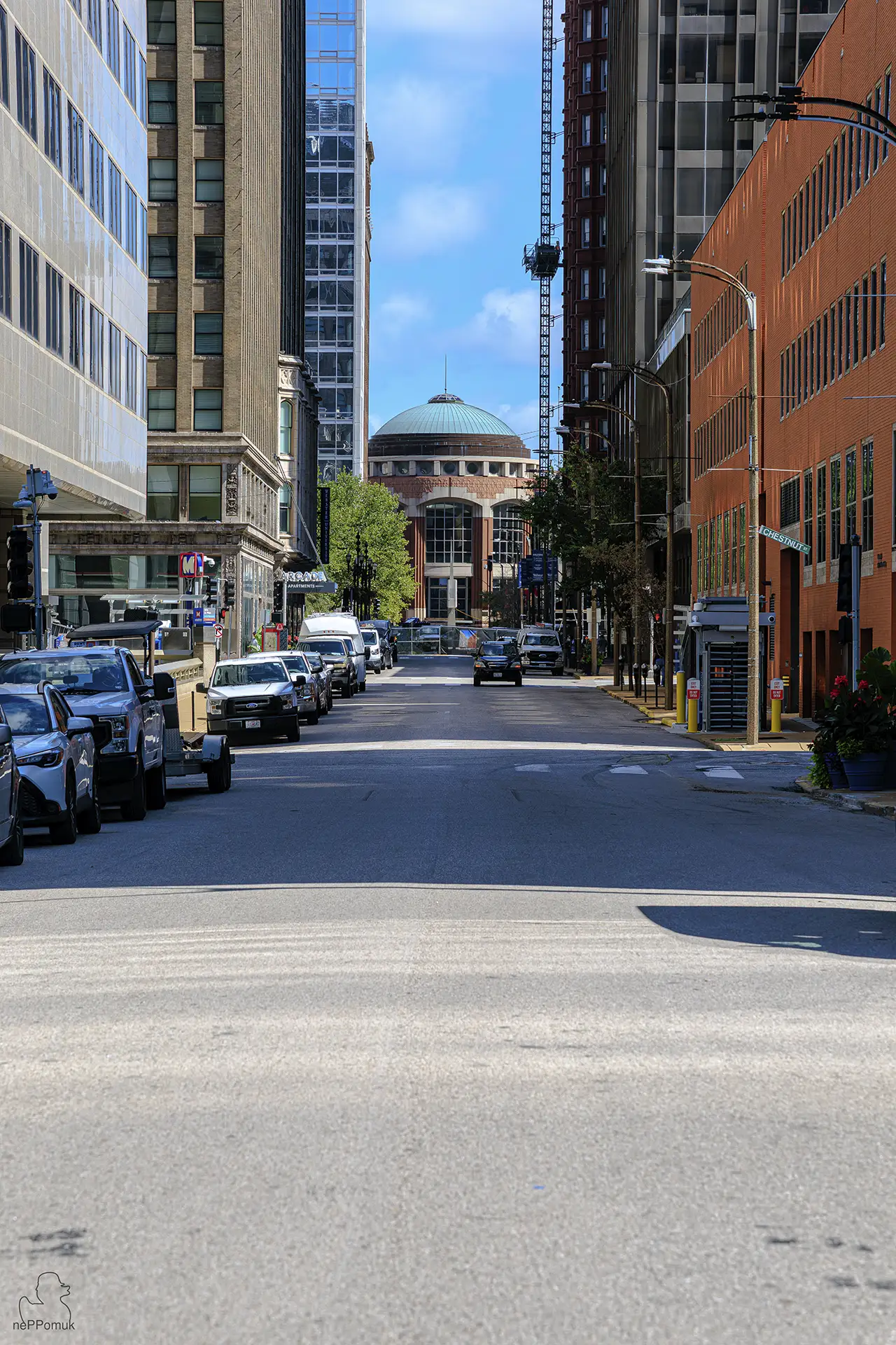
Away from the major attractions, the character of Downtown St. Louisespecially clearly in its streets and building facades. The downtown area is not a uniformly designed historic old town, but the result of numerous economic and urban development changes. Monumental administrative buildings, former department stores, modern office towers and comparatively unassuming brick buildings are often found directly next to one another. It is precisely these architectural contrasts that make the cityscape varied and convey an impression of the metropolis’s different phases of development.
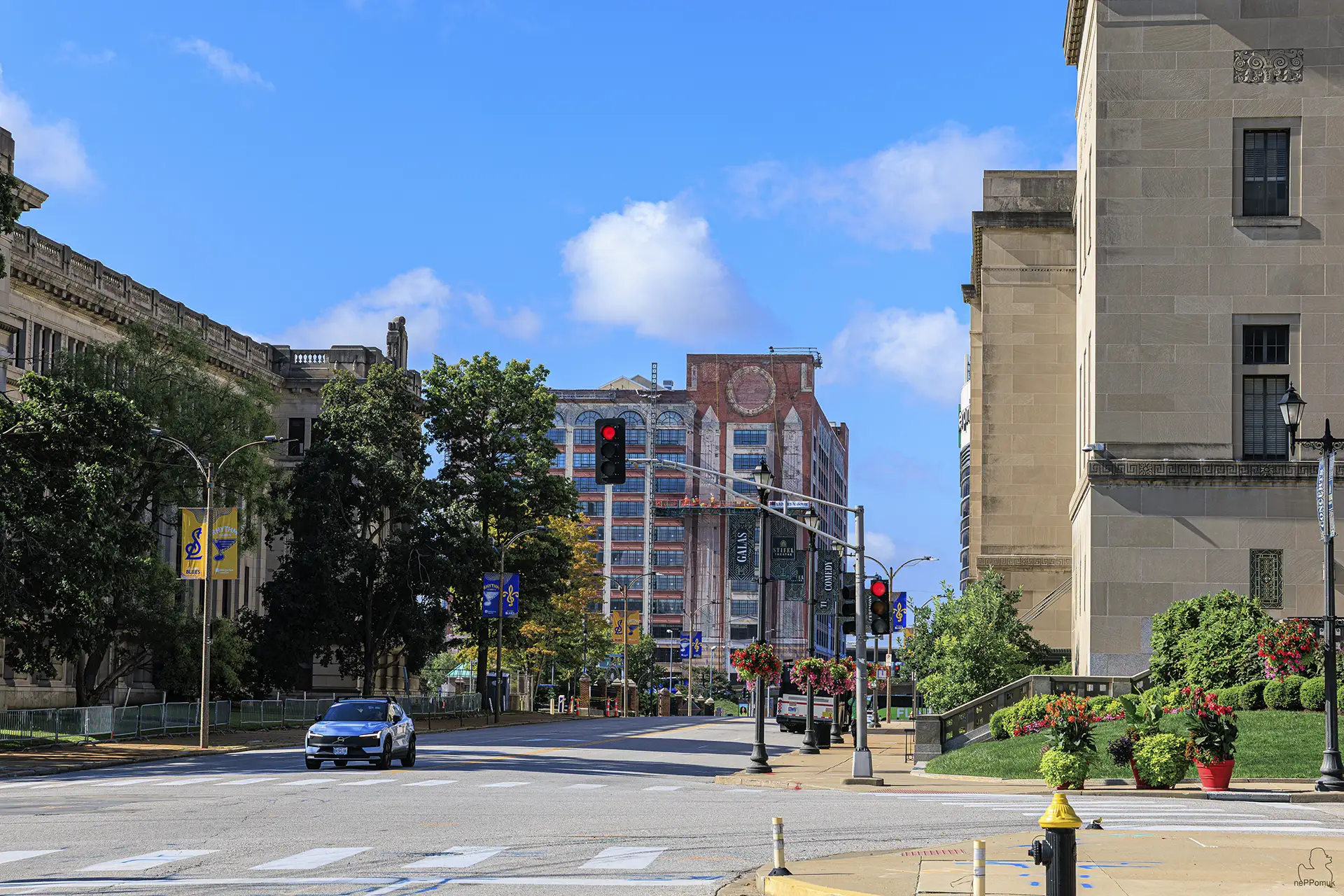
The Market Streetis one of the most important east-west links in downtown. It stretches from the area around the Gateway Arch through the public and economic center of Downtown and connects numerous prominent buildings with one another. Along the street are, among others, the Old Courthouse, the Civil Courts Building, City Hall and the Stifel Theatre. Generous street spaces, representative buildings and public squares illustrate the ambition the city had for designing its center in the early 20th century.
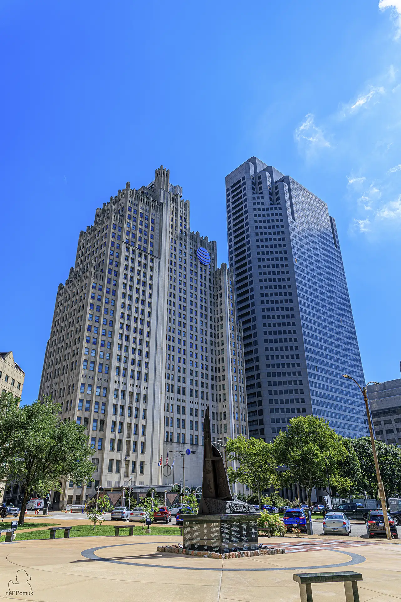
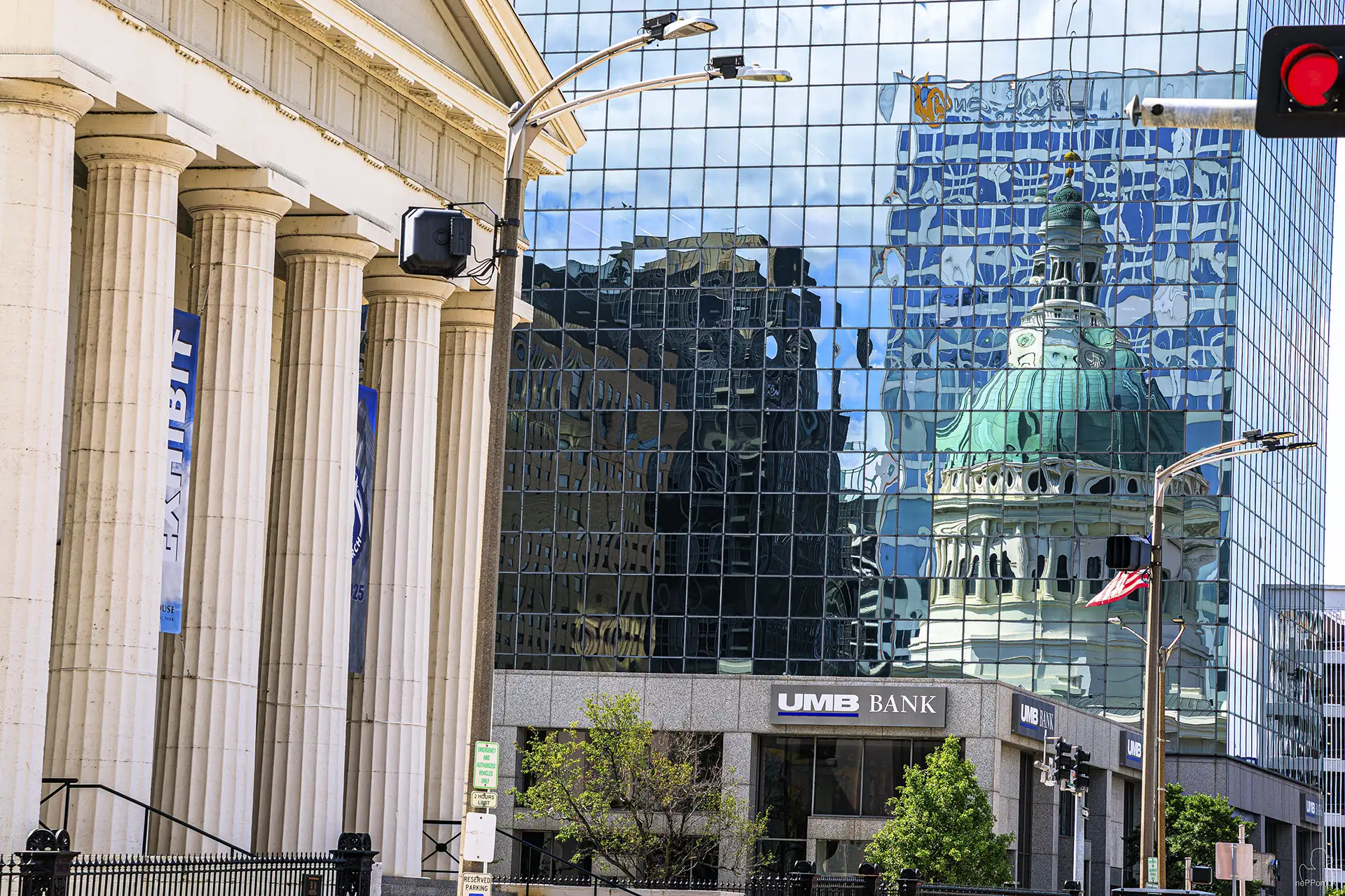
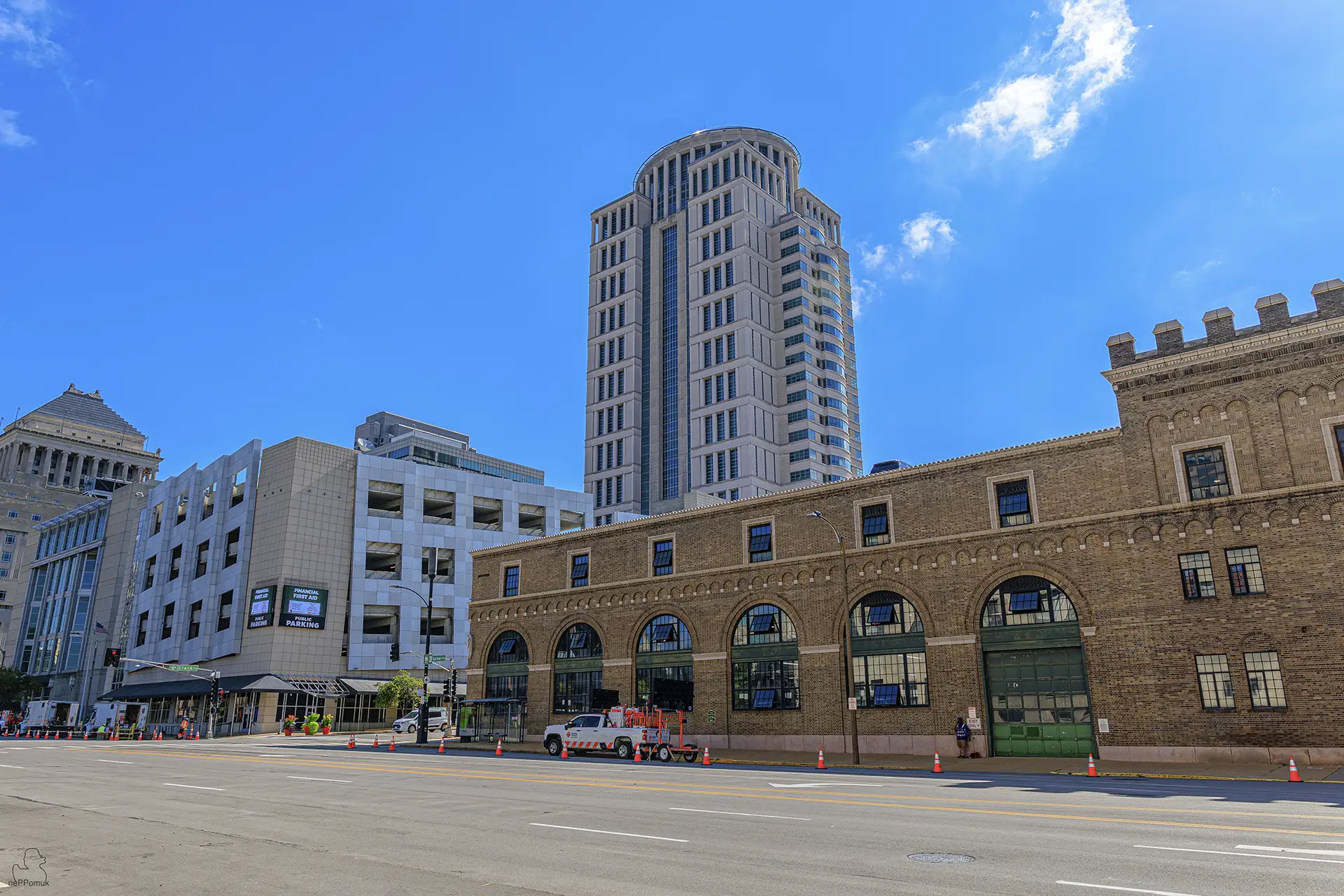
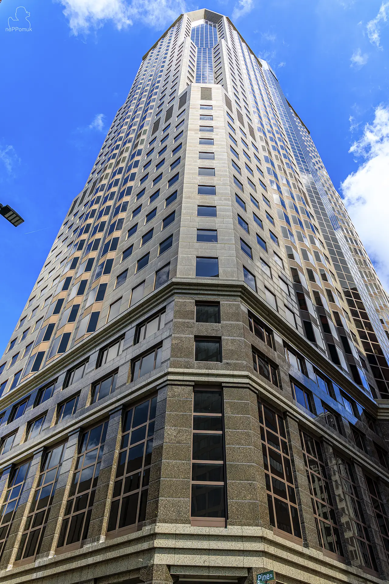
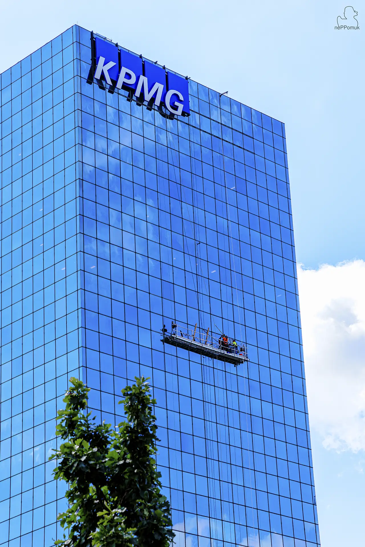
What is particularly striking is the juxtaposition of historic and modern architecture. While the public buildings are often characterized by massive natural stone facades, columns and decorative elements, the newer office towers are dominated by glass, steel and clearly structured facade surfaces. Buildings such as the One Metropolitan Squaredisplay a clearly different architectural style from the historic commercial buildings in their neighborhood. Reflections, differing building heights and changing lines of sight create a multifaceted cityscape.
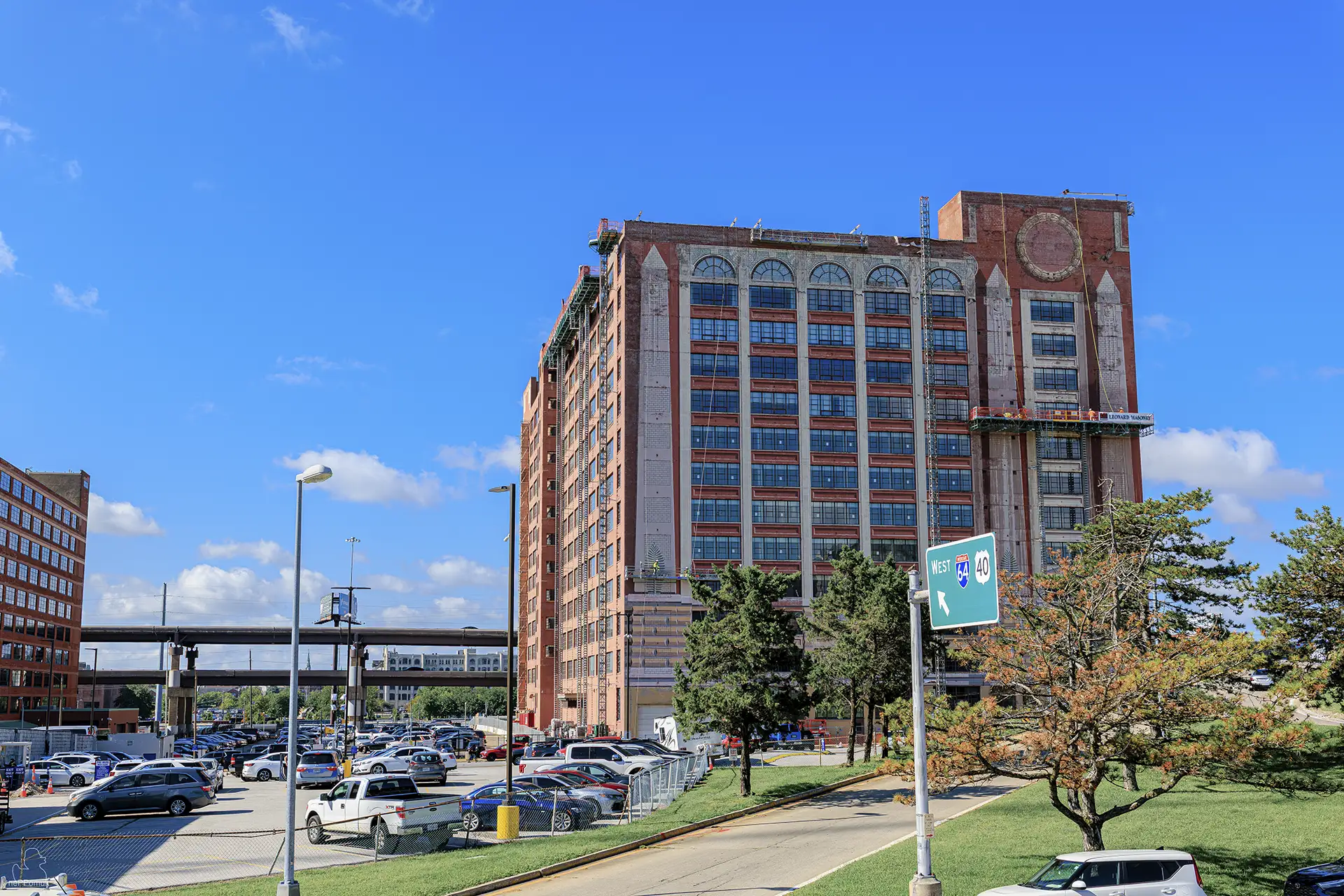
North of Market Street lies Washington Avenueanother important historic commercial street. Especially in the late 19th and early 20th centuries, its surroundings developed into a center of wholesale trade and the clothing industry. Numerous companies had multi-story warehouses, production buildings, and commercial buildings erected here. The proximity to rail connections and the Mississippi favored the movement of goods and made it possible to supply the growing markets in the American interior.
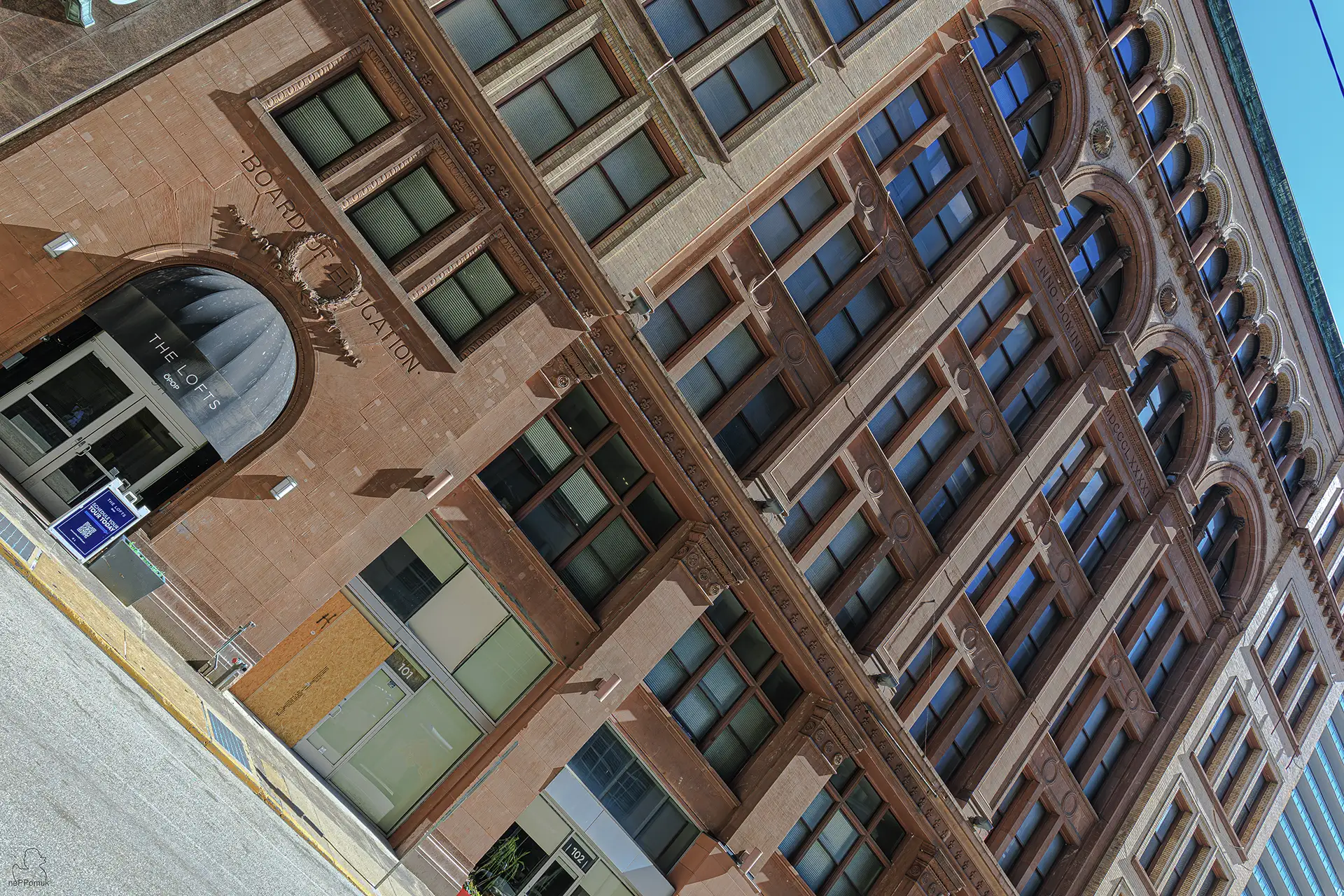
The historic significance of Washington Avenue is still evident today in its preserved building facades. Large window areas, decorative brick ornaments, natural stone elements, and elaborately designed cornices characterize numerous former commercial buildings. Many buildings date from a time when St. Louis was among the most important centers of the American clothing industry. The architecture combines functional requirements for storage and production with the representative aspirations of economically successful companies.
With the decline of traditional industrial and commercial sectors, the use of many buildings changed fundamentally. Former warehouses and commercial buildings were partially abandoned, but later converted into apartments, offices, restaurants, and event spaces. In particular, the conversion of historic commercial buildings into so-called Loft Apartmentschanged the appearance of Washington Avenue. In many cases, the historic building fabric was preserved, while the interiors were adapted to new requirements.
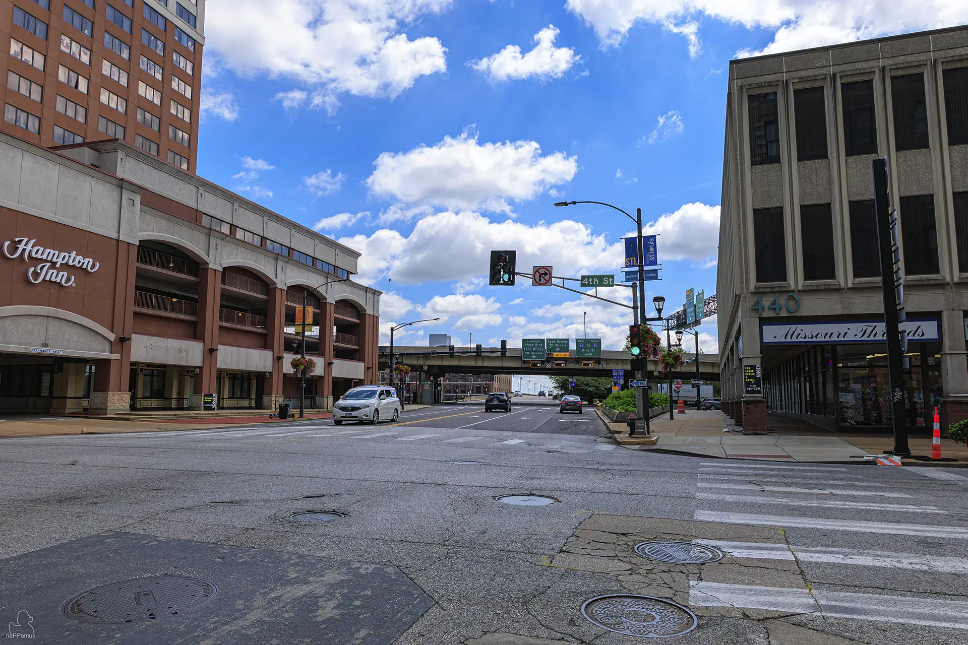
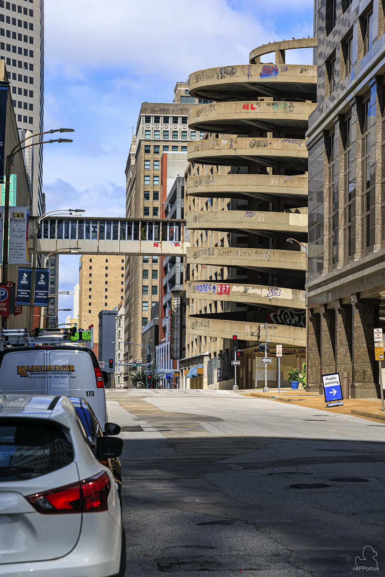
Other areas of Downtown developed less uniformly. In addition to modernized buildings, there are still older facades, unused lots, and larger parking areas. These different uses make clear that downtown St. Louis has been shaped to this day by economic structural change and urban planning adjustments. The decline of traditional retail functions, the relocation of jobs, and the reorganization of traffic have changed the cityscape over decades.
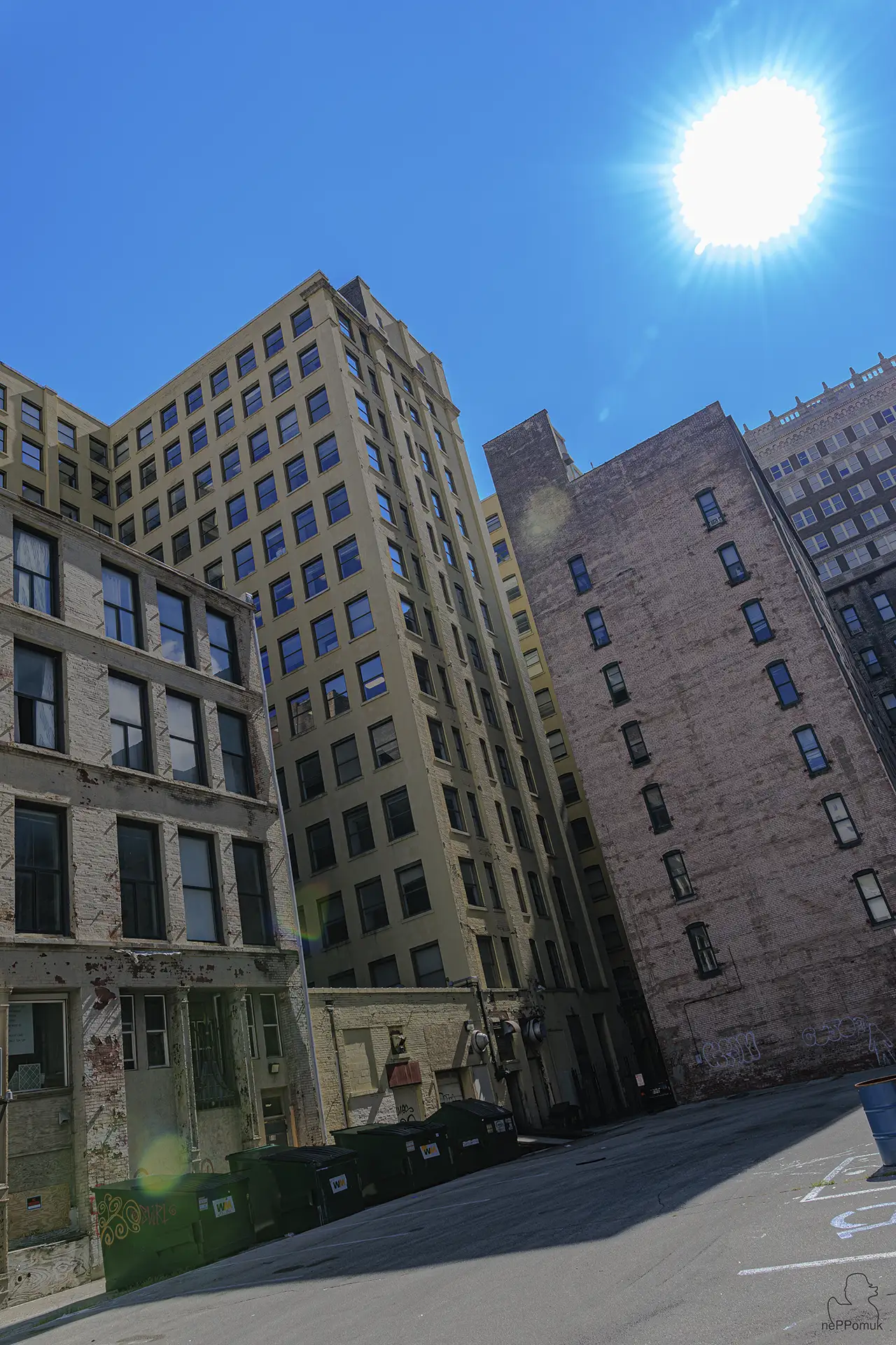
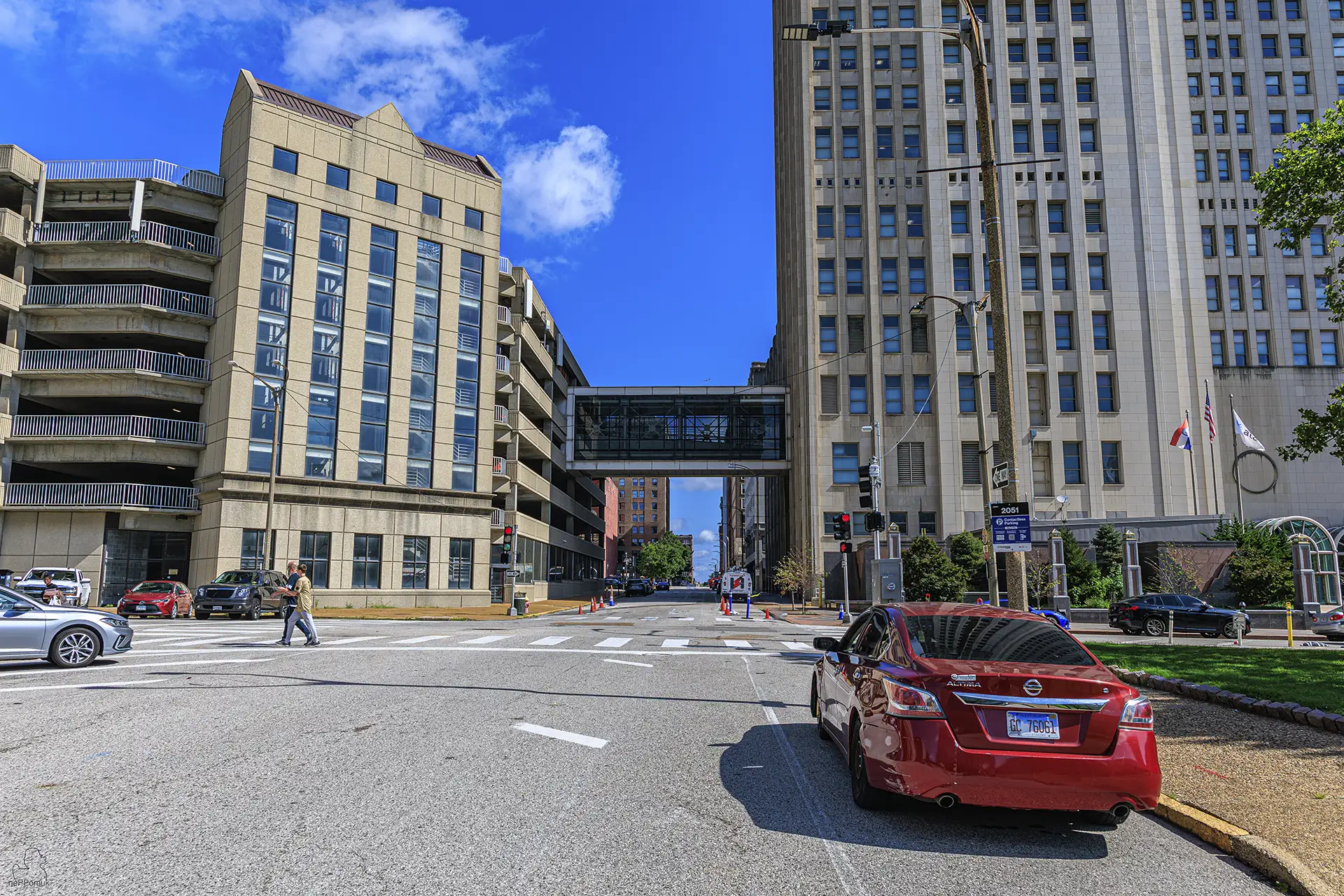
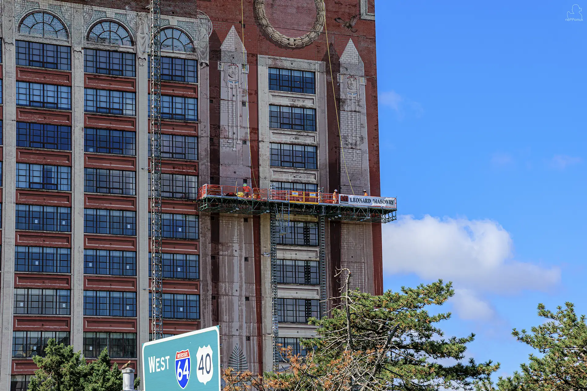
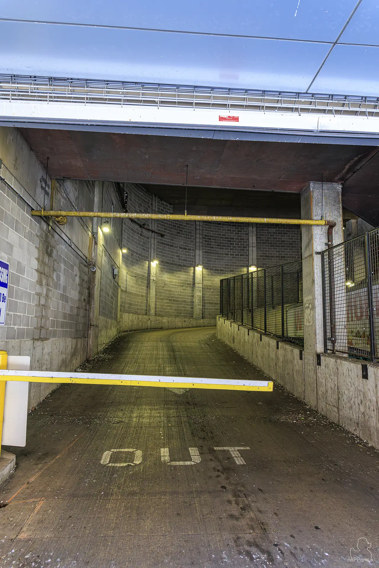
The smaller streets and connections between the major traffic arteries in particular convey a direct impression of this development. Historic brick facades stand next to modern building services, older pedestrian bridges connect different parts of buildings, and large-scale wall designs change the perception of otherwise functional architecture. Ordinary elements of daily urban life such as road traffic, construction sites, parking garages, and technical facilities also belong to the appearance of a downtown that is constantly changing.
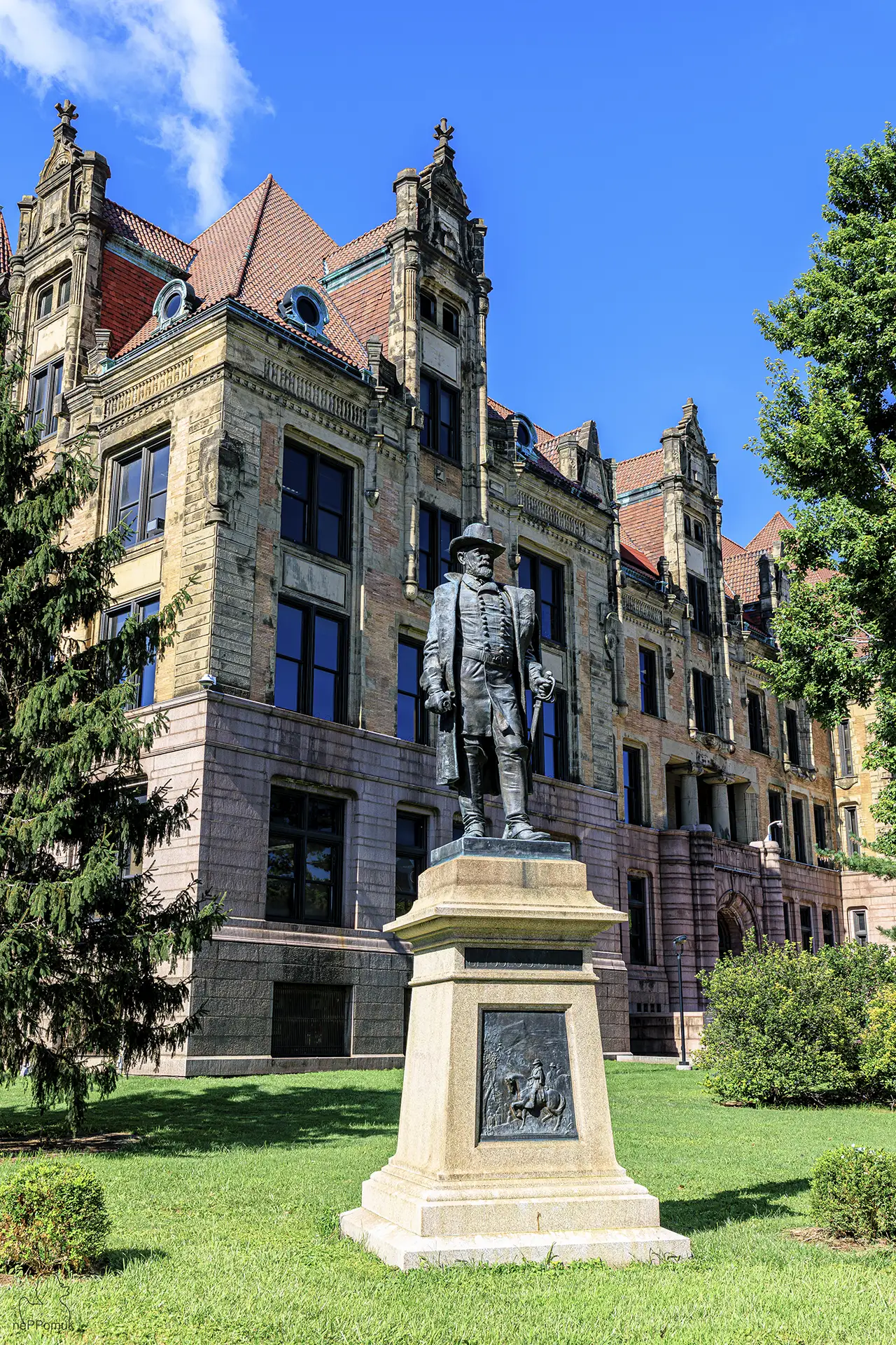
For architectural photography in St. Louisthis creates numerous different motifs. Historic facade details can be viewed just as much as modern glass fronts, geometric lines, or unusual perspectives between the skyscrapers. The especially strong contrasts between monumental buildings and everyday street scenes open up possibilities for depicting the city beyond its familiar landmarks.
The downtown area of St. Louis is therefore not just a place of important historic sights. It also documents the economic transformation of an American metropolis whose architecture was shaped by different social ideas and functional requirements. The interplay of historic heritage, modern urban development, and urban everyday lifemakes Downtown an essential part of the city portrait of St. Louis.


Citygarden St. Louis
Sculpture park and modern art in Downtown
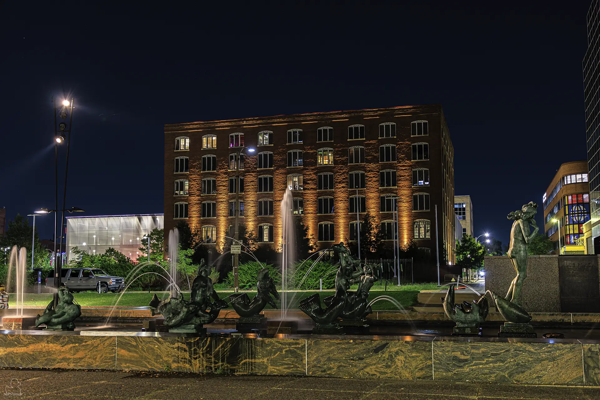
In the middle of Downtown St. Louislies the extraordinary Citygarden public sculpture park, which combines international contemporary art with an elaborately designed urban landscape. Between the skyscrapers and historic buildings of the city center, not an area covering just under three hectares extends: covering around 1.2 hectaresthe complex brings together monumental sculptures, green spaces, fountains, and different areas for lingering. Opened in 2009, the park belongs to the extensive Gateway Mall and forms a deliberate counterpoint to the dense development of the city center.
The distinctive feature of the Citygarden Sculpture Parkis the immediate accessibility of its artworks. Unlike in a traditional museum, the sculptures stand freely among paths, trees, and water features. Visitors can approach the works from different directions and experience them in direct relation to the surrounding architecture. The collection now includes 29 sculptures by international artists, including works by Igor Mitoraj, Erwin Wurm, Yoshitomo Nara, Keith Haring, and other important representatives of modern and contemporary art.
It is precisely the juxtaposition of public art, modern landscape architecture, and urban everyday lifethat makes the Citygarden an interesting part of St. Louis. The sculptures change in effect depending on perspective, natural light, and the buildings in the background. At the same time, the park shows the role that art and attractive public spaces can play in the development of American downtowns.
Read more
Citygarden – art, landscape architecture and public space in downtown St. Louis
The creation of the Citygarden in St. Louisis closely linked to efforts to reshape the downtown area into an attractive public living space again after decades of economic and demographic change. As early as the early 20th century, city planner George Kessler developed the idea of creating a generous series of green spaces and representative public buildings along Market Street. These plans led to the so-called Gateway Mall, a long, linear corridor of green space and open space between the Mississippi and the western parts of downtown.
The development of the Gateway Mall unfolded unevenly over many decades. While individual areas were designed as public squares or green spaces, other areas remained largely unused or lost importance due to urban development changes. At the end of the 1990s, new concepts emerged that were intended to integrate public space more strongly into the economic and cultural development of downtown.
A decisive role in this was played by the Gateway Foundation, a nonprofit foundation that has been committed to art and urban design in the St. Louis region since 1986. Together with the city, it developed the concept of a publicly accessible sculpture park intended to integrate works of art by internationally renowned artists into a contemporary landscaped green space. The relevant agreements were made in 2007, construction began in 2008, and the Citygarden opened in July 2009.
The landscape architectural planning was commissioned to the firm Nelson Byrd Woltz Landscape Architects. The goal was not simply to place a collection of sculptures on an existing lawn. Rather, the aim was to create a cohesive public space whose design takes account of the geographical and ecological characteristics of the region.
Particularly the Mississippi and its river landscapesserved as design models. The concept divides the park into different areas that are reminiscent of the river system’s uplands, floodplains and agriculturally shaped terraces. Curved walls, gently modeled changes in terrain and carefully selected plant species reflect these natural structures. A roughly 168-meter-long wall made of Missouri limestone recalls in its form the erosion-shaped steep slopes along the regional river landscapes.
Great importance was also attached to connecting the planting to the natural surroundings. Numerous native tree species, shrubs and perennials form a varied vegetation that changes in appearance over the course of the seasons. In addition, rain gardens and special drainage systemswere created to absorb rainwater, retain it and in part return it to the soil. Citygarden thus combines landscape-architectural design with practical measures of ecologically oriented urban development.
Among the particularly striking elements are the various water features. An elongated basin with a waterfall, smaller water areas and an interactive water play feature loosen up the design. Especially the so-called Spray Plaza with 102 water jetsmakes the park a lively place to spend time. While the water features are used mainly in the warmer months, the fountains and basins form an important part of the spatial design throughout the year.
The openness of Citygarden is crucial to its character. The park has no enclosing fence and can be entered from the adjacent streets. The artworks are therefore not confined to a separate exhibition area, but are part of the ordinary urban space. Admission to Citygarden is free, making the sculpture collection accessible independently of a visit to the museum.
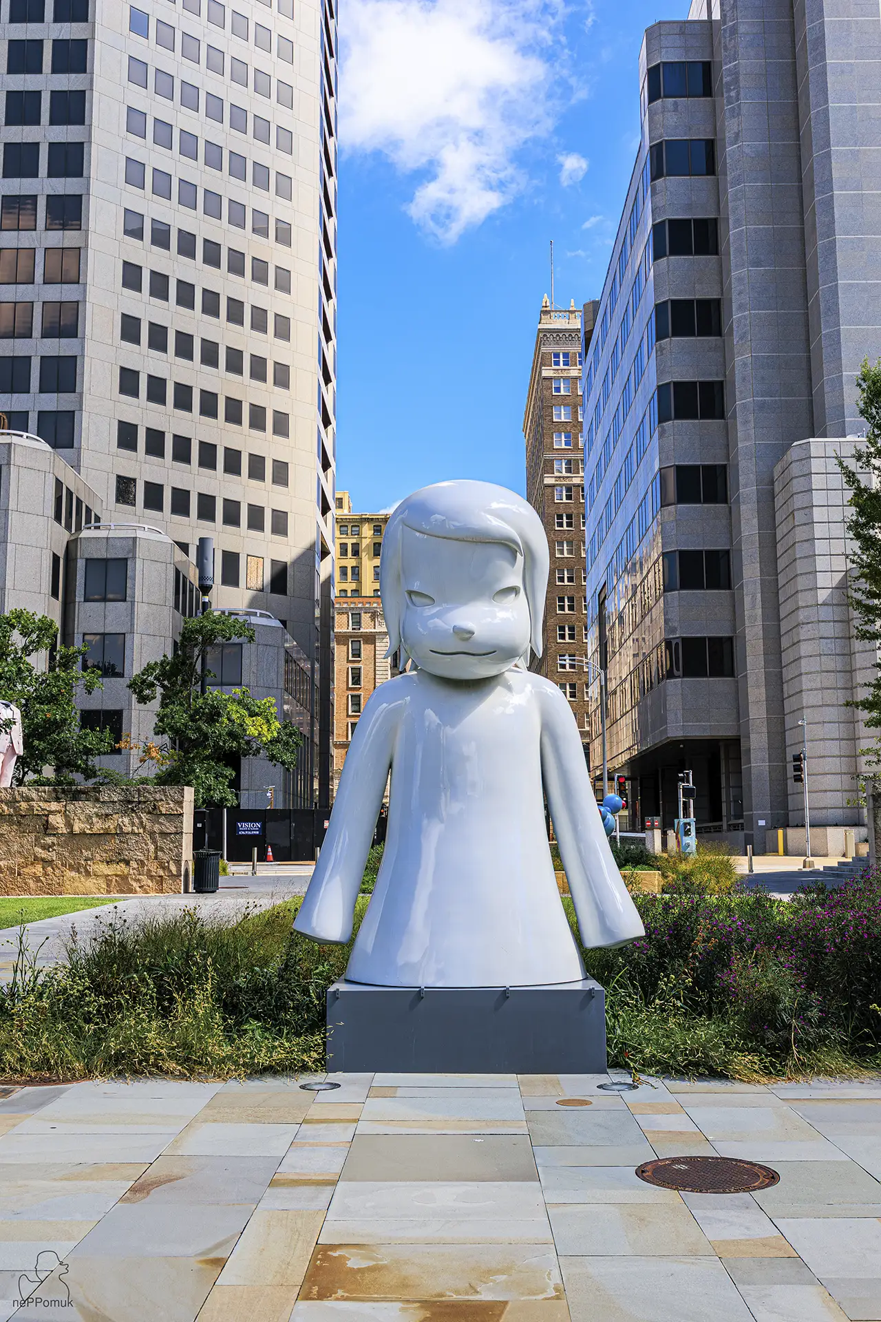
In 2024, Citygarden was expanded and redesigned. The former street connection through the park was turned into a continuous pedestrian and green area. Additional plantings, places to sit, and new sculptures complemented the original layout. Among the newly installed works was also White Ghostby the Japanese artist Yoshitomo Nara.
Today is the Citygarden Sculpture Park one of the special sights of Downtown St. Louis. Its significance comes not only from the quality of the artworks on display, but equally from their urban context. The generous green spaces, the monumental sculptures, and the high-rise buildings directly adjacent to them form a varied environment in which public art and everyday city life meet directly.
Eros Bendato – Igor Mitoraj’s monumental bronze head in the Citygarden
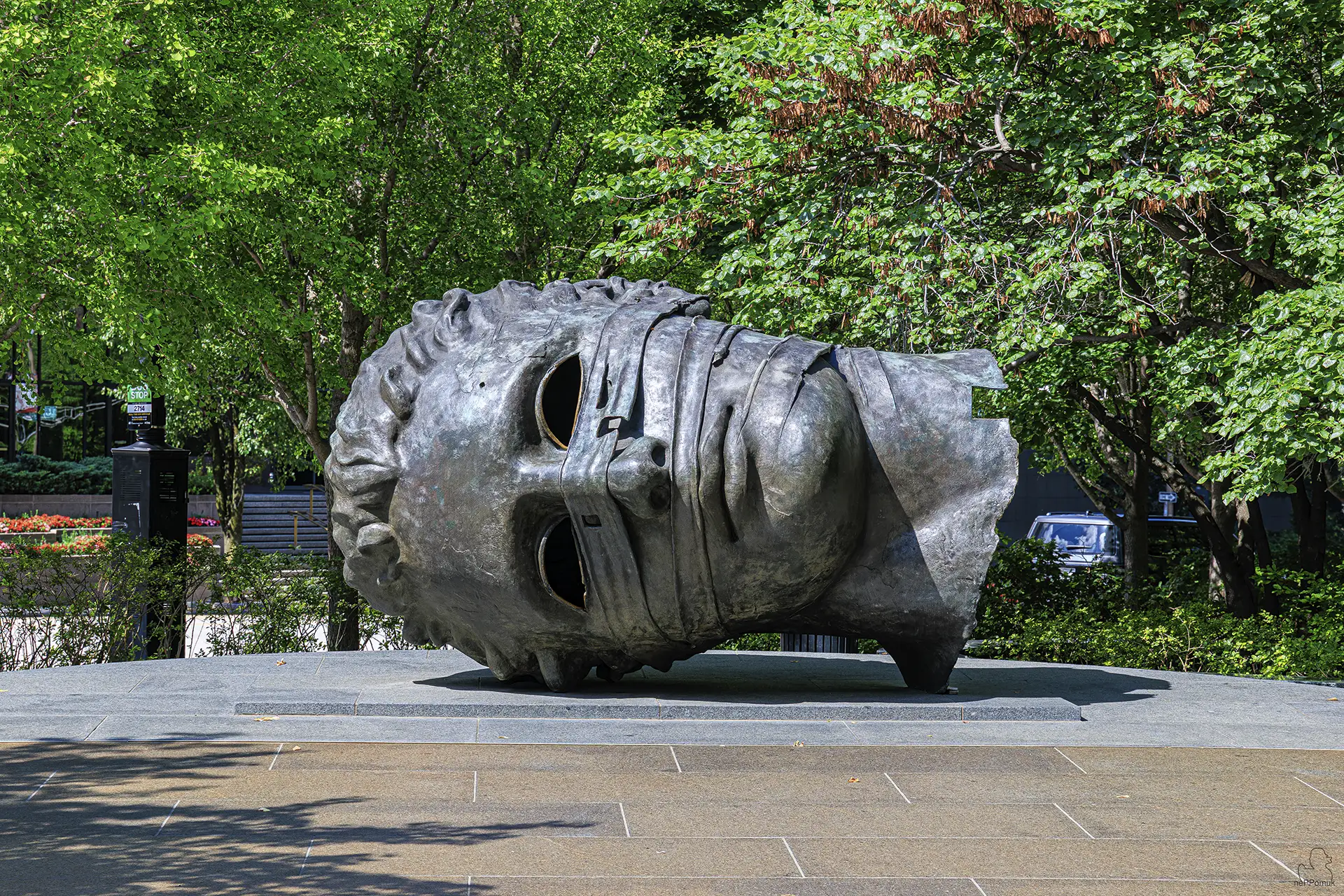
Among the best-known artworks in the Citygarden St. Louisis the monumental bronze sculpture Eros Bendatoof the Polish-French sculptor Igor Mitoraj. The enormous head lying on its side is already a striking feature of the park due to its extraordinary dimensions. The fragmented facial form, the closed or obscured eye areas, and the bandage-like structures give the work a peculiar mixture of classical beauty and visible vulnerability.
Igor Mitoraj was born in 1944 in Oederan, Saxony, and grew up in Poland. After studying at the Academy of Fine Arts in Kraków, he continued his training in Paris. Later, he became deeply involved with the art of ancient cultures and developed his own sculptural language that combined classical human body forms with deliberate fragmentation. He became especially well known for monumental heads, torsos, and other body fragments that often resemble damaged ancient sculptures.
An important influence on his artistic work was the Greek and Roman antiquity. However, Mitoraj did not simply adopt classical sculptural forms; instead, he interpreted them in a contemporary context. The idealized bodies in his works often appear incomplete, broken, or altered by unfamiliar elements. This creates a tension between beauty, transience, and the idea of a once perfect form.
The bronze sculpture Eros Bendato was created in 1999and takes up the figure of Eros from Greek mythology. Eros embodies love, desire, and the power of human attraction. In Mitoraj’s work, however, the mythological figure does not appear as an idealized complete form, but as an isolated, damaged-looking head. The original wholeness of the body is no longer present, and the bandaged facial areas make it difficult to perceive human individuality.
Especially the bandage-like structures over the eyes and mouthare important for interpreting the artwork. They can be understood as a symbol of restricted perception, suppressed feelings, or the vulnerability of human desires. At the same time, the bands are reminiscent of measures used to hold damaged objects together. The artwork thus opens up different possibilities for interpretation: as a depiction of a wounded civilization, as a symbol of lost ideals, or as an attempt to preserve a fragmented form despite its damage.
The extraordinary effect of Eros Bendato also comes from its chosen size. The bronze head measures around 3.7 metersat its longest extent. Its monumental proportions make it appear like an archaeological find that has been detached from a much larger context. At the same time, the sculpture has an unusual spatial presence because of its position on its side. Unlike a classic monument, the figure does not rise upright above the viewer, but rests close to the ground.
In Citygarden, Eros Bendato is located at the eastern entrance near Market Street and 8th Street. The sculpture lies on a slightly inclined, circular granite surface over which a thin film of water flows at times. This design was deliberately integrated into the landscape architecture concept. The round surface and the water echo the natural surroundings, while the massive bronze head forms a clear contrast to the smooth surface of the granite.
The placement makes it possible to view the artwork from different directions. From a frontal perspective, the facial features and the characteristic bandages are especially clear. Side angles, on the other hand, emphasize the fragmented form and the spatial extent of the sculpture. The connection with the surrounding vegetation and the high-rises of downtown creates an additional contrast between archaic sculpture and modern American urban architecture.
It is precisely this spatial situation that makes Eros Bendato a characteristic photo motif in Citygarden. The rough, partly darkly patinated bronze stands out clearly against the light-colored ground surfaces, the greenery of the trees, and the geometric facades of the surrounding buildings. The changing daylight brings different surface textures into focus and alters the effect of the modeled facial features.
Eros Bendato thus exemplifies the special claim of the Citygarden: International art should not be viewed in isolation, but experienced in direct relation to the public urban space.The monumental sculpture combines classical forms with a contemporary interpretation and is among the most impressive artistic accents in the center of St. Louis.
Big Suit and White Ghost – Contemporary sculptures between the skyscrapers
In addition to the classically influenced works by Igor Mitoraj, the Citygarden in St. Louisfeatures numerous works of art that use a distinctly different formal language. Among the particularly striking examples are Big Suit by Erwin Wurmand White Ghost by Yoshitomo Nara. Both sculptures take up familiar motifs from everyday human life, but alter them through unusual proportions, materials, and formal simplifications.
The Austrian artist Erwin Wurmwas born in Bruck an der Mur in 1954 and is one of the internationally known figures of contemporary sculpture. His work often explores the question of what a sculpture actually is and how ordinary objects can be transformed into art through changes in their size, shape, or function. Clothing, furniture, cars, and other everyday objects play an especially important role in this.
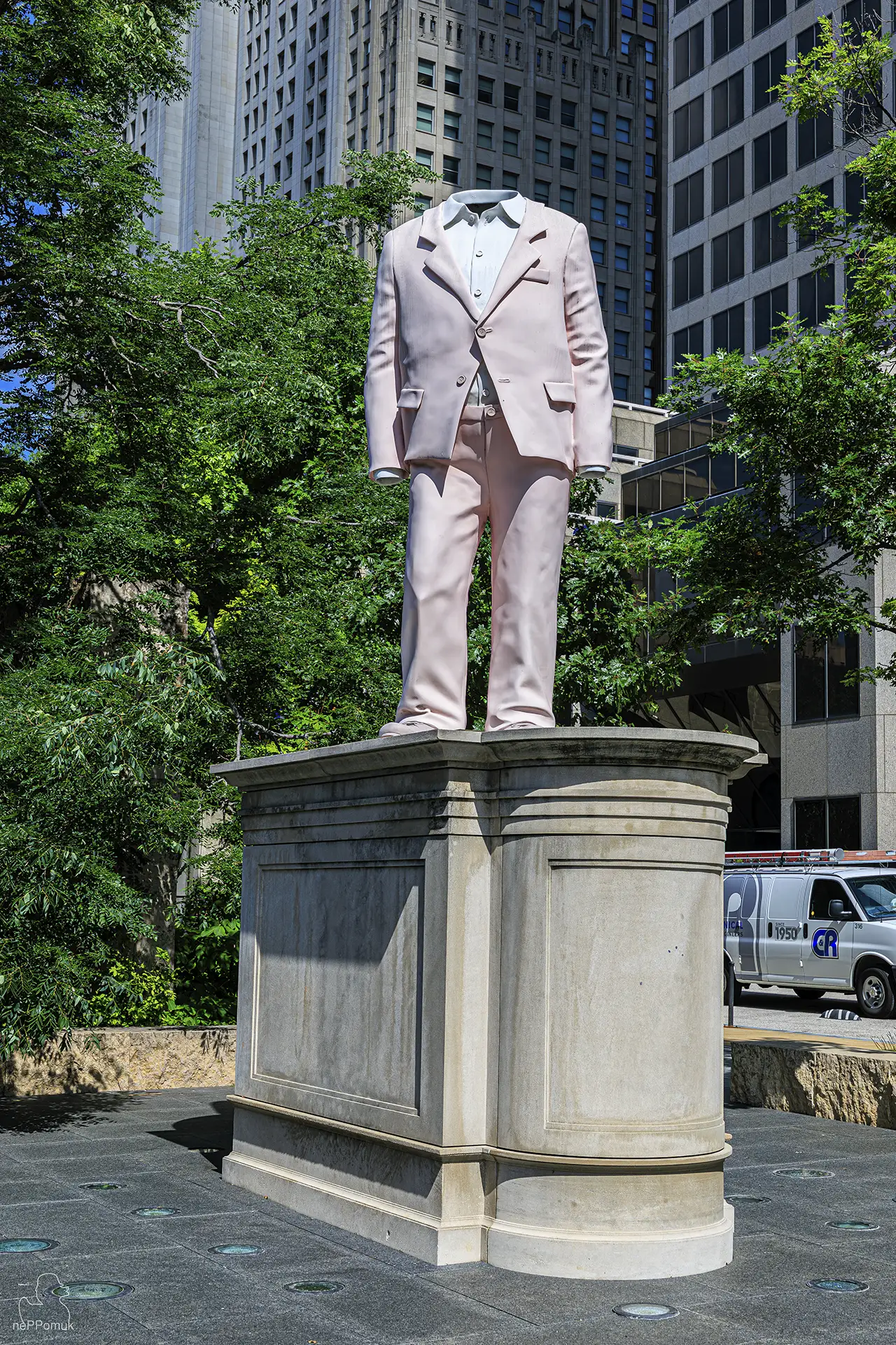
With the sculpture Big SuitWurm takes up the appearance of a classic men’s suit. Created in 2010 and installed in the Citygarden in 2011, the work shows a monumental pink suit standing on a pedestal. The figure has neither head nor hands, and the body inside the clothing is also completely absent. Nevertheless, the shape of the jacket and trousers creates the impression of a human figure whose absence is made visible precisely through its outer shell.
The sculpture consists of painted aluminumand reaches a height of approximately three meters. Its extraordinary proportions turn an everyday item of clothing into a monumental object. The pink surface in particular intensifies the unusual character of the work. While classical monuments often depict important personalities, Big Suit shows only the outer form of a person, without revealing their identity.
The work can be understood as an exploration of social role, outward appearance, and personal identity. Clothing serves not only a practical purpose, but also conveys information about professional status, social expectations, and personal self-presentation. The men’s suit is especially associated with ideas of authority and seriousness in business and political settings. Wurm takes up this familiar symbolism and transforms it through a deliberately exaggerated, almost absurd form.
The result contains both humorous and contemplative elements. The oversized suit initially appears unusual and possibly comical. On closer inspection, however, it raises the question of the relationship between the outward appearance and the person it is meant to represent. Big Suit consciously plays with the contrast between a visible shell and the absence of an individual.
Another artistic approach is taken by the Japanese artist Yoshitomo Nara, whose sculpture White Ghosthas been part of the collection since the expansion of Citygarden in 2024. Nara was born in 1959 in Hirosaki, Japan, and is especially known for his characteristic depictions of childlike figures and animals. His works combine an initially simple, almost cartoon-like design with a frequently multi-layered emotional impact.
The sculpture White Ghost was created in 2010and is made of white, glossy fiberglass. Its highly simplified form combines features of a child and those of a dog. The large eyes, the roundish head, and the long, downward-pointing arms give the figure an unusually quiet appearance. Despite its reduced form, it has a distinct expression that cannot be clearly defined as friendly, sad, or aloof.
It is precisely this ambiguity that is characteristic of many of Yoshitomo Nara’s works. At first glance, his figures seem accessible and are reminiscent of visual worlds from comics or popular culture. At the same time, they often possess a certain distance and independence. The apparent simplicity of the depiction thus conceals a more complex engagement with human emotions, vulnerability, and individuality.
The smooth, almost completely white surface of White Ghost stands out clearly from the materials of the surrounding cityscape. Between the glass and concrete facades of the high-rises, the figure appears as an independent, bright element whose soft contours form a contrast to the straight-lined shapes of the architecture. The darker base also helps lift the sculpture spatially off the ground.
In designing White Ghost, Nara also explored the relationship between contemporary art and its possible future perception. The presentation on a stone-like pedestal is reminiscent of historical sculptures and archaeological finds as they are shown in museums. In this way, the work also refers to the question of how art objects of today might be viewed in a distant future.
In direct comparison, Big Suit and White Ghost represent two very different positions in contemporary sculpture. Erwin Wurm works with the enlargement and alienation of an everyday object. Yoshitomo Nara reduces a human-animal figure to a few characteristic features. While Big Suit stands out through its color and unusual emptiness, White Ghost develops its effect primarily through its closed form and restrained facial expression.
For the Photography in Citygarden St. Louisoffer both works interesting contrasts. The vertical forms of the sculptures can be directly related to the towering buildings of Downtown. At the same time, their different surfaces and colors enable independent image compositions. The pink aluminum figure by Erwin Wurm and the white fiberglass sculpture by Yoshitomo Nara each set a clearly recognizable accent within the urban environment.
Together with Eros Bendato, they illustrate the artistic diversity of the Citygarden. Classically inspired bronze sculpture, conceptual everyday art and contemporary figurative sculpturestand here side by side without the spatial separation of a museum. Their direct integration into the public urban space makes the artworks a fixed part of St. Louis’s present-day cityscape.
Union Station St. Louis
Historic railway station between railway history and modern architecture
The St. Louis Union Station in Missouriis one of the most impressive historic railway stations in the United States. When the monumental rail terminal opened on September 1, 1894, it was regarded as the largest passenger station in the world. Its vast platform facilities, the imposing reception hall, and the distinctive clock tower document the economic importance of St. Louis as a transportation hub between the American East and West.
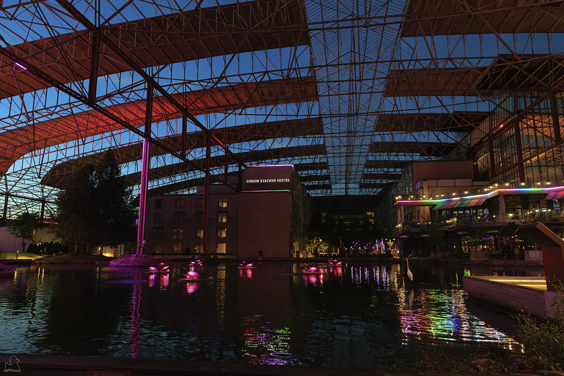
Union Station was designed by the architect Theodore C. Link, who drew inspiration from European Romanesque architecture for the design. Massive natural stone facades, tall round-arch windows, and steep roofs define the historic main building. Behind it stretches a vast steel structure that originally covered dozens of railway tracks. Together, the different parts of the complex form an exceptional example of American railway architecture from the late 19th century.
Today, the Union Station St. Louisis no longer used as a regular long-distance railway station. After extensive renovation and conversion work, a leisure and hotel complex was created with restaurants, an aquarium, and the widely visible St. Louis Wheel. The historic architecture was largely preserved. In particular, the combination of monumental steel structures, modern uses, and colorful evening illumination makes the former station complex a remarkable part of St. Louis’s cityscape today.
Read more
St. Louis Union Station – From railway hub to the world’s largest passenger train station
The history of the St. Louis Union Stationis closely linked to the rise of the American railroad in the 19th century. After the end of the Civil War, the United States rail network developed at an extraordinary pace. New railway lines opened up large parts of the interior and connected the growing industrial centers in the East with the agricultural regions of the Midwest. St. Louis occupied a special position in this process because of its geographic location on the Mississippi. Important transport routes from different directions converged here, while the river continued to play a significant role in interstate trade.
With the opening of the Eads Bridge in 1874the conditions for rail traffic between Missouri and Illinois improved considerably. For the first time, trains could cross the Mississippi at St. Louis over a fixed bridge connection. Before that, railway cars sometimes had to be transported by ferry between the different rail networks. The new steel bridge eliminated a major bottleneck and accelerated traffic between the eastern and western parts of the country.
However, the growing rail traffic posed new organizational challenges for the city. The various railroad companies originally had their own facilities, while the Union Depot, opened in 1875, soon no longer met the growing demands. Travelers had to change between different stations, and the distribution of trains across the existing track facilities also became increasingly difficult. With the founding of the Terminal Railroad Association of St. Louis in 1889a joint organization was eventually created that coordinated key parts of the rail infrastructure and drove forward the construction of a new central station.
The site at the Market Street between 18th and 20th Streetwas deliberately chosen west of the commercial center of the time. There, sufficiently large areas were available to build an extensive station building with numerous tracks and platforms. Architect Theodore C. Link was commissioned with the planning, and his design combined the functional requirements of a modern rail hub with a representative appearance.
On September 1, 1894, Union Station was ceremoniously opened. Around 20,000 invited guests took part in the celebrations. The new station united the connections of 22 railroad companies and featured an enormous track and platform complex. With its spacious waiting areas, dining facilities, hotel rooms and administrative offices, it set new standards for American passenger transport. Union Station was thus far more than a functional station. It served as a central arrival and departure point for travelers from almost all parts of the United States.
The station gained particular significance during the 1904 St. Louis World’s Fair. The Louisiana Purchase Exposition drew millions of visitors to the city, many of whom arrived by train. In order to handle the expected volume of traffic, expansions to the station facilities had already been carried out in the years beforehand. Union Station was thus one of the most important facilities for organizing visitor and travel traffic during one of the most significant international events in the city’s history at the time.
In the following decades, the station remained a central part of the American rail network. Especially during the Second World War, passenger traffic reached its peak. At times, around 100,000 travelers passed through the facilities each day, including numerous soldiers on their way to their deployment locations or back home. Union Station thus also became a place of personal farewells and reunions, whose significance went far beyond ordinary travel.
One of the best-known historical events was a visit by U.S. President Harry S. Truman in November 1948. At the station, the famous photograph was taken in which Truman, after his surprising election victory, holds up a newspaper with the mistaken headline “Dewey Defeats Truman”. The image became one of the best-known documents in American political history and to this day links Union Station with a special moment in the postwar era.
After the Second World War, however, travel behavior in the United States changed fundamentally. The expansion of the interstate highway network, the increasing spread of private automobiles, and the growing air traffic led to a steady decline in rail passengers. Numerous long-distance trains with a long tradition were discontinued, while large stations increasingly lost importance.
Union Station was not spared from this development either. The once heavily used track facilities were used by only a few trains. On October 31, 1978, the last regular long-distance train left the historic station. This marked the end of the original use of one of the largest American rail terminals after 84 years.
The railroad history of Union Station is still directly linked to the economic development of St. Louis today. The building is a reminder of an era in which the railroad was not only the most important means of transportation over long distances, but also decisively influenced the growth of cities, industrial progress, and social mobility.
Theodore Link and the architecture of Union Station – Romanesque style, clock tower, and monumental steel structures
The architecture of St. Louis Union Stationis one of the outstanding examples of American railroad station architecture from the late 19th century. The design comes from the architect Theodore C. Link, who was born in Germany in 1850 and established himself as a prominent architect in St. Louis after immigrating to the United States. In planning the station, he was guided by the so-called Richardsonian Romanesque, an American interpretation of Romanesque architecture, which was particularly shaped by the architect Henry Hobson Richardson.
Characteristic of this architectural style are massive natural stone façades, large round-arched openings, asymmetrical building compositions, and striking roofscapes. These features also define the appearance of Union Station. The elongated main façade on Market Street is made of light-colored limestone and is structured by numerous windows, gables, and towers. Steep red roofs and decorative façade elements give the building a distinctive silhouette.
Particularly striking is the imposing clock tower of Union Station, which dominates the eastern side of the building. It rises about 70 meters above its surroundings and forms a landmark visible from afar. Its slender form contrasts with the broad building wings and the massive natural stone walls. The combination of clock tower, round-arched windows, and steep roof surfaces is reminiscent of European castles and medieval urban architecture, but it was developed for the requirements of a modern railway station.
The historic building complex essentially consists of three functional areas: the representative Reception building, the so-called Headhouse, a connecting passage area and the large platform hall. While the reception building accommodated travelers with waiting areas, ticket counters and dining options, the complex behind it served as access to the individual trains.
One of the most significant interior spaces is the Grand Hall, the station’s original large waiting hall. Its barrel vault, about 20 meters high, was designed with elaborate stucco work, gilded decorations and large-scale wall paintings. Stained-glass windows and monumental light fixtures complement the representative furnishings. The design makes clear the claim of conveying to travelers, as soon as they enter the station, an impression of the city’s economic strength and cultural significance.
Special attention should be given to the elaborately designed window installation, known as the Allegorical Window. Its depiction reflects St. Louis’s role as a connecting railway hub between the major American metropolises. The decorative design of the Grand Hall thus demonstrates not only craftsmanship and artistic quality, but also has symbolic significance for the city’s position in the national transport network.
A completely different structural challenge was posed by the immense platform hall behind the main building. It was designed by engineer George H. Pegram, who developed a special steel truss construction. The Pegram Trussesnamed after him made large spans possible and created a largely column-free roof over the tracks running close together.
The original Train Shed of Union Stationwas, at the time of its construction, one of the largest covered railroad facilities in the world. The roof structure spanned 32 tracks and covered an area of more than ten hectares. Its immense dimensions illustrate the organizational and technical complexity of railroad operations at the time. Hundreds of passengers could board and alight at the same time, while luggage, mail, and other transported goods were moved along separate routes.
The steel structure of the hall consistently followed functional requirements. Large lattice girders distributed the roof loads to comparatively few supports. This created broad, continuous areas that provided enough space for the platforms and the movement of travelers. At the same time, the roof structure allowed extensive natural lighting of the interior.
It is precisely the contrast between the historic station building and the technical hall that makes Union Station architecturally especially interesting. While the Headhouse is characterized by representative natural stone architecture and decorative design, the Train Shed focuses on the structural properties of steel and glass. However, both areas were planned as a unified complex and together form an exceptional example of the combination of architecture and civil engineering.
During the course of the 20th century, individual areas of the station complex were altered several times. The expansion of the track facilities, technical modernizations, and later conversions led to different structural adjustments. Nevertheless, the basic structure of the historic station remained largely recognizable. Because of its exceptional significance for American railroad and architectural history, Union Station was designated as National Historic Landmarkand placed under special preservation protection.
Today, it is above all the monumental facade, the Grand Hall, and the extensive steel structure of the former platform area that define its architectural character. Even without regular rail traffic, the building’s original function is still clearly discernible. The scale of the facilities, the choice of materials, and the structural details document the immense technical effort with which American railroads shaped their central transportation hubs in the late 19th century.
From historic station to leisure complex – hotel, aquarium and the St. Louis Wheel
With the discontinuation of regular passenger service in 1978, St. Louis Union Stationlost its original function. Like many other major American railway stations, it too faced the challenge of finding a new economically viable use. The enormous dimensions of the train shed, the elaborate historic fabric and the high maintenance costs initially made a lasting future difficult. At the same time, a building of national architectural and transport-historical significance had to be preserved.
In the early 1980s, a comprehensive renovation and redesign of the complex finally began. The aim was to preserve the historic architecture while enabling new uses. Former waiting and operational areas were restored, while new commercial and lounge spaces were created under the enormous roof of the former platform hall. At the time, the project was one of the largest adaptive-reuse projects for a historic building complex in the United States.
In In August 1985, Union Station was reopened as a shopping, dining, and hotel complex. The new concept was based on so-called Festival Marketplaces, which combined historic buildings with shops, restaurants, and public seating areas. The former Grand Hall was restored and integrated into the new use. At the same time, modern retail space and other facilities were created in the area of the former track installations.
The repurposing was an important step in preserving the historic station. Instead of completely removing the no-longer-needed railroad infrastructure, large parts of the complex were transferred into a new urban context. The original spatial structure of many areas was retained. The historic Train Shedevolved from a functional platform canopy into a large, versatile hall used for a wide range of purposes.
In the following decades, however, requirements changed once again. With the transformation of American retail, the original shopping concept increasingly lost its importance. Further investments and renovations became necessary in order to keep Union Station attractive as a location in the long term. The complex therefore gradually evolved from a predominantly commercial shopping center into a Leisure and entertainment districtwith tourist attractions.
One of the most important facilities is the St. Louis Union Station Hotel, whose premises are partly integrated directly into the historic reception building. The Grand Hall in particular is now used as a representative lounge and dining area. The restored architectural details, the colored glass windows and the enormous barrel vault give the space a special atmosphere. Modern light projections complement the historic design without changing its fundamental architectural structure.
Another significant expansion took place in 2019 with the opening of the St. Louis Aquarium at Union Station. The facility was housed in part of the historic station grounds and expands the complex with a large water-themed experience world. Different exhibition areas show habitats from rivers, lakes and seas. The connection between the historic railway site and a modern aquarium is emblematic of the site’s fundamental transformation.
Also in 2019, the St. Louis Wheelopened, a Ferris wheel around 61 meters high that now stands out clearly from the surrounding buildings. The enclosed, air-conditioned gondolas provide an elevated view of the downtown area and the former railway facilities. At the same time, the Ferris wheel forms a modern architectural accent whose formal language differs fundamentally from that of the historic Union Station buildings.
In addition to the aquarium and the Ferris wheel, further leisure facilities, restaurants and public gathering areas were created. Different functions thus come together beneath the historic roof and in the adjoining buildings. Catering facilities, technical structures and modern leisure amenities make use of areas that were originally designed entirely for rail traffic.
A special role is played here by the water features and green areas within the former station complex. They divide the large open areas and create places to stay between the historic steel structures and the modern buildings. The sheltered location within the station complex creates an unusual urban space whose appearance differs markedly from the ordinary streets and squares of the downtown area.
Today’s Union Station is an exemplary demonstration of how large-scale historic transport buildings can be preserved through new usage concepts. The original station has not become a pure museum. Rather, it has been transformed into an intensively used part of the city. Railway history, historic architecture and modern leisure activitiescoexist here side by side and document the ongoing transformation of Downtown St. Louis.
Union Station at night – steel architecture, water reflections and the blue hour
The St. Louis Union Stationchanges its effect particularly clearly as daylight gives way to artificial lighting. While during the day the historic natural-stone façade, the clock tower and the expansive steel structures take center stage, in the evening light reflections, colorfully illuminated roofs and mirror-like water surfaces increasingly shape the appearance of the complex. It is precisely this change that opens up different possibilities for photographically capturing the historic architecture and its present-day use.
Even the main façade on Market Street has a special architectural appeal. The striking clock tower, the steep red roofs and the large round-arched openings form a layered composition whose effect changes considerably depending on the perspective. From a greater distance, the elongated front of the building becomes visible, while closer viewpoints emphasize the massive natural-stone walls, the carefully crafted façade details and the different roof shapes more strongly.
With the onset of the Blue hourthere is a clear contrast between the diminishing natural light and the building’s artificial illumination. The bright natural-stone façades stand out against the dark blue sky, while windows, entrances and streetlights add extra accents of light. The historic station thus takes on a different spatial effect than in daylight. The large mass of the building remains recognizable, while the lighting specifically highlights individual architectural elements.
Particularly impressive, however, is the area of the former platform hall. The monumental steel structure of the Train Shedspans large parts of the present-day leisure complex and shapes the overall spatial perception. The regular arrangement of the steel beams, the large spans and the different levels create a complex geometric pattern. The lighting makes individual structural elements stand out particularly clearly.
During the day, the effect is created primarily by the incoming light and the different materials of the roof structure. In the evening, by contrast, the artificial light sources come more strongly to the fore. Purple, blue and warm accents of lightalter the perception of the historic steel framework. This gives the functional architecture of the former station an almost stage-like character, without its original structure being completely overshadowed.
The water surfaces within the complex provide an additional visual appeal. They reflect parts of the roof, the lighting, and the neighboring buildings. The reflections change with the movement of the water surface and create different geometric forms. Especially when the water is calm, nearly symmetrical mirror images emerge, while slight movement breaks the light into irregular patches of color.
The interplay of historic steel architecture and colored water reflectionsgives Union Station an unusual photographic atmosphere. The massive supporting structures form a stable, clearly organized frame, while the reflections on the water change continuously. This creates image compositions that reflect both the technical structure of the building and its present-day use.
The modern facilities of Union Station also offer distinctive subjects. The clearly visible St. Louis Wheelcreates a striking contrast with its circular design to the straight steel beams and the historic roof forms. Especially at night, the illuminated Ferris wheel appears as a clearly recognizable geometric shape. The juxtaposition of traditional railroad architecture and modern leisure activities documents the changing use of the entire complex.
In the water areas, animals can also occasionally be observed making use of the artificially created habitat. Particularly noticeable are the white heron, which forage for food between the water surfaces and the surrounding structures. Their slender body shapes and the light plumage surfaces form a contrast to the heavy steel girders and the darker areas of the complex. Such observations expand the photographic possibilities to include motifs that initially seem unusual within a large urban leisure facility.
The special effect of Union Station arises less from individual attractions than from the interplay of its different components. Historic architecture, modern leisure facilities, bodies of water, plants, and artificial lighting form a distinct urban space. The original function as a railway station remains recognizable through the large hall and its construction, while today’s use adds a new visual layer.
It is precisely this combination that makes the Union Station in St. Louis a versatile subject for architectural and urban photography. Monumental natural stone façades, wide-span steel structures, and modern lighting installations open up different perspectives on a building whose appearance has changed considerably over the course of more than 130 years. The photographs document not only the historic building fabric, but also its present place within a changing American downtown.
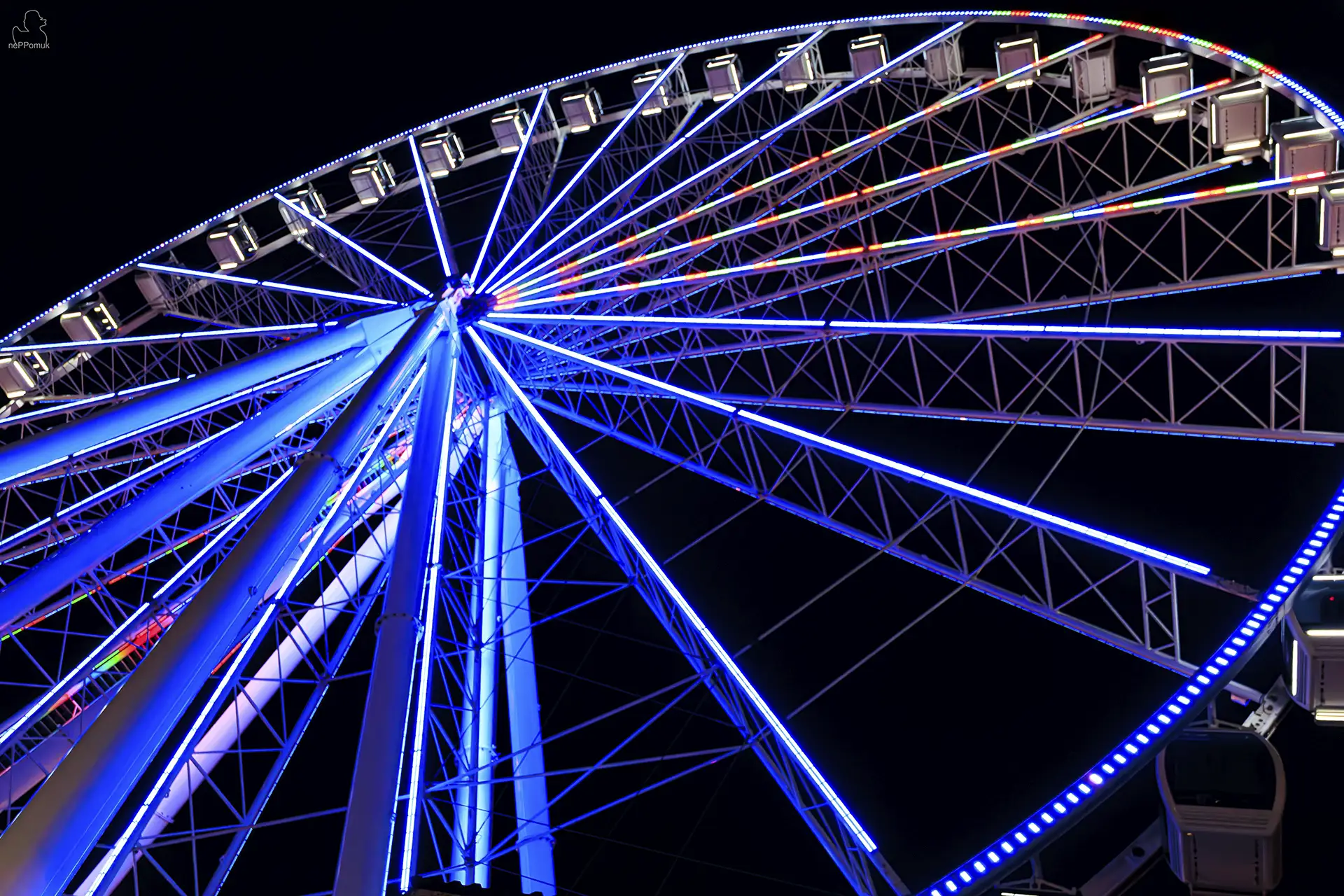

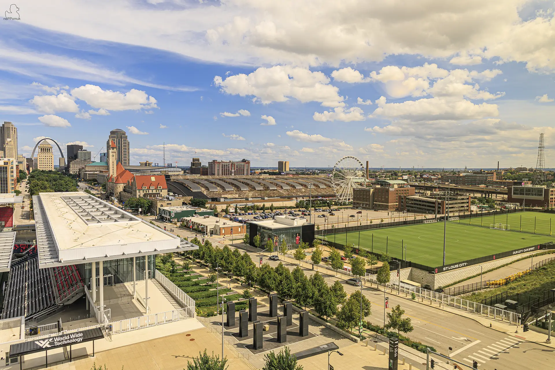
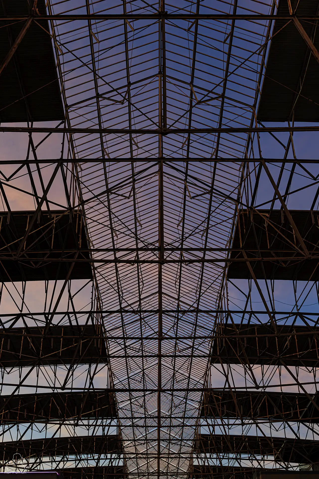
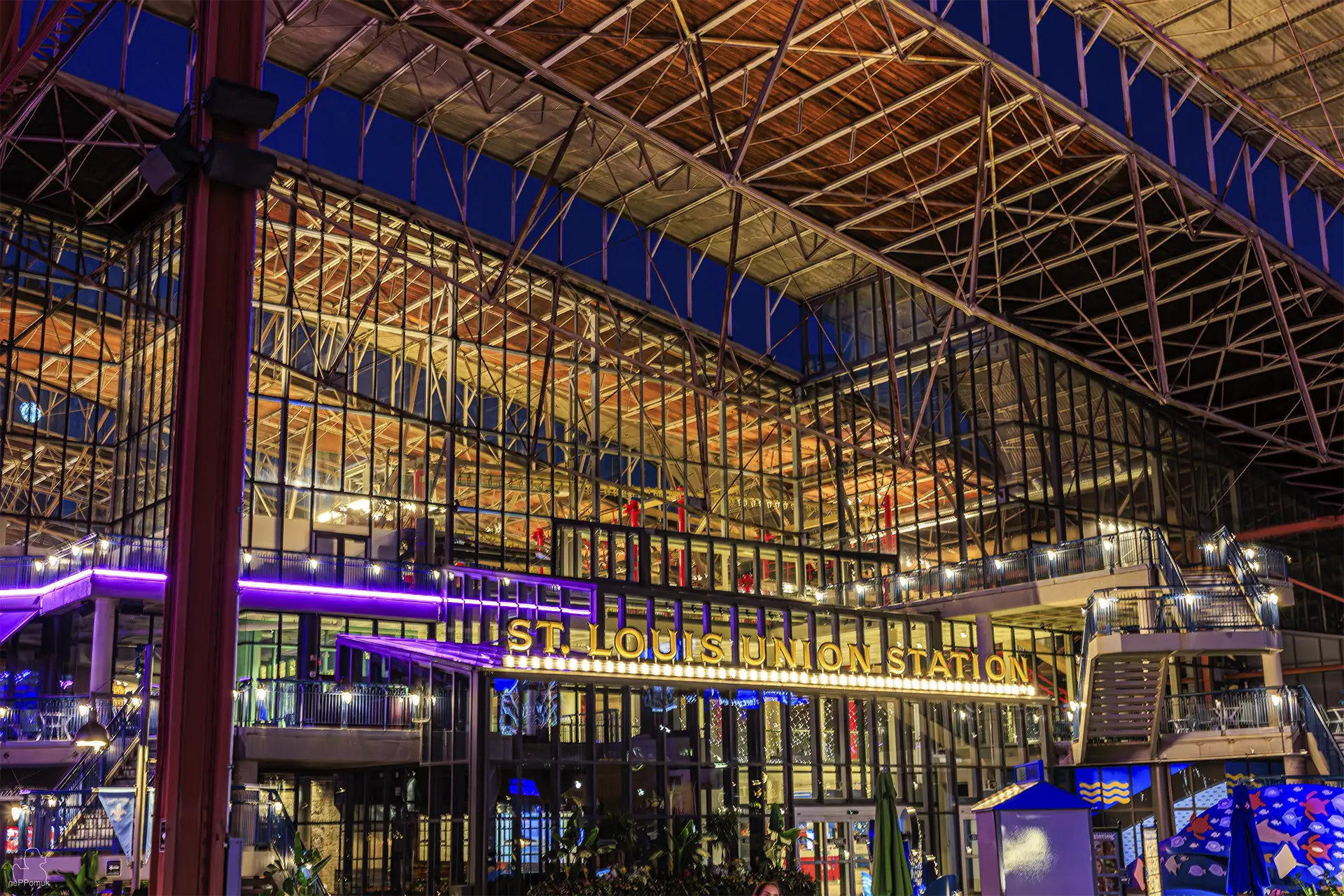

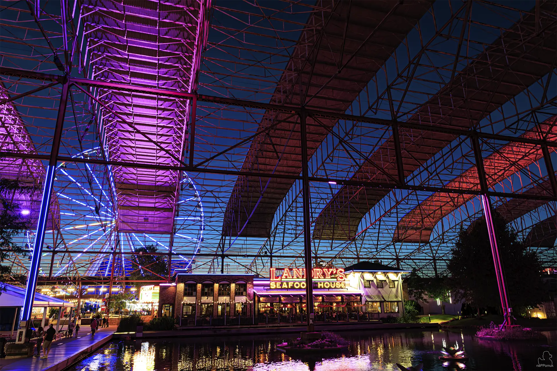
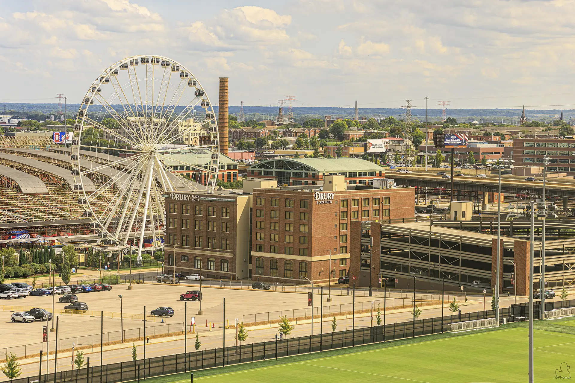

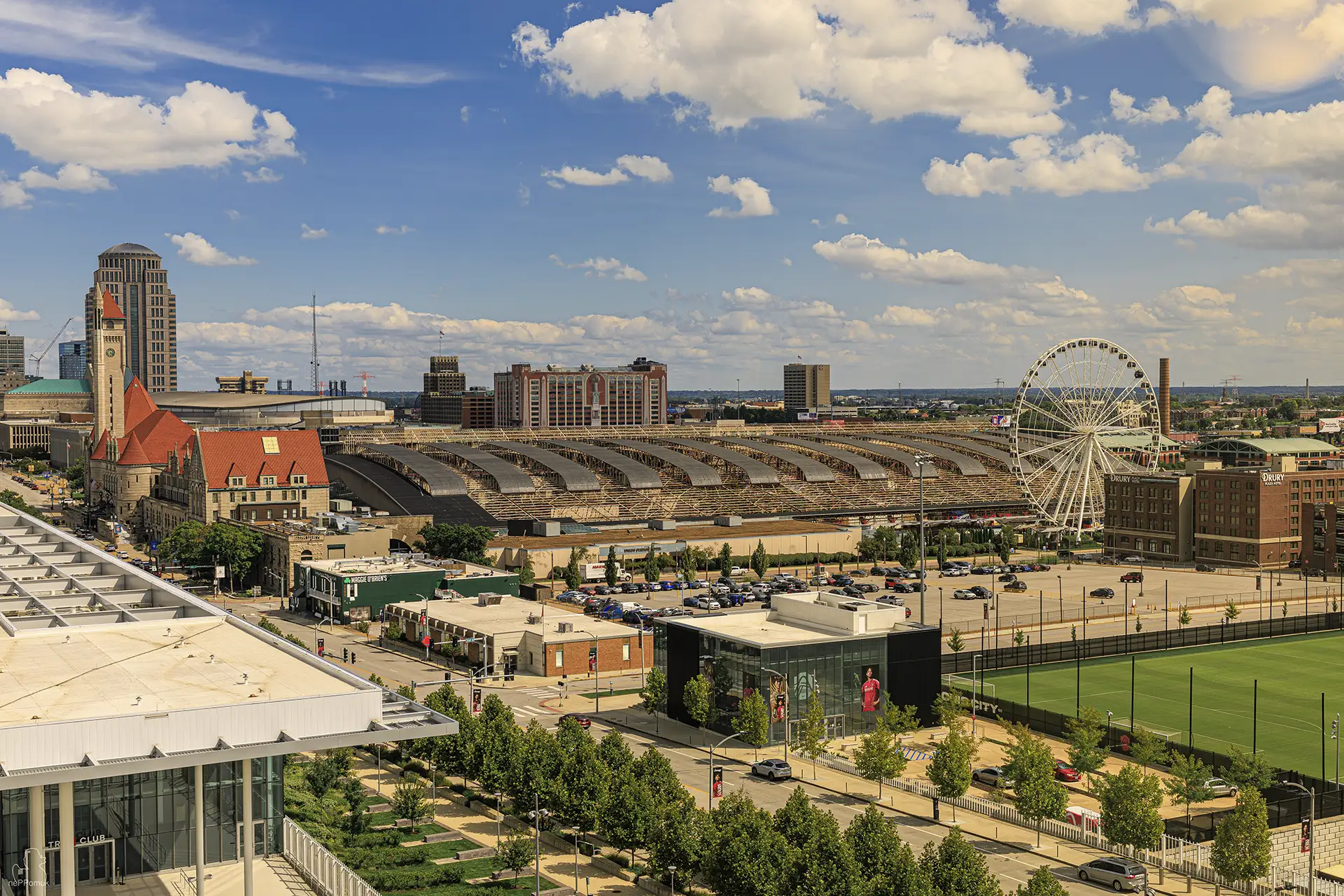
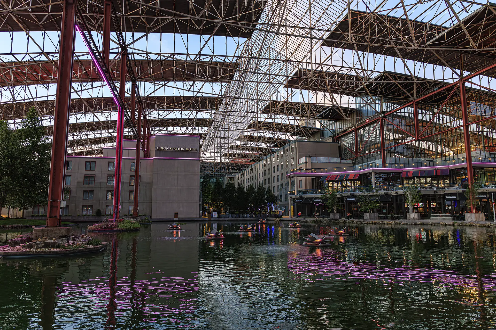
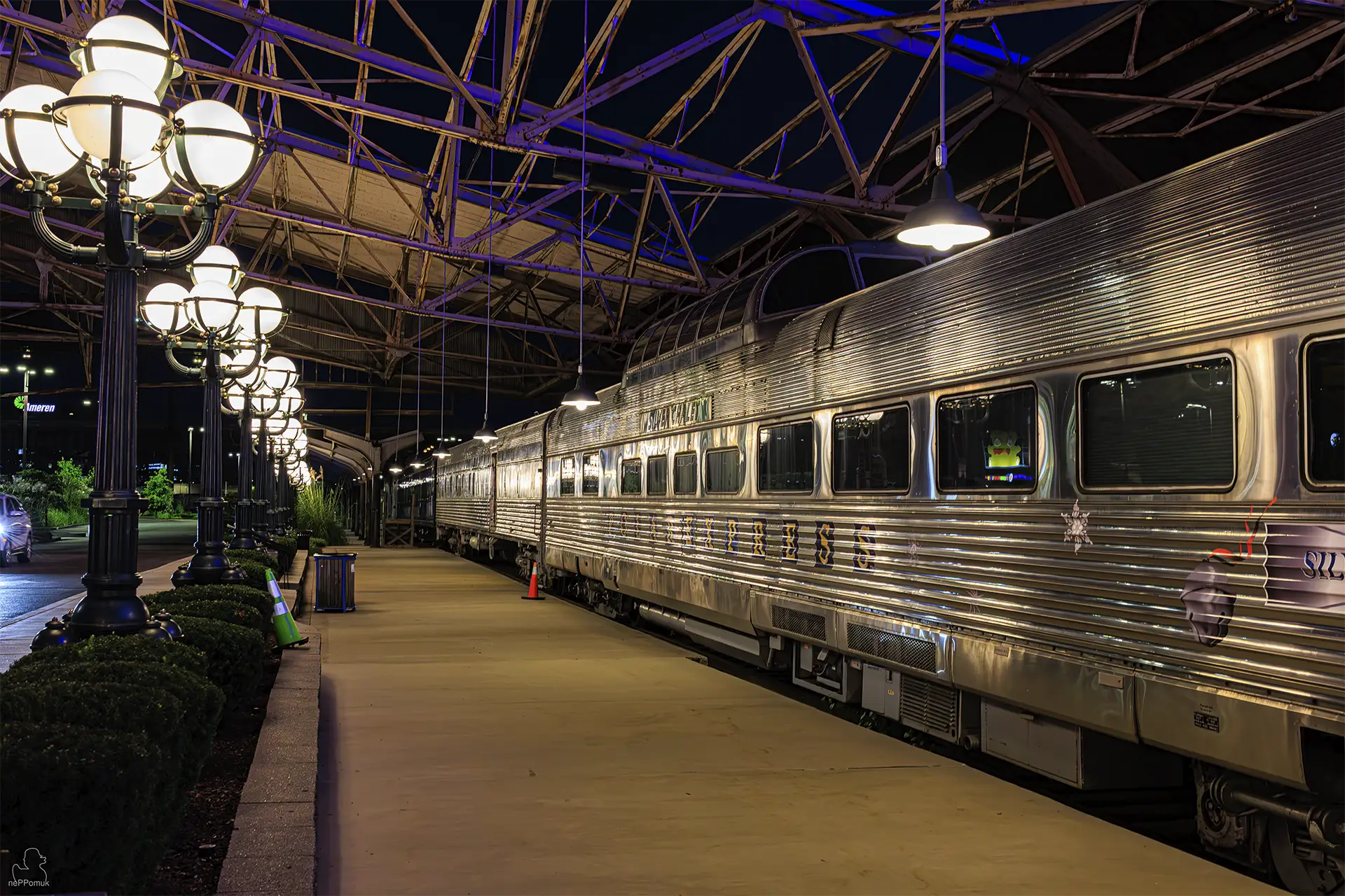
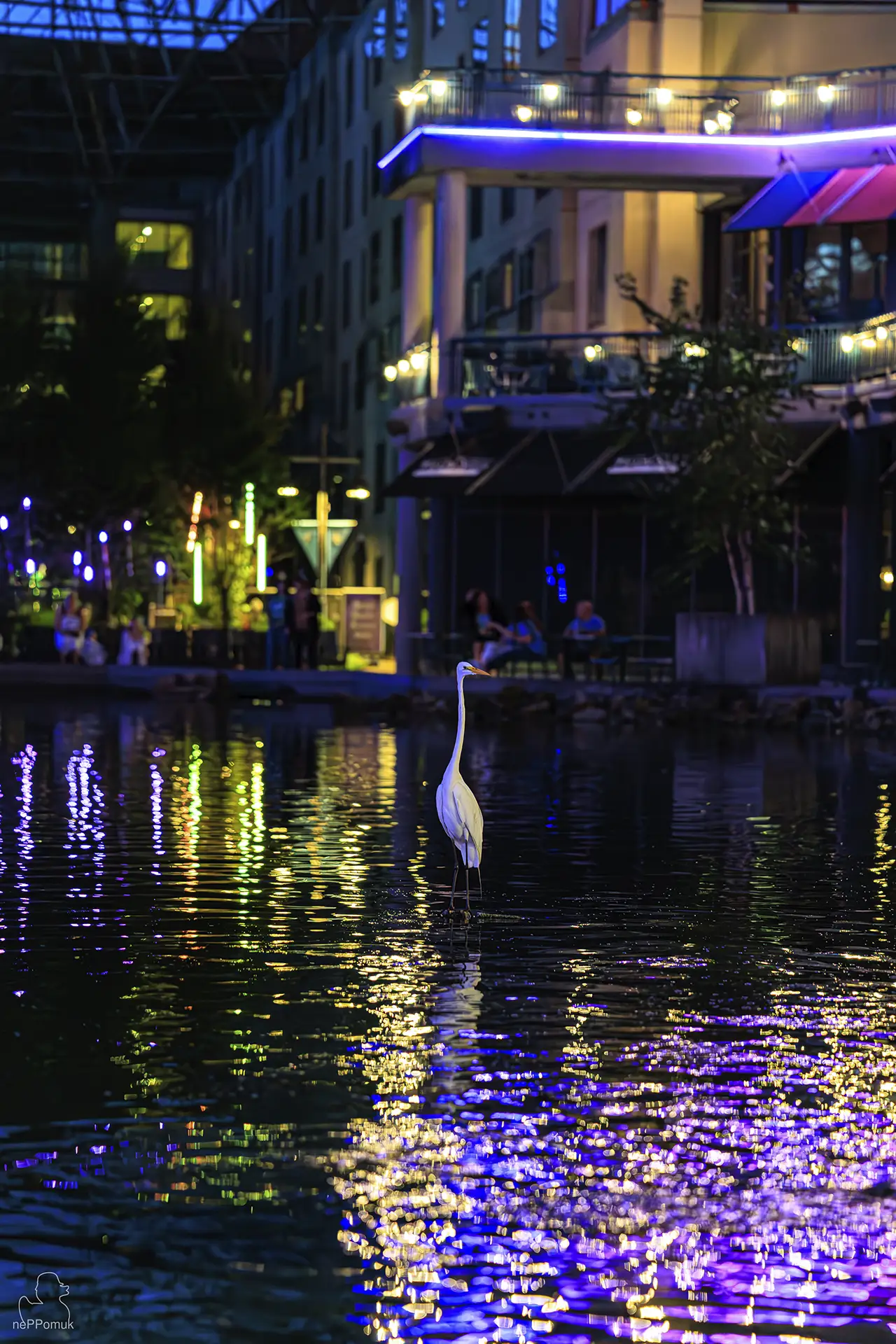
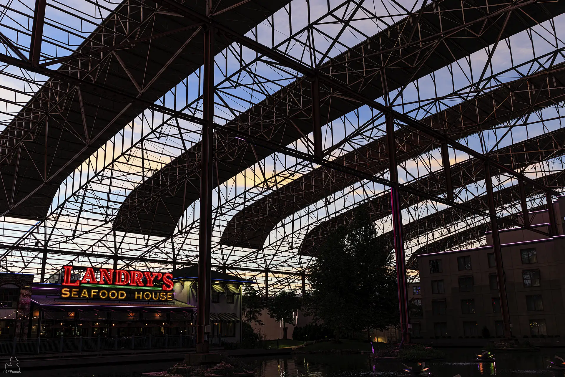
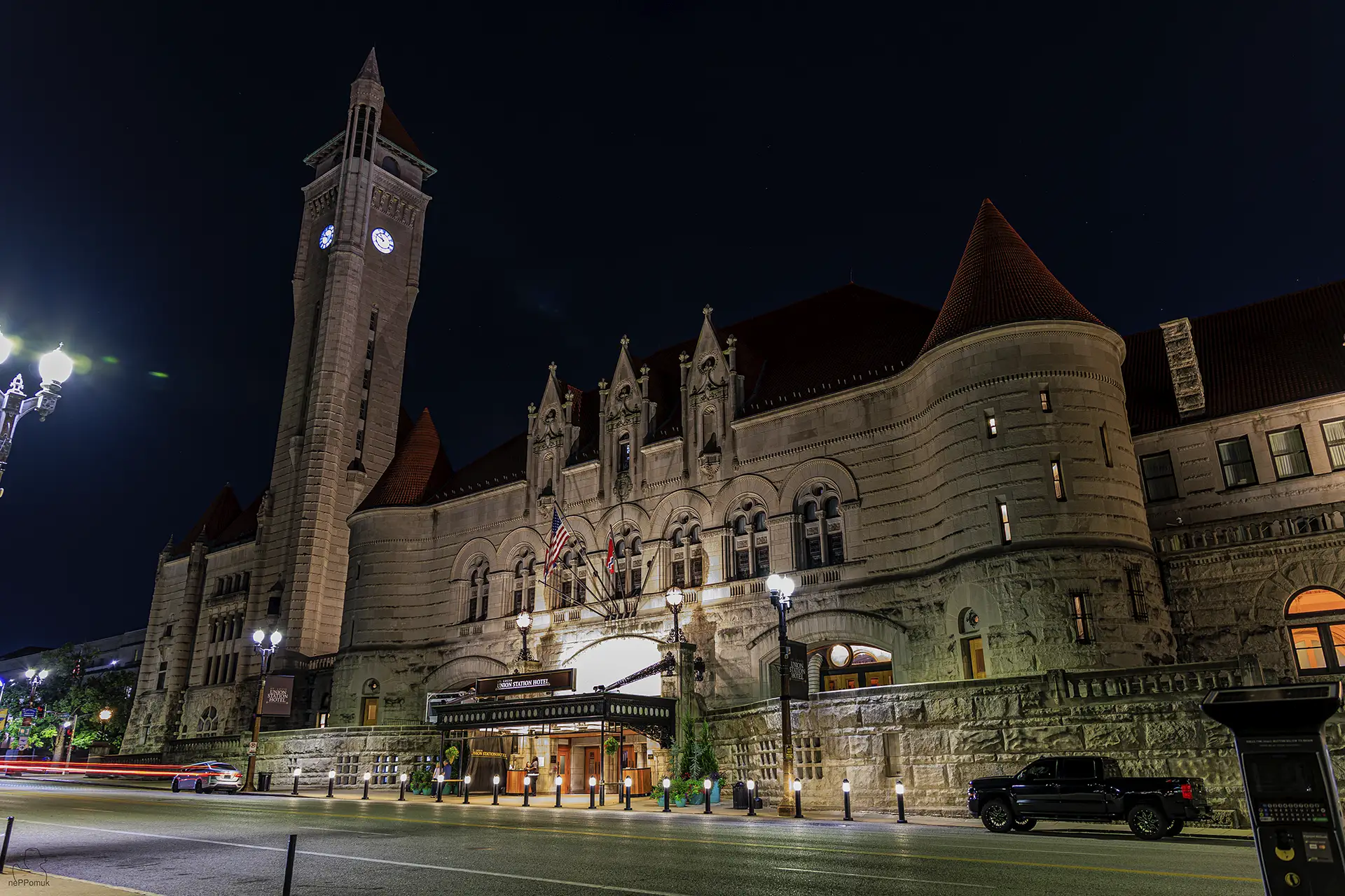
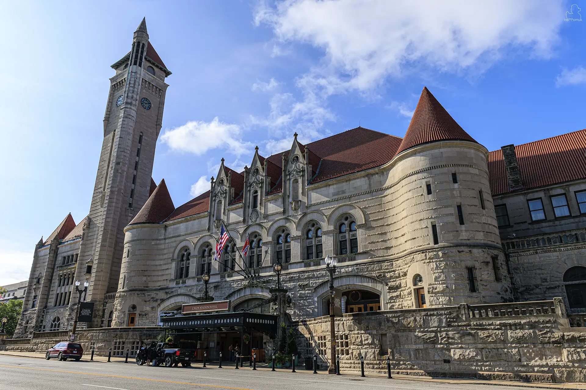
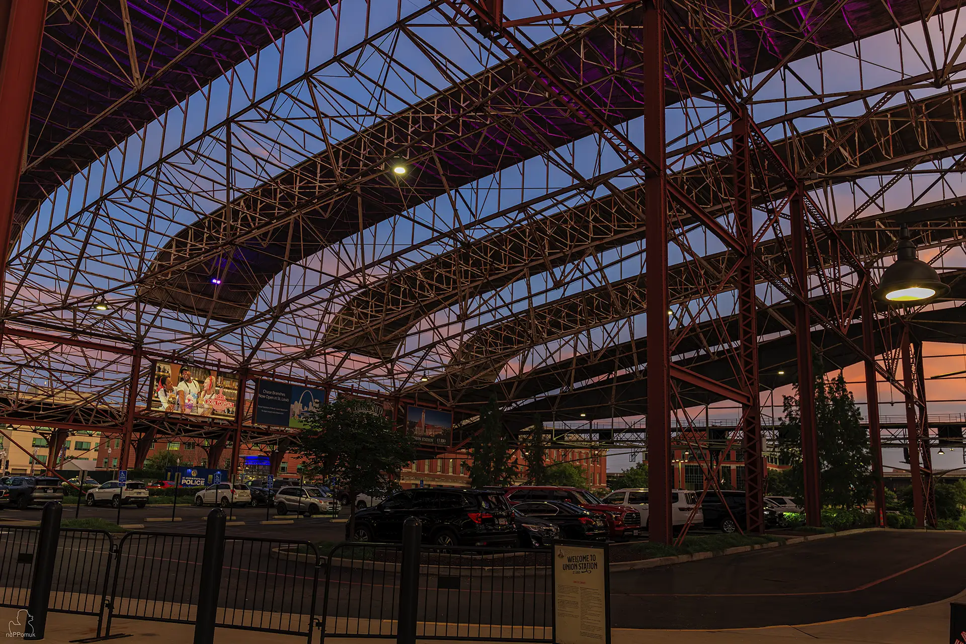
Cathedral Basilica of Saint Louis
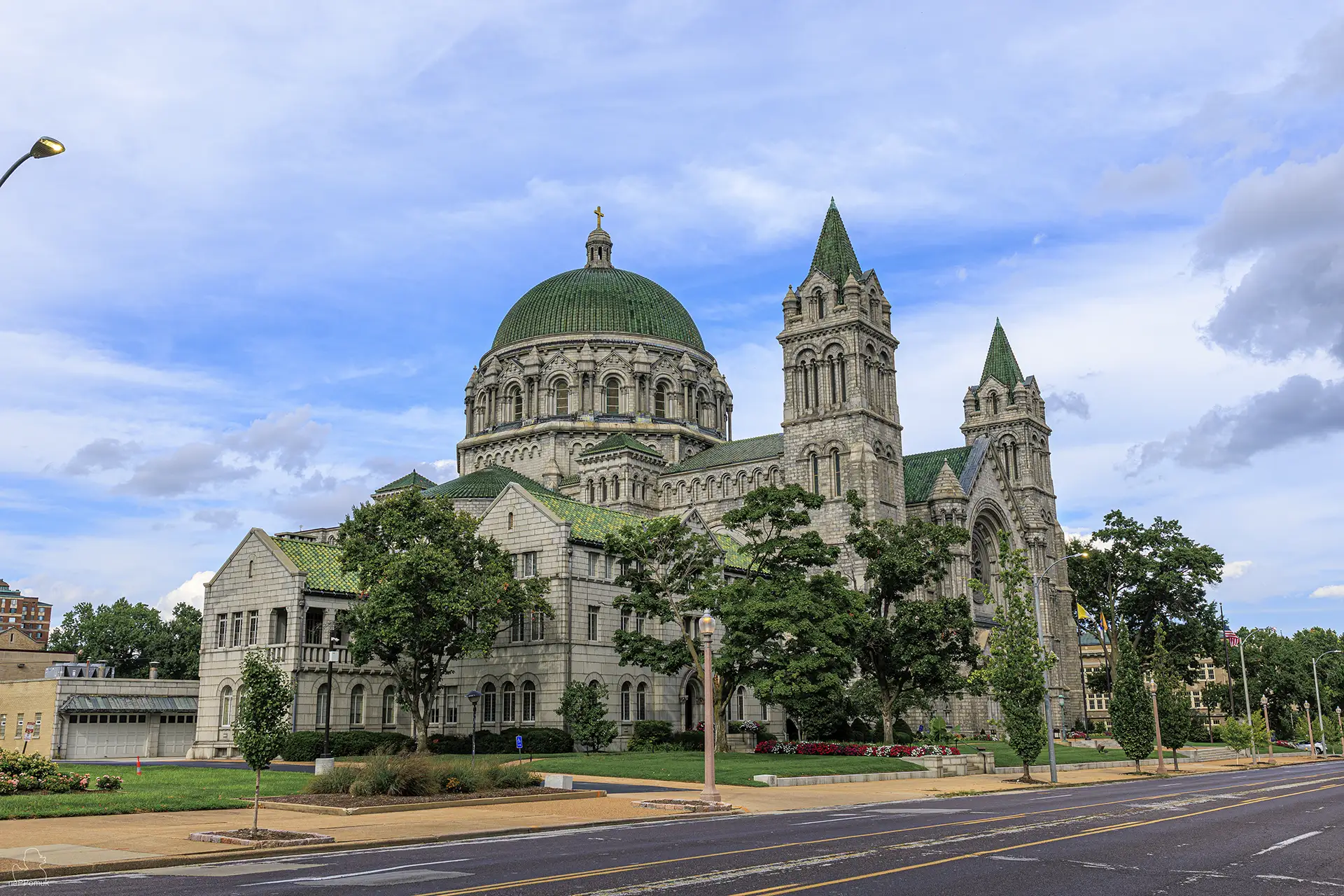
Monumental church architecture and unique mosaic art
The Cathedral Basilica of Saint Louisis one of the most important church buildings in the United States and one of the most impressive examples of Romanesque-Byzantine architecture in North America. The Catholic cathedral is located on Lindell Boulevard in the Central West End district and, with its mighty towers, light natural-stone facades and the widely visible green dome, shapes the skyline of St. Louis. Its unusual architectural style combines elements of European church architecture with a monumental design that was deliberately chosen at the beginning of the 20th century as an expression of religious and social significance.
Construction of the cathedral began in 1907 according to designs by the architect George D. Barnett. As early as 1914, the church, which was still not fully completed, could be used for the first Masses. However, its final artistic decoration took several decades. Particularly well known is the mosaic collection of the Cathedral Basilica, whose around 41.5 million glass tesserae cover walls, vaults and domes over an area of about 7,700 square meters. It is among the largest contiguous mosaic installations in the world.
In addition to its religious significance, the Cathedral Basilica has exceptional architectural and art-historical importance. Monumental round arches, a large rose window, and the characteristic green copper main dome give the exterior a distinctive appearance. Inside, this design continues with Byzantine-inspired spatial forms and elaborate mosaics. The Cathedral Basilica of Saint Louis thus combines architecture, sacred art, and more than a century of city historyinto one of the most remarkable historic buildings in Missouri.
Read more
The history of the Cathedral Basilica – the creation of a new cathedral for St. Louis
The creation of the Cathedral Basilica of Saint Louisis closely tied to the growth of the Catholic Church in Missouri and the economic development of St. Louis. As early as the 19th century, the city had evolved from a French trading post into a major American metropolis. With the growing population, the Catholic population also increased. Immigrants from Ireland, Germany, and other European countries shaped the religious and social life of the region and founded numerous new parishes.
Until the beginning of the 20th century, the historic Cathedral of Saint Louis, King of France, now usually referred to as the Old Cathedral, served as the archdiocese’s central cathedral church. The neoclassical building is located immediately west of today’s Gateway Arch and commemorates the city’s early Catholic history. However, with the growth of St. Louis and the shift of important residential and business districts to the west, the desire arose for a larger and more representative cathedral.
Already under Archbishop Peter Richard Kenrickplans for a new building were considered in the late 19th century. His successor John Joseph Kaineventually acquired the property on Lindell Boulevard and Newstead Avenue. However, implementation of the project was initially delayed by financial difficulties. In particular, the devastating tornado of 1896, which caused considerable damage in St. Louis, also strained the archdiocese’s financial resources.
Only under Archbishop John Joseph Glennondid the construction project take concrete shape. In February 1905, he announced his intention to have a new cathedral built. The structure was to provide not only sufficient space for the growing Catholic population, but also express the significance of the archdiocese within the American Church.
An architectural competition was announced for the design. The commission was awarded in 1906 to the St. Louis architectural firm Barnett, Haynes and Barnett, whose design called for a combination of Romanesque and Byzantine architecture. The decision in favor of these styles was unusual, as numerous representative church buildings of the time were still strongly influenced by Neo-Gothic models. The new cathedral, by contrast, was to have an independent character with monumental domes, powerful round arches, and an exceptional interior design.
On May 1, 1907, construction work began. The solemn laying of the cornerstone followed on October 18, 1908, and was accompanied by a large procession in which representatives of the 77 Catholic parishes of St. Louis at the time took part. The cathedral was dedicated to Christ the Victor and Louis IX of France, the patron saint of the city of St. Louis.
The construction of the monumental building posed a significant challenge both organizationally and financially. The extensive stonework, the enormous dome structures and the elaborate design of the interior required numerous specialized craft businesses. At the same time, the new cathedral was intended to serve permanently as the religious center of the archdiocese and therefore had to meet not only functional but also representative requirements.
On October 18, 1914, the first holy mass was celebrated in the new cathedral. The date was deliberately chosen to mark the sixth anniversary of the laying of the cornerstone. By that time, the building was already largely completed, but its artistic decoration was still far from finished. In the following years, additional chapels were designed, altars completed, and the first large-scale mosaics installed.
Another important milestone was the solemn consecration on June 29, 1926. The ceremony took place in the centennial year of the founding of the Diocese of St. Louis and was accompanied by extensive church celebrations. The new cathedral had thus fully assumed its central religious function, although work on the artistic interior decoration was to continue for several more decades.
The decoration of the domes, vaults, and wall surfaces with mosaics, in particular, developed into a long-term project. Economic crises, the Second World War, and changing financial resources repeatedly led to delays. Only in 1988 were the last large mosaic surfaces completed. More than eight decades thus passed between the start of construction and the completion of the artistic decoration.
The church received a special ecclesiastical honor on April 4, 1997, when Pope John Paul II conferred on it the rank of a Basilica minor. This papal honorary title is awarded to churches that hold a special status within the Catholic Church because of their religious, historical, or artistic significance. Since then, the building has officially borne the name Cathedral Basilica of Saint Louis.
In January 1999, Pope John Paul II visited the cathedralduring his trip to St. Louis. The visit underlined the importance of the house of worship for the archdiocese and also made the Cathedral Basilica known beyond the region.
Today, the Cathedral Basilica of Saint Louisremains an active place of Catholic worship and at the same time one of the city’s most important historic landmarks. Regular services, church celebrations, and concerts combine religious use with broader cultural significance. The building thus documents not only the history of the Catholic Church in Missouri, but also the social and architectural transformation of an American metropolis.
Romanesque-Byzantine architecture – The green dome and the monumental façade
The architecture of the Cathedral Basilica of Saint Louisdiffers significantly from many other major church buildings in the United States. While neo-Gothic cathedrals are often characterized by tall pointed arches, slender towers, and vertically oriented façades, the Cathedral Basilica is based on the massive forms of Romanesque architecture and the dome-covered spaces of Byzantine church architecture.
The architect George D. Barnettdeveloped a design that combines both traditions. The exterior appearance is shaped above all by massive granite façades, round-arched windows, monumental portals, and two tall bell towers. Inside, however, large dome spaces, broad-span arches, and rich mosaic decorations come more strongly to the fore. This deliberate combination of different historical architectural forms gives the building its unusual architectural identity.
Particularly striking is the largely symmetrically designed main façade of the Cathedral Basilica. Two mighty towers flank the central gable and, together with the three entrance gates, form a clearly structured overall composition. The towers have several stacked stories, whose wall surfaces are enlivened by narrow round-arched windows, columns, and decorative stone ornamentation. Their upper sections are characterized by steep, green-covered roofs.
Between the towers is the large Rose window above the main entrance. The circular window opening is set into an elaborately designed round-arch field and forms one of the most important decorative elements of the western exterior facade. Its radially arranged stone elements give the massive facade a delicate structure. At the same time, the rosette creates a connection to European church-building traditions, in which circular windows have played an important role since the Middle Ages.
The three large entrance portals lie beneath stepped round arches supported by slender columns. This architectural articulation reinforces the impression of a massive yet carefully designed stone structure. Unlike a Gothic cathedral, whose facades are often characterized by rich tracery and vertical buttresses, here broad wall surfaces, closed building volumes, and clearly recognizable round-arch forms.
The central focal point, however, is the large green dome of the Cathedral Basilica. It rises above the central nave and is among the most striking architectural elements of the entire building. With its structure, the main dome reaches a height of approximately 67 metersand thus towers clearly above the surrounding roofs. Its sweeping form creates a striking contrast to the straight-lined façades and the steep tower roofs.
The dome rests on a tall substructure pierced by round-arched windows, the so-called Drum. This mediates between the domed roof shape and the supporting structural framework. The regular sequence of windows, columns, and stone articulation elements breaks up the large massing and at the same time emphasizes the circular geometry of the dome.
A special effect is created by the green glazed roof tiles, which cover both the main dome and numerous smaller roof surfaces. Their intense color stands out clearly against the light gray granite of the façades. Especially in sunshine, the different materials become apparent: the natural stone surfaces appear comparatively matte, while the glazed roof surfaces reflect the light more strongly.
The green of the roofs gives the cathedral a distinctive silhouette that remains recognizable even from a greater distance. At the same time, it creates a clear contrast to church buildings in European cities, where copper roofs often only acquire a green tint through natural patination. At the Cathedral Basilica, the color is part of the original material design and thus a deliberate architectural feature.
In addition to the large main dome, the building has several smaller domes and rounded sections. They articulate the structure and make the different interior spaces recognizable from the outside. The interplay of large central dome, lower side roofs, and massive towerscreates a complex roofscape that is characteristic of the Romanesque-Byzantine architectural style.
The design of the side facades follows this principle as well. Large round-arched windows, strong wall projections, and decorative friezes articulate the long natural stone surfaces. Individual sections project forward or recede, creating different zones of shadow. Despite its monumental dimensions, the architecture does not appear as a completely closed block, but rather as a combination of several carefully coordinated structural forms.
The exterior appearance is closely linked to the construction of the interior space. The Byzantine-inspired dome architecturerequires massive supporting structures to absorb the considerable loads of the large vaults. Unlike the light, strongly vertically articulated spatial forms of Gothic churches, the spatial effect here is determined by central, dome-vaulted areas. The architecture thus emphasizes less a purely upward development than the bringing together of different spaces into a monumental overall complex.
Precisely because of the combination of these features, the Cathedral Basilica is one of the notable examples of the Romanesque-Byzantine church architecture in the USA. It draws on European and early Christian architectural forms without directly replicating a single historic cathedral. Instead, it became an independent design that combined the technical and aesthetic possibilities of the early 20th century with traditional forms of sacred architecture.
The cathedral also has a special place in the cityscape. Its location on Lindell Boulevard in the Central West Enddiffers markedly from the densely built-up commercial center of downtown St. Louis. Wide streets, greater distances between the buildings, and the surrounding vegetation allow different views of the facade and the green dome. As a result, the building can be viewed not only head-on, but also from oblique perspectives that make its spatial structure stand out particularly clearly.
For architectural photography in St. Louisthe Cathedral Basilica therefore offers interesting opportunities. Frontal shots emphasize the symmetry of the towers, portals, and the large rose window. Side views, on the other hand, highlight the interplay of the different parts of the building and provide a better view of the monumental main dome. In particular, the green roofs, the light natural-stone surfaces, and the finely articulated round-arched windows form characteristic design elements.
The effect is additionally altered by the surrounding trees and the respective lighting conditions. While open sightlines emphasize the monumental dimensions of the church, branches and foliage can integrate the historic building into everyday urban life. The Cathedral Basilica of Saint Louisthus shows how a strongly historicizing architecture can retain an independent character even within an American urban landscape of the 20th and 21st centuries.
Mosaic art in the Cathedral Basilica – 41.5 million glass tiles and eight decades of craftsmanship
The greatest art-historical special feature of the Cathedral Basilica of Saint Louisis located inside the house of worship. Walls, vaults, arches and domes are fitted with an exceptionally extensive collection of religious mosaics. The colorful depictions form a deliberate contrast to the comparatively restrained natural-stone architecture of the exterior façades and are among the most impressive examples of sacred mosaic art in North America.
The dimensions of this decoration are extraordinary. On a total area of around 83,000 square feet, or 7,700 square metersapproximately 41.5 million individual mosaic pieceswere processed. The design includes more than 8,000 color shades and was carried out over several generations by numerous artists and specialized craft businesses. It was not until 1988 that the last major areas were fully completed.
The long period of creation is explained by the enormous technical and artistic effort involved. Unlike an ordinary wall painting, a mosaic is created from numerous individually cut and assembled stones that are embedded in a prepared surface. Especially in the immense domes and vaults of the Cathedral Basilica, this technique required precise coordination between artistic design, architectural forms, and skilled craftsmanship.
The so-called Tesseraefrom which the mosaics are made consist mostly of colored glass. Individual stones reflect light differently and give the large-scale depictions a special spatial effect. Depending on the incidence of light, colors can stand out intensely or recede in the darker areas of the vaults. In particular, gold-colored and reflective surfaces are reminiscent of traditional Byzantine mosaic art, whose effect is strongly determined by its interplay with natural light.
The roots of this art form go back to antiquity. In the Byzantine Empire, mosaics became an essential part of the furnishings of major churches. The churches of Ravenna in Italy, including San Vitale and Sant’Apollinare in Classe, in particular show the connection between monumental architecture and elaborate religious pictorial programs. The Cathedral Basilica also draws on this tradition, but interprets it in the context of 20th-century Catholic art.
Numerous international artists and specialized workshops were commissioned to execute the mosaics. An important role was played by the originally German firm Puhl & Wagner, whose work was later continued by the St. Louis-based Ravenna Mosaic Companycontinued. The company name deliberately refers to the Italian city of Ravenna, which, because of its early Christian and Byzantine mosaics, is one of the most important centers of this art form.
Among the key artisans were Paul Heuduck and his son Arno Heuduck, who were involved in the execution of the mosaics over decades. Their work contributed significantly to the cohesive effect of the extensive interior decoration. The artistic designs of different designers had to be implemented in such a way that, despite changing styles and periods of creation, a coherent visual overall composition emerged.
Even during the early construction phase, the elaborately decorated side chapels were also designed. In particular, the work of the Tiffany Company from New Yorkand the Gorham Companyillustrate the involvement of prominent American artisan workshops. They took on the design and execution of various chapels, altars, and decorative elements. The combination of international artistic traditions with American workshops is thus an essential part of the history of the Cathedral Basilica’s creation.
The mosaics follow no purely decorative concept. Rather, they form a comprehensive theological and historical iconographic programthat extends through the various spaces of the cathedral. Scenes from the Old and New Testament, depictions of Christian saints, and allegorical motifs are combined with events from church history and the regional history of St. Louis.
As early as the Narthex, the cathedral’s entrance area, mosaics show stages from the life of the French king Louis IX., who is venerated as a saint and gave the city its name. These depictions create a direct connection between the church building and the historical identity of St. Louis. They refer not only to religious themes, but also to the city’s French origins.
In the large domes and vaults, the pictorial program continues with extensive biblical depictions. The central dome in particular has a monumental artistic design that was adapted to the curved architecture. The depictions cannot be viewed like paintings on flat wall surfaces, but instead follow the curved forms of the space. This creates a close connection between Architecture and sacred art.
The design of the mosaics continued to develop over several decades. Artists such as Hildreth Meière, John de Rosen and Mary Reardoncontributed different artistic approaches. Their works were created in some cases at widely separated times and show how ideas of religious art changed during the 20th century.
An important role was taken on by the American artist Hildreth Meière, who from the 1940s onward provided numerous designs for the mosaic decoration. Her works include, among other things, depictions in the domes and vaults as well as ornamental elements that connect various areas of the church interior with one another. Her design was intended to help bring together the individual works created over decades into a harmonious overall composition.
The artist from Poland, John de Rosenwas involved, among other things, in the design of the large central dome. His depictions combine traditional religious themes with a visual language more closely aligned with the monumental spatial forms. The artistic execution also had to take into account both the different viewing distances and the special lighting conditions inside the cathedral.
Among the last significant contributions are the works of the American artist Mary Reardon. In the 1980s, she designed several mosaic surfaces in the transepts and pictorial panels with references to local church history. With the completion of the last works in 1988one of the most extensive mosaic projects in American sacred art was completed.
The artistic effect of the interior spaces, however, does not arise solely from the enormous number of glass tesserae used. What is decisive is the interplay of dome architecture, spatial proportions, the use of light, and iconographic design. The different mosaic fields follow the architectural divisions and emphasize the spatial structure of the church. As a result, arches and vaults appear not only as load-bearing structural elements, but also as carriers of a coherent pictorial program.
The furnishings are complemented by elaborately designed altars, colored stained-glass windows, and a significant organ installation. The connection between church music and architecture has a long tradition in the Cathedral Basilica. In addition to regular services, concerts are also held here, in which the monumental interior spaces provide a special acoustic and spatial setting.
The mosaics of the Cathedral Basilica of Saint Louisare today among the most important sacred art collections of their kind. They document not only the exceptional craftsmanship of several generations, but also the artistic vision of a church that was developed over the course of more than eight decades.
While the massive Romanesque-inspired exterior architecture is characterized by its clear forms and the distinctive green roofs, the interior opens up a much more color-rich and ornamentally shaped world. It is precisely this contrast that makes the Cathedral Basilica an extraordinary church building. It combines the monumental forms of European architectural traditions with a large-scale artistic overall concept that has only a few direct counterparts in the United States.
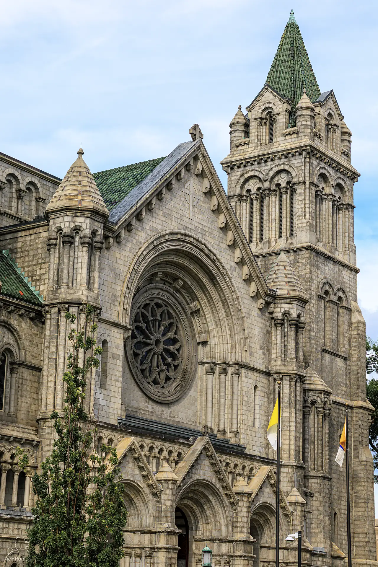
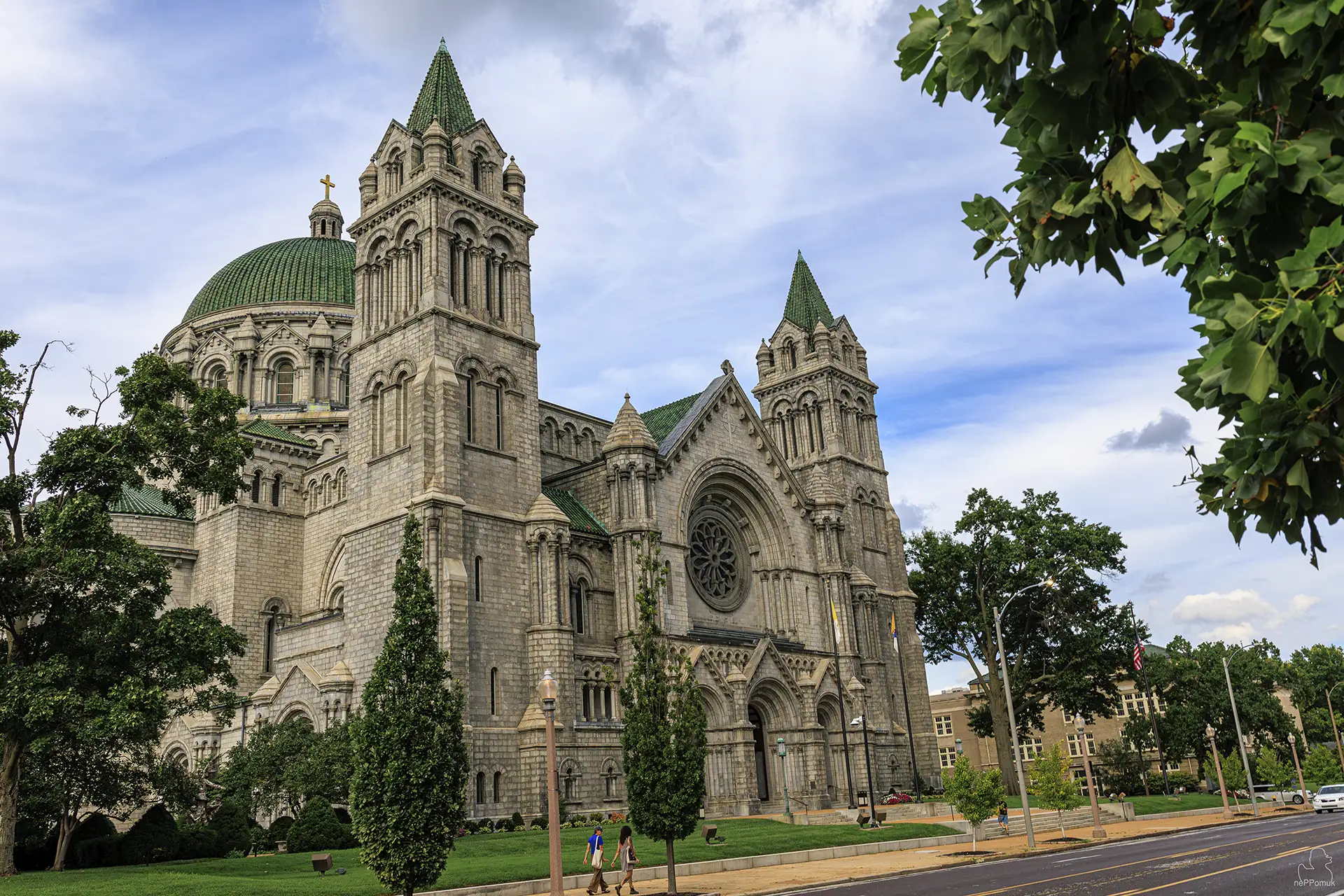
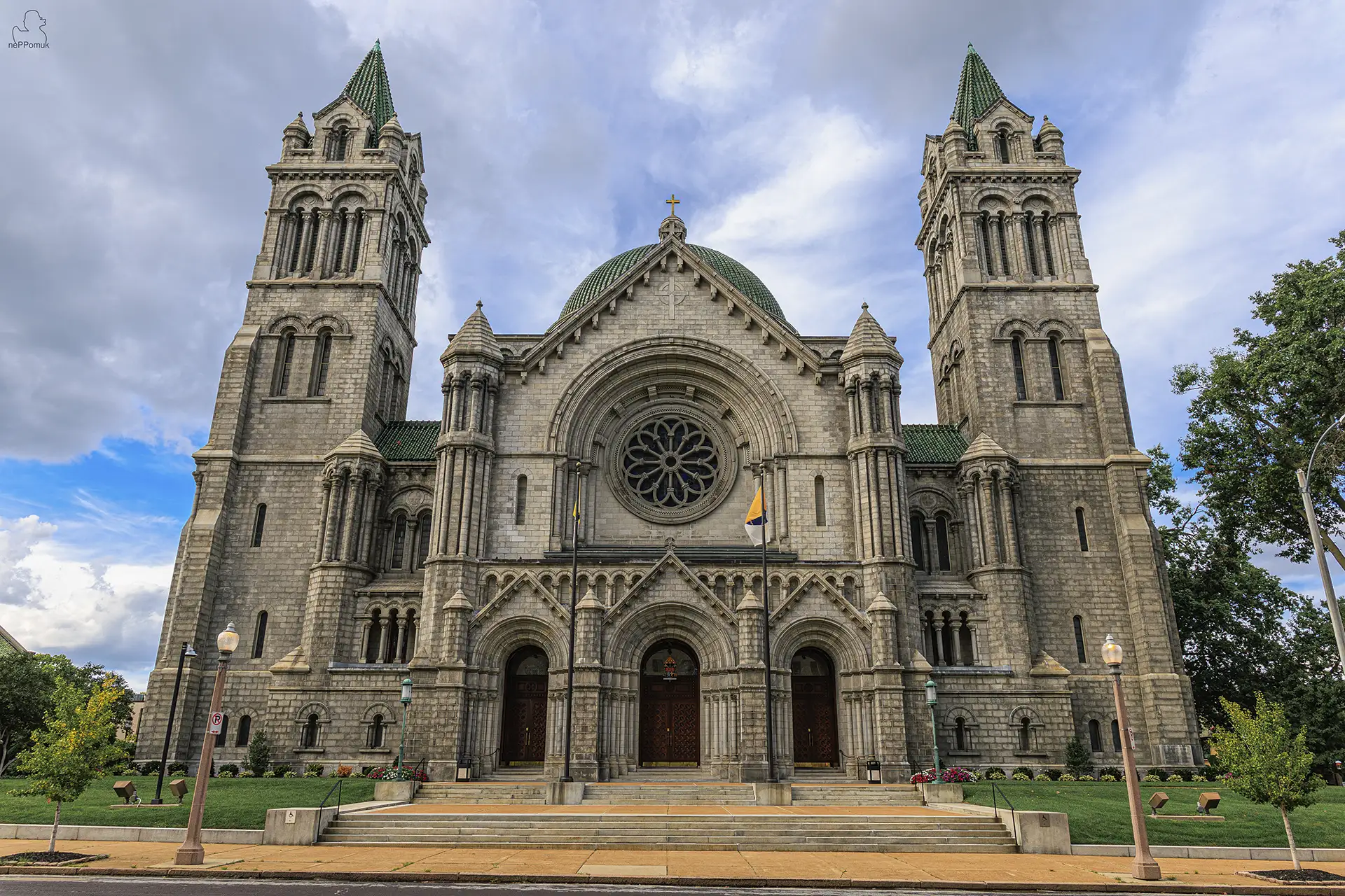
Soldiers Memorial St. Louis

War Memorial, Architecture and American Commemoration
The Soldiers Memorial Military Museum in St. Louisis one of the city’s most important historic memorial sites. The monumental building is located on Chestnut Street in the center of Downtown and originally commemorates the soldiers from St. Louis who lost their lives during the First World War. The memorial, which opened in 1938, combines a строго structured, classically influenced architecture with monumental sculptures and a spacious public commemorative area.
Especially striking are the four Pegasus sculpture groups by the American sculptor Walker Hancock, which stand at the entrances of the building. They embody the concepts Courage, Vision, Loyaltyand Sacrificeand give the Soldiers Memorial its distinctive artistic design. The interplay of monumental stone figures, tall columns and restrained façade surfaces reflects the ideas of public commemorative architecture in the United States during the 1930s.
Today, the historic memorial site includes not only the actual museum building but also the Court of Honor, which is dedicated in particular to those who fell in the Second World War. Additional memorial areas commemorate later military conflicts. After extensive renovation and redesign, the Soldiers Memorial was reopened in 2018. Since then, the site has combined the preservation of historic monuments with modern museum interpretation and is one of the notable sights of Downtown St. Louis.
Read more
Soldiers Memorial Military Museum – history and architecture of an American war memorial
The history of the Soldiers Memorial in St. Louisbegan in the years after the First World War. The war of 1914 to 1918 had claimed millions of lives and in numerous countries had created a pronounced need for public forms of remembrance. The United States entered the war in April 1917 and by the armistice in November 1918 had sent substantial troop contingents to Europe. Many residents of St. Louis also served in the military. Many of them did not return, while others had to continue living with physical injuries or the psychological consequences of their wartime experiences.
As in numerous other American cities, thoughts also arose in St. Louis about dedicating a permanent public memorial to the fallen. The aim was not merely to erect a single monument. Rather, the city pursued the idea of a connected Memorial Plaza, which was intended to link the memory of the war dead with the representative redesign of the civic center.
In 1923, the citizens of St. Louis approved the allocation of six million dollarsfor the acquisition of a larger downtown site and the construction of a memorial. The city ultimately acquired several city blocks in order to create generous public spaces between the existing administrative buildings. The project was also part of the urban planning that was to reorganize the center of St. Louis with squares, parks, and monumental public buildings.
However, the costs of acquiring the land proved considerable. The funds originally allocated were largely needed for the purchase of the designated areas. There was initially not enough money for the actual memorial building, so the start of construction was delayed for several years. Economic difficulties during the Great Depression also made implementation of the project more difficult.
Only under Mayor Bernard F. Dickmanndid the project receive new momentum. In 1933, he advocated for the provision of additional funds. Public funds and support from government employment programs ultimately made it possible to realize the memorial. The construction project thus combined two different aims: commemorating the war dead and creating employment opportunities during a period of high unemployment.
The architectural design was commissioned from the St. Louis office Mauran, Russell & Crowell. The architects designed a monumental building whose appearance is reminiscent of classical temple architecture and at the same time incorporates elements of Art Deco. Characteristic features are the symmetrical articulation, the heavy natural stone facades, and the tall, closely spaced columns that define the open entrance area.
The architecture of the Soldiers Memorial thus differs markedly from numerous older American war memorials, which were often designed as freestanding columns, obelisks, or figurative monuments. In St. Louis, instead, a closed building was created that combines the public memorial site with exhibition and assembly rooms. The representative exterior architecture was intended to convey the special significance of the place even before entering the museum.
The façade is characterized by a monumental colonnade and a broad upper cornice. Above the entrance areas is the inscription “TO OUR SOLDIER DEAD”, which refers directly to the original dedication of the monument. The reduced geometric forms and the extensive stone cladding give the building a severe, almost timeless appearance.
The design of the smaller architectural details also follows this principle. Reliefs, decorative stonework and symbolic depictions complement the façade without overpowering its clear overall structure. The materials used underline the claim to permanence. Light limestone and massive granite plinths combine the monumental architecture with the stone sculptural groups that were placed at the entrances.
On 21 October 1935, construction work began. The following year, the project received special public attention through a visit by the American president. On 14 October 1936, Franklin D. Roosevelt officially dedicated the memorial site to the war dead of St. Louis. However, the ceremony took place before the entire building complex had been completed.
The actual opening took place on Memorial Day, May 30, 1938when Mayor Dickmann handed over the Soldiers Memorial to the public. This gave St. Louis a central memorial site that was intended both to commemorate the fallen of World War I and to serve the historical documentation of military events.
Inside, rooms were set up for exhibitions and commemorative events. Of particular significance is the central memorial area with a cenotaph, a symbolic grave monument for the fallen. Such monuments are of important significance, especially in connection with modern wars, since numerous soldiers were buried far from home or their mortal remains could not be recovered.
Over the decades, Soldiers Memorial developed into an important venue for public commemorative events in St. Louis. Especially on Memorial Day and Veterans Day, the fallen were remembered here and the history of the American armed forces was honored. At the same time, society’s perception of military conflicts changed, which also increasingly expanded the tasks of historical memorial sites.
Today, Soldiers Memorial Military Museumnot only for the memory of the First World War. It also documents how American commemorative culture has developed over several generations. Its monumental architecture preserves the design ideals of the 1930s, while its museum use places historical events and their impact on individual people and families in a broader context.
Courage, Vision, Loyalty and Sacrifice – The Pegasus sculptures by Walker Hancock
Among the most striking artistic elements of the Soldiers Memorial Military Museumare the four monumental sculptural groups that stand at the northern and southern entrances of the building. They were designed by the American sculptor Walker Kirtland Hancockand each depict a human figure in connection with a winged horse. The representations thus take up the mythological motif of the Pegasusup, but connect it with an allegorical statement about the experiences and values of war.
Walker Hancock was born in St. Louis in 1901and received his artistic training, among other places, at Washington University in his hometown as well as at the Pennsylvania Academy of the Fine Arts. Additional studies took him to Europe, including the American Academy in Rome. His sculptural work was strongly oriented toward the human figure and combined classical design principles with the requirements of public monuments.
For the Soldiers Memorial, Hancock was originally meant to create sculptures showing winged horses as monumental flanking figures for the entrances. However, the association with the Pegasus motif was not self-evident. In Greek mythology, the winged horse is often associated with poetic inspiration and extraordinary creative powers. This meaning could not be directly transferred to a war memorial.
Hancock therefore developed a solution in which human figures give the mythological motif a new symbolic meaning. The sculptures were not intended to represent military victory or physical strength alone. Instead, he associated the winged horses with four concepts that embody different human qualities and experiences related to war and military service.
The four groups in total were given the names Courage, Vision, Loyalty and Sacrifice. Their names are incorporated into the granite bases and allow the allegorical depictions to be identified immediately. The sculptures were carved from light-colored limestone and completed in 1939, that is, after the official opening of the museum building. Their massive forms take up the monumental architecture while at the same time creating independent sculptural accents.
On the south side of the Soldiers Memorialstand the two figures Courage and Vision. They flank the entrance area and, together with the columns behind them, form a symmetrical arrangement. Although both groups are based on the motif of the winged horse, they differ clearly in the posture and presence of the human figures.
The sculpture Courage – Courageshows a male warrior beside a Pegasus. The powerful figure wears a helmet and holds a sword, while the other hand touches or guides the horse. The body is designed to be upright and tense. The pronounced musculature and clear posture are based on classical depictions of heroic figures from Greek and Roman art.
The work embodies the concept of courage without depicting a specific historical person. Courage is therefore not a depiction of an individual soldier, but an allegory of human bravery.The sword and the classical armor refer to military contexts, while the winged horse introduces an additional mythological level. The entire composition conveys solidity, determination, and physical strength.
Especially in the close-up view, it becomes clear how closely the human figure and the horse are connected. The warrior’s hand rests on the animal’s head or neck, while the large wings and massive body form of Pegasus complement the figure spatially. The carefully modeled surfaces and pronounced anatomical forms show Hancock’s orientation toward classical sculpture.
Beside it is Vision – far-sightedness or imagination. This sculpture shows a female figure who is likewise accompanied by a winged horse. Unlike Courage, physical strength is not the focus here. Rather, the upright posture and raised hand convey the impression of a forward-looking or guiding gesture.
The figure can be understood as a symbol of the ability to look beyond the immediate present. In the context of a war memorial, Vision may refer to hope for a more peaceful future or to the ability to draw conclusions from historical experience. These interpretations arise from the allegorical title and the design, without the sculpture prescribing a single definitive interpretation.
On the north side of the Soldiers Memorialare the two additional groups Loyalty and Sacrifice. They expand the symbolism to include loyalty, solidarity, and willingness to sacrifice. Here too, Hancock uses classical human figures in combination with a winged horse, thereby linking them to the design of the opposite entrance side.
Loyalty – Fidelityis embodied by a male warrior standing beside his horse and holding a sword. The gesture is to be understood less as an immediate act of combat and more as an expression of reliability and attachment. In the context of military service, the term refers to responsibility toward other people and to commitment within a community.
Another emotional dimension is conveyed by Sacrifice – Offering. The sculpture shows a female figure with a child in her arms. While the other depictions primarily symbolize qualities of individual adults, Hancock here broadens the view to the family and social consequences of war. The child makes clear that the effects of military conflicts extend far beyond the soldiers directly involved.
The depiction of mother and child was not undisputed during the creation of the sculpture. The additional figure caused higher costs, and there was initially discussion about how to finance them. In the end, the participating stonemasonry company covered the extra costs. This history of its creation shows that the artistic design of the Soldiers Memorial was also influenced by financial and organizational conditions.
All four groups have a close relationship to the architecture of the building. The light limestone figures stand on massive granite pedestals, whose clear geometric form harmonizes with the columns behind them. At the same time, the organic body shapes of the people and horses differ clearly from the straight-lined facade elements. This contrast creates a tension between architectural rigor and figural representation.
The sculptures are part of a well-conceived overall artistic concept. Their size and arrangement were coordinated with the monumental entrances, so that they appear neither as mere facade decoration nor as fully independent works of art. They mediate between the public square and the interior of the memorial building.
In the photography of the Pegasus sculpturesthese connections can be brought out particularly clearly. Overall views show the relationship between the figures, their pedestals, and the architecture of the Soldiers Memorial. Close-ups, on the other hand, emphasize the sculptural design, the posture of the human figures, and the pronounced body forms of the winged horses.
The two works standing on the south side, Courage and Vision, illustrate the range of allegorical representation through their differing expressions. While Courage primarily conveys physical strength and determination, Vision has a calmer effect geared toward spiritual orientation. Both sculptures form an essential part of the artistic identity of the Soldiers Memorial in St. Louis.
With its four Pegasus sculptural groups, Walker Hancock created an extraordinary example of American memorial art of the 1930s. The works combine ancient mythology, classical figurative sculpture, and modern commemorative culture. They give abstract concepts a visible form and add an artistic dimension to the memorial building’s historical message.
Court of Honor – Commemoration of the World Wars and the development of the memorial site
Immediately south of the Soldiers Memorial extends the Court of Honor, a publicly designed memorial square that expands the original remembrance of the fallen of the First World War with further historical perspectives. Together with the museum building, the complex forms a continuous space of remembrance within downtown St. Louis and is part of the larger Memorial Plaza.
While the Soldiers Memorial was built in the 1930s, the Court of Honor was not created until after the Second World War. The conflict from 1939 to 1945 also had profound social consequences in St. Louis. Numerous residents served in the military, worked in war-related industries, or were otherwise affected by the political and economic changes. After the war, there was therefore a need to also commemorate the fallen of this conflict in an appropriate public form.
The Court of Honor, opened in 1948was designed according to plans by the architect Eugene Mackey Jr.. Unlike the monumental museum building, the complex is conceived primarily as an open memorial space. Paths, green spaces, and commemorative elements form a cohesive plaza design that invites a quieter stay and personal reflection on the historical events.
Among the most important components is a stone memorial pillar nearly twelve meters high, which was designed by the sculptor Hillis Arnold. It forms a vertical focal point within the Court of Honor and stands in a deliberate spatial relationship to the façade of the Soldiers Memorial. Its simple, monumental form differs from the figurative Pegasus sculptures of the older memorial building.
The complex is complemented by memorial walls and inscriptions dedicated to the fallen of the Second World War. The design thus uses different forms of remembrance. While individual monuments create a public impact through their size and materiality, the names and inscriptions provide a more specific connection to the people to whom the memorial is dedicated.
With the later military conflicts of the United States, the significance of the entire memorial site also changed. The Korean War from 1950 to 1953and the long Vietnam Warled to further losses and social disputes. The memory of these wars was gradually incorporated into the design of Memorial Plaza.
The Vietnam War in particular made it clear that military commemoration in the United States is not always associated with a uniform social assessment. While the Second World War is often linked to the fight against National Socialist rule and the expansion of the Axis powers, American involvement in the Vietnam War remained highly controversial politically and socially. A historical site of remembrance must therefore not only document military service and personal sacrifice, but also create room for different experiences and assessments.
Over the course of decades, the Soldiers Memorial Military Museumcontinued to be used, although both the building facilities and the museum presentation increasingly became in need of modernization. In particular, the requirements for accessibility, air conditioning, conservation conditions, and contemporary exhibition technology had changed significantly since the opening in 1938.
A fundamental change was brought by the cooperation with the Missouri Historical Society, which took over responsibility for the operation and further development of the museum in 2015. The long-established historical society has extensive experience in preserving and conveying regional history. Its involvement created the conditions for a comprehensive redesign of the historic memorial site.
In the following years, the Soldiers Memorial was renovated as part of a project worth approximately 30 million US dollars. The work included the restoration of historic building sections, the renewal of technical systems, and the creation of contemporary museum spaces. At the same time, the adjacent Court of Honor was also fundamentally revised in order to strengthen the spatial and thematic connection between the two areas.
An important goal was to preserve the historic fabric while making the memorial more accessible at the same time. The structural interventions were therefore guided by the original architecture, while new pathways and technical facilities were intended to make use easier. The planning also took into account the experiences of veterans with disabilities so that the historic memorial site would be open to as many people as possible.
The redesign is especially evident in the Court of Honor. The existing plaza was expanded to include a long, narrow reflecting pool, whose calm surface mirrors the memorial column and parts of the surrounding architecture. The clear form of the pool emphasizes the central axis between the open plaza and the museum building.
Added to this was the Five Branches Fountain, a fountain that symbolizes the five traditional branches of the United States armed forces: Army, Navy, Marine Corps, Air Force and Coast Guard. Its design reflects the military significance of the memorial site, while the water features and green areas create a calmer atmosphere.
The existing memorial elements for the Korea and Vietnam wars were also more strongly integrated into the new path layout. Additional monuments now also commemorate people from St. Louis who lost their lives in later military operations. As a result, the site developed into a place of remembrance that spans several generations of American military history.
At the On 3 November 2018, the Soldiers Memorial Military Museum reopened after its extensive renovation. Since then, the modernized exhibition spaces have combined historical documents, photographs, personal keepsakes and other exhibits with an educational approach that focuses more strongly on individual biographies.
An important role in this is played by the distinction between public commemoration and the historical examination of military events. The Soldiers Memorial is both a memorial and a museum.While the architecture and the memorial grounds are dedicated to the fallen, the museum presentation makes it possible to take a deeper look at the historical contexts, personal experiences and social impacts of military conflicts.
The urban setting also contributes to the effect of this place of remembrance. The Soldiers Memorial is located between major traffic arteries and the representative buildings of Downtown. However, the broad lawns, the facades with their tall columns and the ordered paths create a clearly different spatial atmosphere from the surrounding commercial streets.
In particular, the south facade with its flags, the forecourt Court of Honor and the monumental Pegasus sculpturesform a closed ensemble whose architectural effect extends beyond the individual monuments. The different materials and forms – light natural stone, dark inscriptions, water features and well-kept green spaces – connect the historical and modern components of the complex with one another.
The Soldiers Memorial thus documents an important change in American commemorative culture. From a memorial for those who fell in the First World War, it developed into a historic place that addresses different military conflicts and their consequences. The combination of monumental art, architecture and museum interpretation makes the Soldiers Memorial an important part of the history and public life of St. Louis.
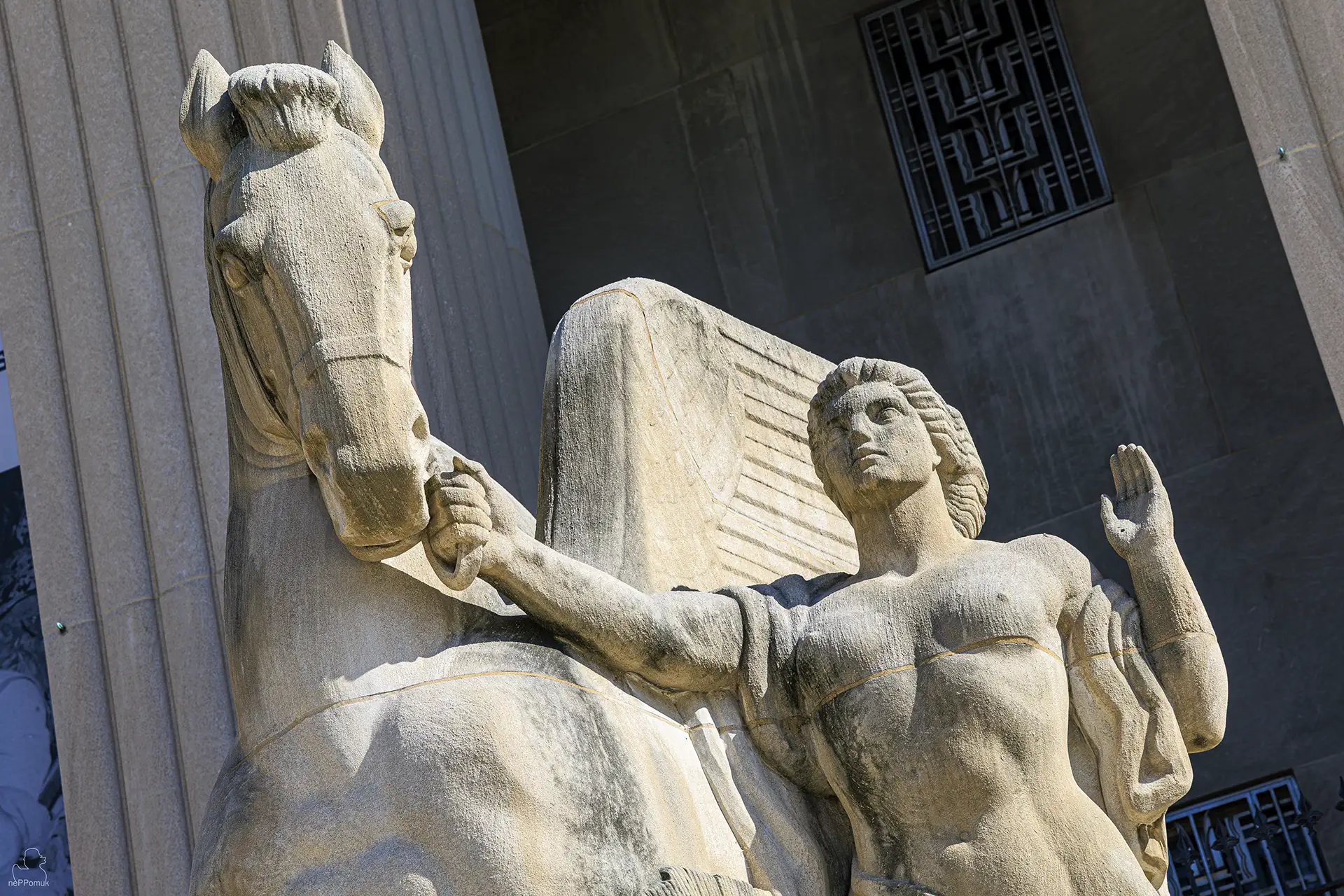
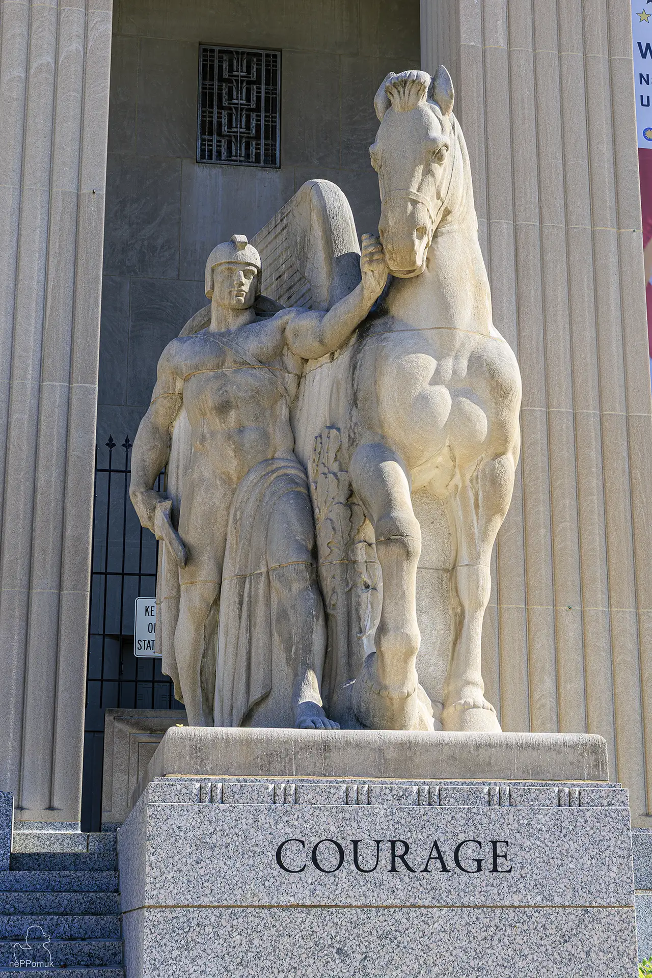
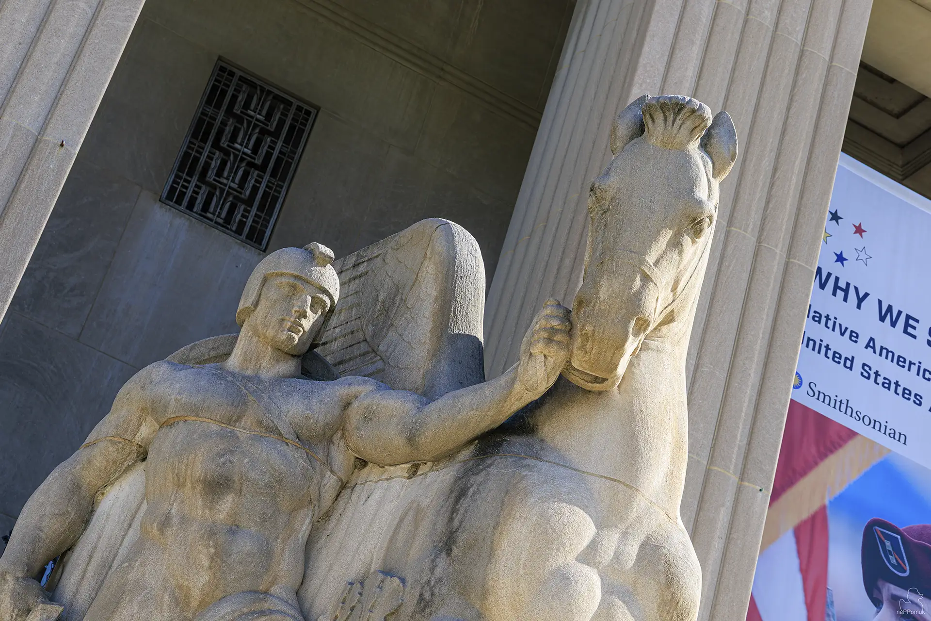
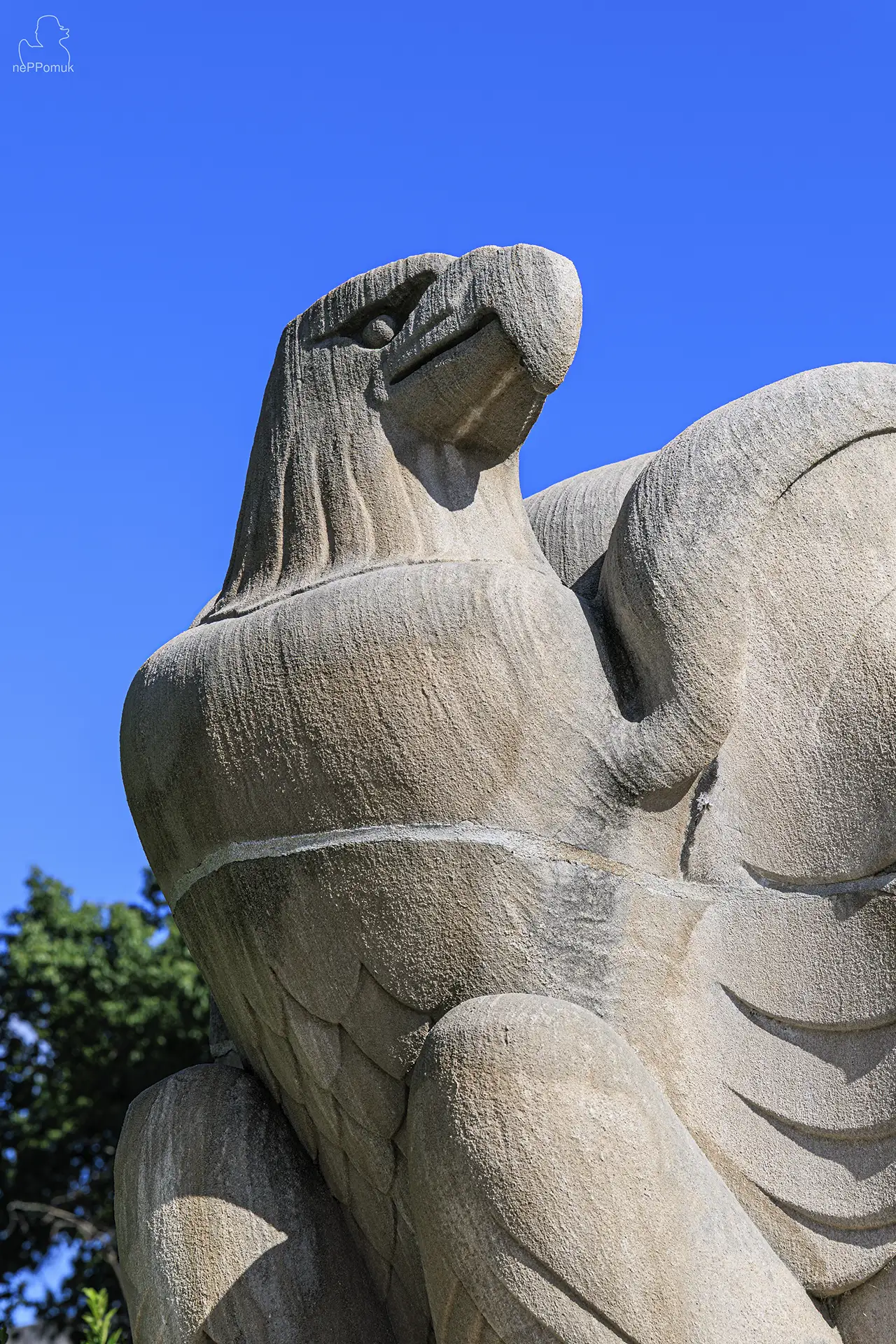
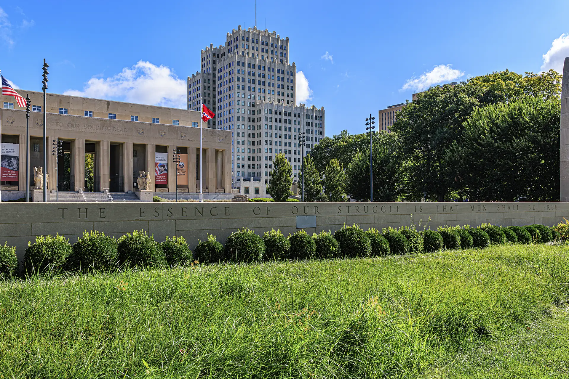

Culture, neighborhoods and Route 66
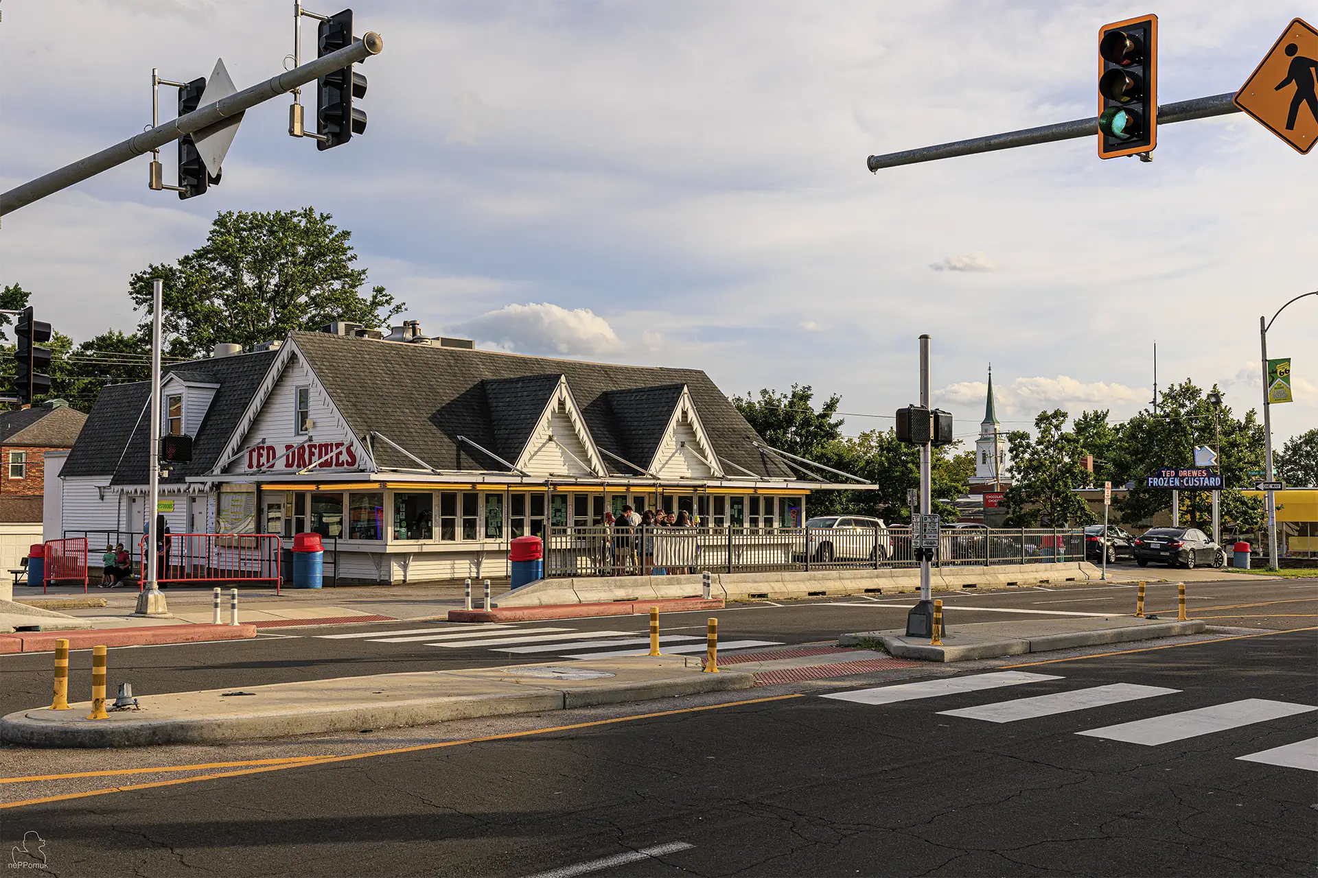
The diverse St. Louis away from the major sights
St. Louis is not defined only by the Gateway Arch, the Mississippi and its historic architectureshaped. The city has a diverse cultural identity whose origins are closely linked to African American music history, European immigrant communities, and the development of American everyday culture. Historic houses, traditional shops, sports venues, and unassuming stretches of street tell the story of a major city that has produced important cultural impulses over generations.
Among the most important figures is the composer Scott Joplin, whose ragtime music became known far beyond Missouri around the turn of the 20th century. On Delmar Boulevard, his former home recalls this era. The street itself also illustrates the different social and economic developments within St. Louis. Modern soccer stadiums, long-established baseball clubs, and urban sports facilities complement this multifaceted picture.
The historic Route 66is also part of the cultural history of St. Louis. Its route through the city connects former commercial streets, traditional restaurants, and transportation structures with one of the best-known symbols of American mobility. Ted Drewes Frozen Custard on Chippewa Street in particular recalls the time when Route 66 was one of the most important east-west connections in the United States. Together with regional specialties such as Toasted Ravioli and Brain Sandwich, this reveals a side of St. Louis whose significance lies less in monumental sights than in long-established local traditions.
Read more
Scott Joplin House – Ragtime und die afroamerikanische Musikgeschichte von St. Louis
Die Musikgeschichte von St. Louisgehört zu den bedeutendsten kulturellen Beiträgen der Stadt zur amerikanischen Geschichte. Bereits im ausgehenden 19. Jahrhundert entwickelte sich die Region zu einem wichtigen Zentrum populärer Musik, in dem unterschiedliche europäische und afroamerikanische Traditionen aufeinandertrafen. Besonders der Ragtime, eine durch rhythmische Verschiebungen und synkopierte Melodien geprägte Klaviermusik, erlangte hier eine außergewöhnliche Bedeutung. Zu seinen bekanntesten Vertretern gehört der afroamerikanische Komponist und Pianist Scott Joplin, dessen ehemaliges Wohnhaus heute als historische Gedenkstätte erhalten ist.
Scott Joplin wurde vermutlich Ende der 1860er-Jahre in Texas geboren und wuchs in einer Familie auf, in der Musik eine wichtige Rolle spielte. Schon früh beschäftigte er sich mit dem Klavierspiel und entwickelte ein besonderes Interesse an den musikalischen Formen seiner Zeit. Während seiner Jugend und frühen Erwachsenenjahre reiste er als Musiker durch verschiedene Regionen der Vereinigten Staaten und lernte dabei unterschiedliche Musiktraditionen kennen. Besonders die Verbindung europäisch geprägter Klaviermusik mit afroamerikanischen Rhythmen wurde zu einer wesentlichen Grundlage seines späteren kompositorischen Schaffens.
In den 1890er-Jahren ließ sich Joplin zeitweise in Sedalia im Bundesstaat Missourinieder. Dort studierte er Musik und entwickelte seinen charakteristischen Kompositionsstil weiter. Einen entscheidenden Durchbruch erzielte er 1899 mit dem Maple Leaf Rag, der beim Musikverlag von John Stark veröffentlicht wurde. Die Komposition wurde zu einem der erfolgreichsten Ragtime-Stücke ihrer Zeit und begründete Joplins Ruf als herausragender Vertreter dieser Musikrichtung.
Anders als viele populäre Unterhaltungsstücke jener Epoche zeichnet sich der Maple Leaf Rag durch eine sorgfältig ausgearbeitete musikalische Struktur aus. Die Melodien werden durch charakteristische rhythmische Verschiebungen geprägt, während die linke Hand am Klavier eine regelmäßige Begleitung übernimmt. Diese Verbindung aus klarer Form und komplexer Rhythmik gehört zu den wesentlichen Merkmalen des klassischen Ragtime. Joplin betrachtete seine Kompositionen nicht lediglich als Tanz- oder Unterhaltungsmusik, sondern als anspruchsvolle Werke, die ein präzises und kontrolliertes Spiel erforderten.
Im Frühjahr 1901 zog Scott Joplin nach St. Louis, wo er am damaligen Morgan Street, dem heutigen Delmar Boulevard, eine Wohnung bezog. Das erhaltene Backsteingebäude an der Adresse 2658 Delmar Boulevardstammt aus dem 19. Jahrhundert und unterscheidet sich äußerlich kaum von zahlreichen anderen historischen Wohnhäusern der Stadt. Seine Bedeutung ergibt sich nicht aus einer monumentalen Architektur, sondern aus der Verbindung mit einer Persönlichkeit, die die amerikanische Musikgeschichte nachhaltig beeinflusste.
Während seiner Zeit in St. Louis widmete sich Joplin zunehmend dem Komponieren und Unterrichten. Die Einnahmen aus dem Verkauf seiner Noten ermöglichten ihm eine größere künstlerische Unabhängigkeit. In dieser produktiven Phase entstanden mehrere seiner bekanntesten Werke, darunter The Entertainer, Elite Syncopations, March Majesticund The Ragtime Dance. Besonders The Entertainer, 1902 veröffentlicht, gehört heute zu den bekanntesten Ragtime-Kompositionen überhaupt.
St. Louis bot Joplin ein lebendiges musikalisches Umfeld. In den Theatern, Tanzlokalen und Unterhaltungseinrichtungen der Stadt traten zahlreiche afroamerikanische Musiker auf, deren Musik neue rhythmische und stilistische Entwicklungen hervorbrachte. Besonders die Gegend um das Rosebud Café des Pianisten und Komponisten Tom Turpingehörte zu den wichtigen Treffpunkten der frühen Ragtime-Szene. Musiker tauschten dort musikalische Ideen aus, entwickelten neue Kompositionen und trugen zur Verbreitung einer Musikrichtung bei, die weit über die Grenzen von Missouri hinaus bekannt werden sollte.
Die Entwicklung dieser Musik lässt sich jedoch nicht von den damaligen gesellschaftlichen Verhältnissen trennen. Afroamerikanische Künstler waren in den Vereinigten Staaten um 1900 weiterhin mit rassistischer Diskriminierung und weitreichenden Einschränkungen ihrer beruflichen Möglichkeitenkonfrontiert. Trotz ihrer wachsenden kulturellen Bedeutung standen ihnen viele gesellschaftliche und wirtschaftliche Einrichtungen nicht gleichberechtigt offen. Die afroamerikanische Musikszene entwickelte sich deshalb häufig in eigenen Veranstaltungsorten und Netzwerken, die sowohl kulturelle Freiräume als auch wirtschaftliche Möglichkeiten boten.
Joplin versuchte während seiner Karriere wiederholt, diese Grenzen zu überwinden. Neben seinen erfolgreichen Ragtime-Stücken beschäftigte er sich mit größeren musikalischen Formen und komponierte unter anderem die Oper A Guest of Honor, deren Partitur heute als verschollen gilt. Später entstand mit Treemonishaeine weitere Oper, in der er afroamerikanische Geschichte und gesellschaftliche Fragen in einer anspruchsvollen musikalischen Form behandelte. Zu Lebzeiten gelang es ihm allerdings nicht, für diese Werke eine breite öffentliche Anerkennung zu erreichen.
Scott Joplin starb 1917 in New York, nachdem sich seine gesundheitliche Situation über mehrere Jahre verschlechtert hatte. In den folgenden Jahrzehnten verlor der klassische Ragtime zunächst an öffentlicher Popularität. Erst im späteren 20. Jahrhundert setzte eine breitere Wiederentdeckung seiner Kompositionen ein. Besonders die Verwendung von The Entertainer im Film The Stingaus dem Jahr 1973 machte seine Musik erneut einem großen Publikum bekannt.
Heute gilt Scott Joplin als einer der bedeutendsten afroamerikanischen Komponisten seiner Zeit und als wichtiger Wegbereiter der amerikanischen Popularmusik. Der Ragtime beeinflusste insbesondere die Entwicklung des frühen Jazz und gehört zu den prägenden musikalischen Strömungen an der Wende vom 19. zum 20. Jahrhundert.
An diese Geschichte erinnert das Scott Joplin House State Historic Siteam Delmar Boulevard. Das restaurierte Wohnhaus vermittelt einen Eindruck von den Lebensbedingungen der damaligen Zeit und dokumentiert Joplins künstlerische Entwicklung. Historisch eingerichtete Räume und Ausstellungen beschäftigen sich mit seiner Biografie, seinen Kompositionen und dem musikalischen Umfeld von St. Louis.
Das Gebäude besitzt dabei eine besondere Aussagekraft. Anders als die monumentalen Theater und öffentlichen Gebäude der Innenstadt steht es für die alltäglichen Lebensverhältnisse eines Künstlers, dessen Werke weltweite Bekanntheit erlangten. Die vergleichsweise schlichte Backsteinfassade des Scott Joplin Houseverweist auf eine Kulturgeschichte, die sich nicht allein in repräsentativen Bauten, sondern ebenso in gewöhnlichen Wohn- und Geschäftsvierteln entwickelte.
Die Erhaltung des historischen Hauses macht einen wichtigen Teil der afroamerikanischen Musikgeschichte von St. Louissichtbar. Sie erinnert an die kulturellen Leistungen jener Musiker und Komponisten, die trotz gesellschaftlicher Benachteiligung entscheidend zur Entwicklung eigenständiger amerikanischer Musikformen beitrugen. Das Scott Joplin House gehört damit zu den historisch bedeutenden Kulturstätten der Stadt.
Delmar Boulevard – Stadtviertel, Straßenkultur und gesellschaftlicher Wandel
Der Delmar Boulevard in St. Louisgehört zu den Straßen, an denen sich die unterschiedlichen Entwicklungsphasen der amerikanischen Großstadt besonders deutlich nachvollziehen lassen. Die lange Ost-West-Verbindung führt durch verschiedene Wohn- und Gewerbegebiete und verändert dabei mehrfach ihren Charakter. Historische Backsteinbauten, kleinere Werkstätten, Geschäftshäuser und moderne Einrichtungen stehen entlang der Straße in unterschiedlichen städtebaulichen Zusammenhängen.
Ursprünglich trug ein Teil der Straße den Namen Morgan Street. Mit dem Wachstum von St. Louis wurden die Verkehrswege erweitert und zunehmend mit den westlich gelegenen Stadtvierteln verbunden. Während des 19. und frühen 20. Jahrhunderts entstanden entlang dieser Achse Wohnhäuser, Geschäfte und gewerbliche Einrichtungen, die den wirtschaftlichen und gesellschaftlichen Wandel der Stadt widerspiegelten. Das Scott Joplin House erinnert noch heute an diese frühe Entwicklungsphase.
Die architektonische Vielfalt am Delmar Boulevard unterscheidet sich von den repräsentativen Straßenzügen rund um Market Street und Memorial Plaza. Statt monumentaler öffentlicher Gebäude prägen vielfach gewöhnliche Gewerbebauten, Werkstätten und historische Wohnhäuserdas Straßenbild. Gerade diese alltägliche Architektur dokumentiert, wie sich St. Louis abseits seiner bekannten Sehenswürdigkeiten entwickelte und welche Bedeutung kleinere Unternehmen für das wirtschaftliche Leben der Stadt besaßen.
Ein typisches Merkmal amerikanischer Geschäftsstraßen ist die enge Verbindung zwischen funktionalen Gebäuden und individuell gestalteten Fassaden. Autowerkstätten, Reparaturbetriebe und andere Gewerbe nutzen häufig ältere Gebäude, deren ursprüngliche Architektur im Laufe der Jahrzehnte an veränderte Anforderungen angepasst wurde. Neue Tore, Werbeschilder und Wandgestaltungen treten dabei neben ältere Fensteröffnungen und ursprüngliche Mauerstrukturen.
Besonders auffällig sind die großflächigen Wandmalereien und Fassadengestaltungen, die an einzelnen Gebäuden entlang des Delmar Boulevard zu finden sind. Solche Motive erfüllen unterschiedliche Funktionen. Sie können auf das Angebot eines Unternehmens hinweisen, einen gestalterischen Akzent setzen oder die Identität eines Geschäfts nach außen sichtbar machen. Gleichzeitig verändern sie die Wahrnehmung der umgebenden Straßenräume, indem sie ansonsten funktionalen Gebäuden eine eigenständige visuelle Wirkung verleihen.
Gerade an Werkstattgebäuden lässt sich diese Verbindung von Funktion und Gestaltung beobachten. Ein großflächiges Wandbild mit Augen und einem Sportwagen verweist beispielsweise unmittelbar auf die automobile Nutzung des Gebäudes und verbindet sie mit einer auffälligen grafischen Darstellung. Solche Fassaden sind keine klassischen Sehenswürdigkeiten, gehören aber zum unverwechselbaren Erscheinungsbild gewachsener Gewerbeviertel.
Die Bedeutung des Delmar Boulevard reicht jedoch über Architektur und Straßenkultur hinaus. Die Straße ist eng mit einem der bekanntesten gesellschaftlichen Phänomene von St. Louis verbunden: dem sogenannten Delmar Divide. Damit wird eine historisch entstandene soziale und wirtschaftliche Trennlinie bezeichnet, die besonders zwischen Stadtvierteln nördlich und südlich des Delmar Boulevard sichtbar wurde.
Die Ursachen dieser Ungleichheiten liegen in einer langen Entwicklung von rassistischer Wohnungsmarktpolitik, wirtschaftlicher Benachteiligung und räumlicher Segregation. Im frühen und mittleren 20. Jahrhundert schränkten diskriminierende Immobilienverträge und andere Praktiken die Wohnmöglichkeiten afroamerikanischer Einwohner erheblich ein. Banken und Versicherungen behandelten bestimmte Wohngebiete systematisch schlechter, was Investitionen erschwerte und langfristig zu unterschiedlichen wirtschaftlichen Entwicklungsmöglichkeiten führte.
Eine besondere Rolle spielte das sogenannte Redlining. Dabei wurden Wohngebiete nach vermeintlichen wirtschaftlichen Risiken bewertet, wobei rassistische Vorurteile und die Zusammensetzung der Bevölkerung wesentlich in die Einstufung einflossen. In benachteiligten Vierteln war es dadurch häufig erheblich schwieriger, Hypotheken oder andere Finanzierungsmöglichkeiten zu erhalten. Die Folgen solcher Praktiken wirkten über mehrere Generationen hinweg und beeinflussten die Vermögensbildung, den Gebäudezustand und die wirtschaftlichen Perspektiven einzelner Stadtteile.
Mit der Suburbanisierung nach dem Zweiten Weltkrieg verschärften sich diese Entwicklungen zusätzlich. Wohlhabendere Haushalte und zahlreiche Unternehmen verlagerten ihren Wohn- beziehungsweise Geschäftssitz in die Außenbezirke. In anderen Stadtvierteln gingen Arbeitsplätze verloren, die Bevölkerung schrumpfte und die öffentliche Infrastruktur geriet zunehmend unter Druck. Die dadurch entstandenen Unterschiede sind bis heute ein wichtiges Thema der Stadtentwicklung von St. Louis.
Der Begriff Delmar Divide beschreibt deshalb keine tatsächliche administrative Grenze, sondern eine historisch gewachsene gesellschaftliche Trennung. Auch lassen sich die vielfältigen Lebensverhältnisse der unterschiedlichen Stadtviertel nicht allein durch die Lage nördlich oder südlich einer einzelnen Straße erklären. Dennoch ist der Delmar Boulevard zu einem allgemein bekannten Bezugspunkt für Diskussionen über soziale Ungleichheit und Stadtentwicklung geworden.
In den vergangenen Jahren entstanden unterschiedliche Initiativen, die den wirtschaftlichen und gesellschaftlichen Austausch zwischen den benachbarten Vierteln stärken sollen. Investitionen in Wohngebäude, kleinere Unternehmen, öffentliche Einrichtungen und die Gestaltung der Straßenräume sollen dazu beitragen, historisch entstandene Nachteile schrittweise abzubauen. Die Entwicklung ist jedoch langfristig angelegt und lässt sich nicht allein an einzelnen Bauprojekten beurteilen.
Ein anderes Gesicht zeigt der weiter westlich gelegene Delmar Loop, der sich zu einem bekannten Geschäfts- und Kulturviertel entwickelt hat. Restaurants, Veranstaltungsorte, Geschäfte und kulturelle Einrichtungen prägen dort den Straßenraum. Obwohl beide Bereiche durch den Delmar Boulevard miteinander verbunden sind, besitzen sie unterschiedliche städtebauliche Strukturen und eigene Entwicklungsgeschichten.
Für die Stadtfotografie in St. Louiseröffnet der Delmar Boulevard einen Blick auf jene Bereiche, die in klassischen Darstellungen amerikanischer Metropolen häufig weniger Aufmerksamkeit erhalten. Historische Wohnhäuser, Reparaturwerkstätten und individuell gestaltete Gewerbefassaden dokumentieren das alltägliche wirtschaftliche Leben. Ihre Bedeutung entsteht nicht aus monumentalen Dimensionen, sondern aus dem Zusammenhang zwischen Architektur, Nutzung und städtischem Wandel.
Die unterschiedlichen Straßenbilder zeigen, dass der Charakter von St. Louis nicht allein durch Downtown und den Mississippi bestimmt wird. Delmar Boulevard verbindet Kulturgeschichte, Alltagsarchitektur und gesellschaftliche Entwicklungenzu einem vielschichtigen Abschnitt des amerikanischen Stadtlebens. Gerade diese Verbindung macht die Straße zu einem wichtigen Bestandteil eines umfassenderen Stadtporträts.
Baseball, Fußball und Eishockey – Die Sportstadt St. Louis
Sport besitzt in St. Louis seit Generationen einen hohen gesellschaftlichen Stellenwert.Besonders Baseball ist eng mit der Identität der Stadt verbunden. Die St. Louis Cardinals gehören zu den traditionsreichsten und erfolgreichsten Mannschaften der Major League Baseball, während die St. Louis Blues im nordamerikanischen Eishockey und St. Louis CITY SC im professionellen Fußball wichtige Rollen einnehmen. Die unterschiedlichen Sportstätten sind zugleich ein Bestandteil der Architektur und Stadtentwicklung von St. Louis.
Die Geschichte der St. Louis Cardinalsreicht bis in das Jahr 1882zurück, als die Mannschaft unter dem Namen St. Louis Brown Stockings gegründet wurde. Nach verschiedenen Namensänderungen etablierte sich Anfang des 20. Jahrhunderts die bis heute bekannte Bezeichnung Cardinals. Der Verein entwickelte sich zu einer der erfolgreichsten Mannschaften im amerikanischen Baseball und gewann zahlreiche Meisterschaften der National League sowie mehrere Titel in der World Series.
Besonders die sportlichen Erfolge des 20. Jahrhunderts prägten den Ruf von St. Louis als Baseballstadt. Spieler wie Stan Musial, Bob Gibson, Lou Brock und Ozzie Smithgehören zu den bedeutendsten Persönlichkeiten der Vereinsgeschichte. Ihre Leistungen machten die Cardinals weit über die Stadtgrenzen hinaus bekannt und trugen zur Entwicklung einer ausgeprägten lokalen Fankultur bei.
Eine zentrale Rolle spielt das Busch Stadium in Downtown St. Louis, das seit 2006 die Heimspielstätte der Cardinals ist. Das moderne Stadion liegt südwestlich des Gateway Arch und wurde als Ersatz für das ältere Busch Memorial Stadium errichtet. Seine Architektur verbindet die funktionalen Anforderungen eines großen Baseballstadions mit einer bewussten Einbindung in das städtische Umfeld.
Besonders charakteristisch sind die offenen Tribünenbereiche und die Blickbeziehungen zur Innenstadt. Von bestimmten Plätzen aus lässt sich die Skyline von St. Louis mit dem Gateway Archerkennen. Das Stadion ist dadurch nicht vollständig von seiner städtischen Umgebung abgeschirmt, sondern nutzt die Lage im Zentrum als Teil seiner architektonischen Wirkung.
Die Eröffnung fand am 10. April 2006statt. Noch im selben Jahr gewannen die Cardinals die World Series und feierten damit einen ihrer bedeutenden sportlichen Erfolge unmittelbar nach dem Einzug in das neue Stadion. Ein weiterer Meistertitel folgte 2011. Die Verbindung aus langjähriger Vereinsgeschichte, sportlichem Erfolg und einer zentral gelegenen Spielstätte macht das Busch Stadium zu einem der bekanntesten Sportorte in Missouri.
Neben Baseball besitzt auch Eishockey eine lange Tradition in St. Louis. Die St. Louis Blueswurden 1967 im Rahmen einer Erweiterung der National Hockey League gegründet und entwickelten sich zu einem festen Bestandteil des professionellen amerikanischen Eishockeys. Ihre Heimspiele tragen sie im Enterprise Center aus, das sich ebenfalls in Downtown befindet.
Eine besondere Bedeutung erlangte die Mannschaft im Jahr 2019, als die St. Louis Blues erstmals den Stanley Cup gewannen. Im Finale setzten sie sich gegen die Boston Bruins durch. Der Titelgewinn löste umfangreiche Feierlichkeiten aus und machte die Bedeutung des Sports für das gesellschaftliche Leben der Stadt besonders deutlich.
Während Baseball und Eishockey über lange Traditionen verfügen, hat sich der professionelle Fußball erst in jüngerer Zeit zu einem zusätzlichen Schwerpunkt entwickelt. Mit St. Louis CITY SCerhielt die Stadt eine eigene Mannschaft in der Major League Soccer, die 2023 ihren Spielbetrieb aufnahm. Die Gründung knüpfte zugleich an eine wesentlich ältere lokale Fußballgeschichte an, die von Einwanderergemeinschaften, Amateurvereinen und regionalen Jugendprogrammen geprägt wurde.
Das neue Fußballstadion wurde 2022 fertiggestellt und trug zunächst den Namen CITYPARK. Seit dem 1. Januar 2025 heißt die Anlage Energizer Park. Das moderne Stadion befindet sich westlich der historischen Union Station und besitzt rund 22.500 Zuschauerplätze. Seine zentrale Lage war Teil eines umfassenderen Konzepts, den professionellen Fußball mit der Entwicklung der westlichen Innenstadt zu verbinden.
Die Architektur des Energizer Parkunterscheidet sich deutlich von den klassischen amerikanischen Mehrzweckstadien des 20. Jahrhunderts. Die Tribünen sind vergleichsweise steil angeordnet und liegen nahe am Spielfeld. Eine weitgehend umlaufende Dachkonstruktion schützt große Teile der Zuschauerbereiche und betont die geschlossene Form der Arena. Gleichzeitig öffnen sich bestimmte Bereiche zum umliegenden Stadtraum.
Die Errichtung des Stadions war mit weiteren Investitionen in das angrenzende Umfeld verbunden. Neue Trainingsanlagen, öffentliche Verkehrswege und begleitende Einrichtungen veränderten einen Bereich, der zuvor vor allem durch größere Verkehrsflächen und gewerbliche Nutzungen geprägt war. Die Nähe zur Union Station verdeutlicht dabei, wie unterschiedliche Entwicklungsphasen der Stadt unmittelbar aufeinandertreffen.
Besonders die Dachkonstruktion des Energizer Parkbildet einen auffälligen architektonischen Akzent. Die weit auskragenden Elemente und die regelmäßige Anordnung der Tragwerke verleihen dem Stadion eine eigenständige Silhouette. Aus seitlichen Perspektiven lässt sich die Verbindung zwischen der modernen Sportarchitektur, benachbarten Gewerbebauten und den historischen Anlagen der Union Station nachvollziehen.
Damit zeigt sich die Bedeutung des Sports nicht allein an den sportlichen Erfolgen der Mannschaften. Die großen Stadien und Arenen wirken auch als städtebauliche Orientierungspunkteund beeinflussen die Nutzung ihrer Umgebung. Spieltage führen Besucher in die Innenstadt, während die Anlagen außerhalb der Veranstaltungen weiterhin das Stadtbild prägen.
Busch Stadium, Enterprise Center und Energizer Parkstehen für unterschiedliche Generationen moderner Sportstätten. Gemeinsam verdeutlichen sie, welchen Stellenwert Sport in der kulturellen Identität von St. Louis besitzt und wie eng sich die Entwicklung professioneller Mannschaften mit der Architektur und wirtschaftlichen Veränderung der Stadt verbindet.
Route 66 und Ted Drewes – Amerikanische Straßenkultur an der Chippewa Street
Die historische Route 66 in St. Louisist Teil einer der bekanntesten Fernstraßen der Vereinigten Staaten. Die 1926 offiziell eingerichtete Straßenverbindung führte von Chicago in Illinois über Missouri, Kansas, Oklahoma, Texas, New Mexico und Arizona bis nach Kalifornien. Über Jahrzehnte hinweg entwickelte sie sich zu einer wichtigen Verkehrsachse für Fernreisende, Händler und Menschen, die neue wirtschaftliche Perspektiven im amerikanischen Westen suchten.
Die Route 66 besaß allerdings nie die durchgehend einheitliche Straßenführung einer modernen Autobahn. Vielmehr setzte sie sich aus bereits bestehenden Straßen zusammen, die im Laufe der Jahrzehnte mehrfach ausgebaut, verlegt oder neu beschildert wurden. Auch im Raum St. Louis verlief die historische Route 66 über unterschiedliche Straßenzüge, deren Bedeutung sich mit dem Ausbau der Verkehrswege veränderte.
Die Lage am Mississippi machte St. Louis zu einem wichtigen Übergangspunkt zwischen Illinois und Missouri. Historische Brücken und ehemalige Durchgangsstraßen verbanden die Stadt mit den weiter südwestlich gelegenen Abschnitten der Route 66. Besonders die alte Chain of Rocks Bridgenördlich von Downtown erinnert an jene Zeit, als der Fernverkehr noch unmittelbar durch bestehende Stadtgebiete und über vergleichsweise schmale Brücken geführt wurde.
Mit der zunehmenden Verbreitung des Automobils entstanden entlang der Route 66 zahlreiche Betriebe, die sich auf die Bedürfnisse der Reisenden spezialisierten. Tankstellen, Reparaturwerkstätten, Motels und Restaurants bildeten eine Infrastruktur, die den wachsenden Individualverkehr versorgte. Viele dieser Einrichtungen waren kleine Familienunternehmen und entwickelten über Jahre hinweg eine eigene regionale Bekanntheit.
Die Route 66 wurde dadurch mehr als eine reine Verkehrsverbindung. Sie entwickelte sich zu einem Symbol amerikanischer Mobilität, individueller Reisefreiheit und wirtschaftlicher Aufbruchsstimmung. Zugleich gehört zu ihrer Geschichte die ungleiche gesellschaftliche Wirklichkeit des damaligen Reisens: Während viele Amerikaner neue Möglichkeiten entdeckten, waren afroamerikanische Reisende entlang der Strecke aufgrund rassistischer Diskriminierung häufig erheblichen Einschränkungen ausgesetzt.
Mit dem Bau moderner Interstate Highways verlor die Route 66 ab den 1950er-Jahren schrittweise ihre ursprüngliche Bedeutung. Schnellere und leistungsfähigere Fernstraßen führten zunehmend an den alten Ortszentren vorbei. Viele traditionelle Straßenbetriebe verloren dadurch ihre wirtschaftliche Grundlage. Im Jahr 1985 wurde die Route 66 offiziell aus dem amerikanischen Bundesfernstraßennetz gestrichen.
Dennoch blieb ihre kulturelle Bedeutung bestehen. Historische Straßenabschnitte, ehemalige Tankstellen und traditionelle Restaurants wurden zu Erinnerungsorten einer besonderen Epoche amerikanischer Verkehrsgeschichte. Besonders im Zusammenhang mit dem wachsenden Interesse an historischen Fernstraßen entwickelte sich die Route 66 zu einem eigenständigen Reiseziel.
Einer der bekanntesten erhaltenen Betriebe an der Route 66 in St. Louisist Ted Drewes Frozen Custard an der Chippewa Street. Das familiengeführte Unternehmen besitzt eine ungewöhnlich lange Geschichte und gehört zu den bekanntesten kulinarischen Einrichtungen der Stadt.
Gegründet wurde das Unternehmen von Ted Drewes Sr., einem erfolgreichen amerikanischen Tennisspieler. Im Jahr 1929 eröffnete er während eines Aufenthalts in Florida seinen ersten Verkaufsstand für Frozen Custard. Das Geschäft erwies sich als erfolgreich, sodass er die Idee im folgenden Jahr nach St. Louis übertrug. 1930 entstand eine erste Niederlassung an der Natural Bridge Road, 1931 folgte ein weiterer Standort an der South Grand Avenue.
Die bis heute besonders bekannte Filiale an der 6726 Chippewa Street wurde 1941 eröffnet. Sie liegt an einem historischen Abschnitt der Route 66 und entwickelte sich rasch zu einem beliebten Anlaufpunkt für Reisende und Einwohner der Stadt. Das vergleichsweise einfache Gebäude mit seiner auffälligen Beschilderung und den Ausgabefenstern entspricht bis heute dem Charakter eines traditionellen amerikanischen Frozen-Custard-Stands.
Das angebotene Frozen Custardunterscheidet sich in seiner Zusammensetzung von gewöhnlichem Speiseeis. Neben Milch und Sahne enthält es Eigelb, das zu einer besonders dichten und cremigen Konsistenz beiträgt. Bei der Herstellung wird vergleichsweise wenig Luft eingearbeitet, wodurch das gefrorene Dessert eine feste, zugleich geschmeidige Struktur erhält.
Besonders bekannt wurde Ted Drewes durch den sogenannten Concrete, eine ausgesprochen dicke Frozen-Custard-Spezialität, die mit unterschiedlichen Zutaten vermischt wird. Die heute bekannte Form entstand 1959, nachdem ein jugendlicher Stammkunde wiederholt ein besonders festes Dessert verlangt hatte. Ted Drewes Jr. entwickelte daraufhin eine Mischung, deren Konsistenz so dicht war, dass sie beim Umdrehen des Bechers nicht herausfiel.
Aus dieser ungewöhnlichen Eigenschaft entwickelte sich ein Markenzeichen des Unternehmens. Noch heute gehört das kurzzeitige Umdrehen eines frisch zubereiteten Concretes zu den bekannten Traditionen von Ted Drewes. Die besondere Zubereitung wurde damit ebenso Teil der lokalen Esskultur wie der ursprüngliche Verkaufsstand selbst.
Eine weitere Besonderheit ist der saisonale Weihnachtsbaumverkauf, mit dem das Unternehmen seit 1952 seine wirtschaftlichen Aktivitäten während der kalten Jahreszeit ergänzt. Die Verbindung zwischen sommerlichem Frozen Custard und winterlichem Weihnachtsbaumhandel gehört zu den ungewöhnlicheren Aspekten dieser Familiengeschichte.
Der Standort an der Chippewa Street vermittelt noch heute einen Eindruck traditioneller amerikanischer Straßenkultur. Das niedrige Gebäude, die zahlreichen Verkaufsfenster und die großzügigen Verkehrsflächen spiegeln eine Geschäftsform wider, die auf den motorisierten Kundenverkehr ausgerichtet ist. Anders als bei modernen Restaurantkomplexen steht hier nicht ein großflächiger Innenraum im Mittelpunkt, sondern der schnelle Verkauf über die Theke und der Aufenthalt im unmittelbaren Außenbereich.
Auch die Architektur besitzt eine eigene historische Aussagekraft. Die Gebäudeform ist funktional und weitgehend schmucklos, während große Schriftzüge und die klare Gestaltung der Fassade die Aufmerksamkeit der vorbeifahrenden Verkehrsteilnehmer auf sich ziehen. Das Erscheinungsbild erinnert damit an eine Zeit, in der Unternehmen entlang amerikanischer Fernstraßen vor allem durch ihre Wiedererkennbarkeit aus der Straßenperspektiveauf sich aufmerksam machen mussten.
Ted Drewes an der historischen Route 66steht somit für eine alltägliche Form amerikanischer Kulturgeschichte. Der Standort verbindet die Entwicklung des Individualverkehrs, die Tradition familiengeführter Gastronomiebetriebe und die lokale Identität von St. Louis. Gerade weil die Anlage ihren ursprünglichen Charakter weitgehend bewahrt hat, gehört sie zu den bemerkenswerten historischen Orten entlang der früheren Fernstraße.
Toasted Ravioli und Brain Sandwich – Kulinarische Traditionen aus St. Louis
Die regionale Küche von St. Louisist von unterschiedlichen Einwanderungsgeschichten, industriellen Arbeitswelten und gewachsenen Restauranttraditionen geprägt. Neben bekannten amerikanischen Gerichten haben sich zahlreiche Spezialitäten entwickelt, die außerhalb von Missouri weniger verbreitet sind. Besonders Toasted Ravioli, Brain Sandwich und Frozen Custardstehen für unterschiedliche Facetten dieser kulinarischen Geschichte.
Einen wichtigen Einfluss auf die lokale Esskultur übten italienische Einwanderer aus, die sich seit dem späten 19. Jahrhundert in St. Louis niederließen. Besonders im Stadtviertel The Hillentstand eine bedeutende italienisch-amerikanische Gemeinschaft, deren Restaurants, Bäckereien und Lebensmittelgeschäfte über Jahrzehnte hinweg das kulinarische Angebot der Stadt prägten. Viele Familien brachten traditionelle Rezepte aus Italien mit und passten sie im Laufe der Zeit an amerikanische Zutaten und Essgewohnheiten an.
Zu den bekanntesten Spezialitäten gehören die Toasted Ravioli, häufig kurz als T‑Ravsbezeichnet. Dabei handelt es sich um gefüllte Ravioli, die paniert und anschließend in heißem Fett frittiert werden. Trotz ihres englischen Namens werden sie also nicht im herkömmlichen Sinne geröstet oder getoastet. Die goldbraunen Nudeltaschen besitzen eine knusprige Hülle und werden traditionell mit Tomatensauce beziehungsweise Marinara sowie geriebenem Parmesan serviert.
Die Verbindung zur italienischen Küche ist unmittelbar erkennbar. Ravioli gehören zu den klassischen gefüllten Teigwaren Italiens und werden dort in unterschiedlichen regionalen Varianten zubereitet. Die frittierte Form entwickelte sich jedoch zu einer eigenständigen italienisch-amerikanischen Spezialität, deren Popularität besonders mit den Restaurants von St. Louis verbunden ist.
Wo die Toasted Ravioli ursprünglich entstanden, ist bis heute umstritten.Mehrere Restaurants aus dem Umfeld von The Hill beanspruchen, das Gericht erfunden oder besonders früh angeboten zu haben. Zu den häufig genannten Betrieben gehören das frühere Oldani’s, das spätere Angelo’s beziehungsweise Charlie Gitto’s und Lombardo’s. Besonders verbreitet ist die Erzählung, ein Koch habe versehentlich Ravioli in heißes Frittieröl gegeben und damit eine neue Spezialität geschaffen.
Historisch lässt sich diese Geschichte allerdings nicht eindeutig belegen. Bereits vor der Popularisierung des Gerichts in St. Louis waren in den Vereinigten Staaten Rezepte für frittierte Ravioli bekannt. Dennoch entwickelte sich die Zubereitungsart spätestens während der ersten Hälfte des 20. Jahrhunderts zu einem charakteristischen Bestandteil der lokalen Restaurantkultur. Die verschiedenen Überlieferungen gehören inzwischen selbst zur kulinarischen Geschichte der Stadt.
Heute finden sich Toasted Ravioli in zahlreichen Restaurants und Gaststätten von St. Louis. Sie werden häufig als Vorspeise oder kleineres Gericht serviert und besitzen innerhalb der regionalen Küche einen ähnlichen Stellenwert wie andere lokale Spezialitäten, die eng mit einer bestimmten Stadt verbunden werden.
Eine deutlich ungewöhnlichere Tradition verkörpert das Brain Sandwich, das vor allem mit der früheren Schlachthof- und Arbeiterkultur des Großraums St. Louis verbunden ist. Das Gericht besteht aus paniertem und frittiertem Tierhirn, das in einem Brötchen oder zwischen Brotscheiben serviert wird. Je nach Restaurant ergänzen Senf, Essiggurken, Zwiebeln und weitere Zutaten die Zubereitung.
Die historischen Ursprünge reichen bis in das späte 19. Jahrhundert zurück. Damals gehörten Schlachthöfe, Viehmärkte und fleischverarbeitende Betriebe zu den wichtigen Wirtschaftszweigen der Region. Besonders die großen Stockyards von East St. Louisauf der gegenüberliegenden Mississippi-Seite spielten eine bedeutende Rolle bei der Versorgung der amerikanischen Fleischindustrie.
Im Umfeld dieser Betriebe entstand eine Esskultur, in der möglichst viele Teile der geschlachteten Tiere verwertet wurden. Innereien und andere weniger gefragte Produkte waren oft preiswerter erhältlich oder wurden von Beschäftigten selbst verwendet. Das Brain Sandwich entwickelte sich aus dieser wirtschaftlich geprägten Tradition und wurde in einfachen Gaststätten, Arbeitervierteln und kleineren Restaurants angeboten.
Mit dem Wandel der amerikanischen Essgewohnheiten und den Veränderungen der Fleischindustrie ging die Verbreitung des Gerichts deutlich zurück. Innereien verloren in vielen Teilen der Vereinigten Staaten an Popularität, während gleichzeitig neue lebensmittelrechtliche Anforderungen und veränderte Produktionsbedingungen die Verarbeitung beeinflussten.
Dennoch ist das Fried Brain Sandwich in der Region St. Louisnicht vollständig verschwunden. Zu den wenigen bekannten Gaststätten, die diese Spezialität weiterhin pflegen, gehört Schottzie’s Bar & Grill in South County. Der Betrieb serviert seine Variante traditionell mit paniertem Hirn, Senf, roten Zwiebeln und Essiggurken auf Brot.
Die Zubereitung unterscheidet sich deutlich von vielen anderen amerikanischen Sandwichvarianten. Während Hamburger, Pulled Pork oder Roastbeef vor allem durch die Textur des verwendeten Muskelfleisches geprägt werden, besitzt das Innere eines Brain Sandwich eine wesentlich weichere Konsistenz. Einen erheblichen Anteil am geschmacklichen Eindruck haben deshalb die Panade, die Gewürze und die ergänzenden Zutaten.
Das Gericht ist heute weniger ein verbreiteter Bestandteil der alltäglichen amerikanischen Küche als vielmehr ein kulinarisches Relikt einer früheren Wirtschafts- und Arbeitswelt. Gerade darin liegt seine kulturhistorische Bedeutung. Es verweist auf Essgewohnheiten, die aus den wirtschaftlichen Bedingungen industrieller Städte hervorgegangen sind und teilweise bis in die Gegenwart überdauert haben.
Eine dritte Besonderheit bildet das bereits mit der historischen Route 66 verbundene Frozen Custard von Ted Drewes. Anders als Toasted Ravioli und Brain Sandwich steht es weniger für europäische Einwanderungstraditionen oder die Verwertung industrieller Fleischproduktion. Vielmehr verkörpert es die amerikanische Kultur kleiner, familiengeführter Straßenbetriebe, deren Erfolg eng mit dem wachsenden Individualverkehr des 20. Jahrhunderts verbunden war.
Auch andere Spezialitäten gehören zur regionalen Küche, darunter die St. Louis-style Pizza, die häufig mit dem lokal bekannten Provel-Käse zubereitet wird, sowie Gooey Butter Cake, ein besonders reichhaltiger Kuchen mit weicher, süßer Füllung. Beide Gerichte verdeutlichen, dass die Esskultur der Stadt nicht auf wenige einzelne Spezialitäten beschränkt ist.
Gemeinsam zeigen diese unterschiedlichen Gerichte, wie eng Kulinarik, Einwanderung, Industriegeschichte und amerikanische Alltagskultur in St. Louismiteinander verbunden sind. Die italienisch geprägten Toasted Ravioli, das historische Brain Sandwich und das Frozen Custard der Route 66 besitzen jeweils eigene Ursprünge und gesellschaftliche Zusammenhänge.
Gerade diese Unterschiede machen die lokale Küche interessant. Sie erzählt nicht nur von Geschmack und Zubereitung, sondern auch von den Menschen, Unternehmen und wirtschaftlichen Veränderungen, die St. Louis über Generationen geprägt haben. Die kulinarischen Spezialitäten von St. Louissind damit ein eigenständiger Bestandteil der Stadtgeschichte und ergänzen das Bild der amerikanischen Metropole um eine unmittelbar erfahrbare kulturelle Dimension.









East St. Louis
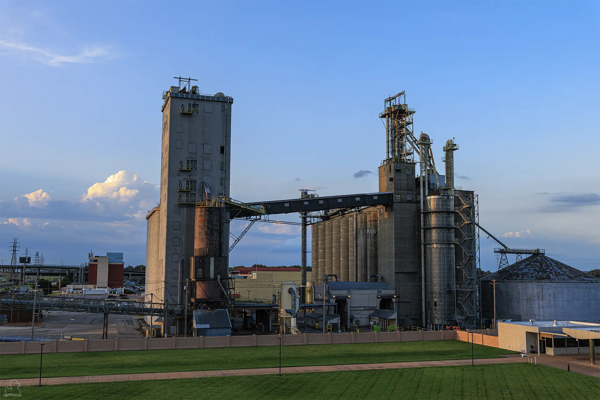
Industrial history and urban landscape on the eastern bank of the Mississippi
Directly opposite the skyline of St. Louis, on the eastern side of the Mississippi, lies the independent city of East St. Louis in the U.S. state of Illinois. Although the two cities are separated only by the river, they developed under different political, economic, and social conditions. While St. Louis in Missouri is characterized by its historic business districts, stately buildings, and the Gateway Arch, East St. Louis is largely defined by railway facilities, industrial infrastructure, and extensive transport areas along the riverfront.
The history of East St. Louis is closely tied to the expansion of the American railroad network and the industrialization of the Midwest. From a small settlement on the Mississippi, it developed in the 19th century into an important transshipment point for goods and raw materials. Large livestock markets, factories, rail facilities, and port operations formed the basis of an economically significant industrial city, whose development in the 20th century was, however, shaped by profound changes.
To this day, the monumental Cargill grain silos, the extensive freight yards, and the numerous road and rail links make this history visible. At the same time, the Malcolm W. Martin Memorial Parkan exceptional view over the Mississippi to the Gateway Arch and downtown St. Louis. It is precisely the contrast between industrial infrastructure, expansive traffic areas and the representative skyline on the opposite riverbank that makes East St. Louis a special part of the cityscape.
Read more
East St. Louis in Illinois – Between the Mississippi, industrialization and social change
The history of East St. Louisbegan long before the present-day city came into being. The eastern bank of the Mississippi is part of the extensive river lowland of the so-called American Bottom, whose fertile soils and natural transportation routes were already used by Indigenous communities. The region was closely connected to the pre-Columbian culture of Cahokia, which between the 11th and 14th centuries produced one of the most important settlement centers in North America. Archaeological studies show that settlement at that time extended over a much larger area than the monumental structures of Cahokia preserved today.
During the colonial period, various French trading posts and smaller settlements emerged along the Mississippi. The river formed the most important transportation link between the agricultural inland areas and the trading centers in the south. However, the development of today’s city of East St. Louis only began to accelerate with the economic growth of the 19th century.
The original settlement was initially known as Illinoistown. Its economic importance was based mainly on its immediate proximity to St. Louis on the west side of the river. Even before the construction of permanent bridges, ferries connected the two banks and enabled the transport of people, livestock, and trade goods. The ferry connections were an essential part of the regional economy, as numerous transport routes ended at the Mississippi and could only continue after crossing the river.
With the increasing expansion of the railroad network, the importance of the eastern bank changed fundamentally. In 1857, the Ohio and Mississippi Railroad reached the region, which tied East St. Louis more closely into the regional and national railroad network. Other railroad companies followed, so that the settlement increasingly developed into the western terminus of numerous rail connections. At the same time, its proximity to the Mississippi enabled the transfer between rail and river transport.
In the year 1861, Illinoistown was officially renamed East St. Louis. The city received a new municipal charter in 1865 and developed over the following decades into an independent economic center. The naming underscored the close relationship to the larger neighboring city in Missouri, even though the two cities did not share a common administration. This political separation continues to this day: St. Louis belongs to Missouri, whereas East St. Louis belongs to St. Clair County in the state of Illinois.
An important step in its development was brought by the opening of the Eads Bridge in 1874. The new steel bridge made it possible for the first time to have a fixed rail connection across the Mississippi at St. Louis. This eliminated a major disadvantage of the previous ferry service, in which railroad cars had to be laboriously transported between the two banks. The direct link to the transport routes on the Missouri side strengthened East St. Louis as a railroad hub and created additional conditions for industrial investment.
Already in the 1870s, large livestock trading and meat-processing businesses emerged in the area around the city. The National Stock Yards, which opened in the neighboring area of the later National City in 1873, developed into one of the most important livestock trading centers in the United States. Although these facilities did not belong to the actual city area of East St. Louis, they were closely connected to the city economically and socially. Thousands of employees worked in the livestock markets, slaughterhouses, and adjacent businesses.
In the following decades, further industries were added. Companies from the metalworking, chemical industry, glass manufacturing, and railway engineeringtook advantage of the favorable location between the Mississippi and the major rail connections. The economic expansion attracted numerous workers and led to strong population growth. By the turn of the 20th century, East St. Louis was one of the most important industrial locations in Illinois.
However, the rapid growth also brought considerable social tensions. The city was marked by strong economic disparities, difficult working conditions, and intense competition for jobs. During the so-called Great Migrationnumerous African Americans moved from the southern states to the industrial centers of the North and Midwest. They sought employment opportunities and hoped to escape the racist laws and violence in the South.
In East St. Louis, the newly arrived people encountered a labor market in which companies sometimes deliberately exploited racial tensions to weaken organized workers. Competition for jobs was intensified by racial prejudice and political interests. In the summer of 1917, these tensions culminated in the East St. Louis massacre, one of the worst racially motivated acts of violence in early 20th-century American history.
On July 2 and in the days that followed, white mobs attacked African American residents, destroyed homes and businesses, and killed numerous people. The exact number of victims is still unknown; historical estimates range from several dozen to more than one hundred fatalities. Thousands of African American residents fled the city. The events sparked nationwide protests and became an important point of reference for the early American civil rights movement. The massacre is inseparably linked to the history of East St. Louis and illustrates the social contradictions of industrialization at the time.
Despite these events, East St. Louis initially remained an important economic center. The railroads, industrial plants, and livestock markets continued to employ numerous people. In 1950, more than 82,000 residents lived in East St. Louis. In 1958, the city was awarded the All-America City, with which civic engagement and the development of urban communities were honored.
In the second half of the 20th century, however, the economic conditions changed fundamentally. The increasing automation of industrial production processes, the relocation of companies, and the decline of traditional industrial and transport sectors led to significant job losses. At the same time, the expansion of suburban residential areas outside the old city centers encouraged the departure of residents and companies.
The economic consequences were profound. Declining tax revenues made it more difficult to finance public institutions, while vacant commercial and residential buildings increasingly became part of the cityscape. The existing social inequalities were further exacerbated by the loss of industrial jobs. According to the 2020 census, there were still 18,469 residents, leaving the city significantly smaller than its former population size.
However, the economic transformation cannot be reduced to a simple story of decline. East St. Louis remained part of the regional transportation and economic structure. Various industrial and logistics companies continue to take advantage of the proximity to the Mississippi and to major transportation routes. At the same time, initiatives emerged to stabilize the economy, improve housing conditions, and redesign public spaces.
The present-day cityscape of East St. Louisdocuments different phases of American economic and social history. Historic industrial districts, modern transport routes, residential neighborhoods, and public green spaces are situated in close proximity to one another. The city has its own history and identity that extend far beyond its role as the opposite bank of St. Louis.
Industry on the Mississippi – rail traffic, Cargill grain silos, and historic port facilities
The industrial history of East St. Louisis inextricably linked to its exceptional transport location. On the eastern bank of the Mississippi, numerous railway lines met the waterways of the American interior as early as the 19th century. This connection created favorable conditions for the storage, processing, and onward transport of large quantities of goods. In particular, companies dependent on heavy raw materials or the transport of agricultural products benefited from the immediate proximity between the river and rail traffic.
The first major rail connections reached East St. Louis in the 1850s. Within just a few decades, the city developed into one of the most important rail hubs in the Midwest. Around the turn of the 20th century, routes of numerous railway companies ended or began here. In 1905, East St. Louis had connections from around 27 railway companies, linking the location with the major industrial and commercial centers of the United States.
A special importance was attached to freight transport. While St. Louis in Missouri grew as a business, trade, and administrative center, extensive classification yards, workshops, and industrial transshipment facilitiesemerged on the Illinois side. Freight trains transported coal, metals, livestock, agricultural products, and finished industrial goods between the different regions of North America.
Railway transport was thus not only a means of transportation, but also an essential foundation of industrial development. Companies were able to obtain raw materials in large quantities and sell their products over long distances. At the same time, jobs were created in shunting operations, in railway workshops, in locomotive maintenance, and in the numerous businesses that depended directly on the transport sector.
Especially the National Stock Yards in neighboring National Cityopened in 1873 made the region an important center of American livestock trading. The vast facilities were designed for the transport and marketing of cattle, pigs, and sheep. Livestock shipments from agricultural regions reached the site by rail, while meat processing plants took over the animals and sent the products obtained from them to different parts of the country.
The National Stock Yards developed at times into one of the largest livestock trading centers in the country. Their economic significance extended far beyond the actual operating grounds. Employees lived in East St. Louis and the neighboring communities, smaller commercial businesses supplied the industrial workers, and numerous transport companies were involved in the transport of goods. The decline of the major livestock markets began as early as the middle of the 20th century; In 1997, the operation of the National Stock Yards was permanently discontinued.
In addition to the meat industry, other industrial sectors shaped the region. Metalworking and steel production required large quantities of coal and ore, while chemical companies depended on efficient transport routes. The proximity to the railroads and the Mississippi facilitated the supply of these businesses. This gave rise to an industrial landscape in which factories, storage areas, railroad tracks, and port facilities stood directly next to one another.
The natural conditions of the eastern riverbank also influenced development. Large parts of the American Bottom lie in a flat lowland that historically was regularly affected by flooding. Especially the Mississippi flood of 1903caused significant damage in East St. Louis. In the following decades, levees, drainage systems, and other protective structures were built to better safeguard the industrial and residential areas against flooding.
To this day, this largely flat landscape determines the spatial structure of the eastern Mississippi riverbank. Unlike the partly elevated west bank of St. Louis, industrial and transport areas here often have only slight natural differences in elevation. Large marshalling yards, harbor basins, and transshipment sites could therefore be laid out on contiguous areas. At the same time, the proximity to the river required extensive hydraulic engineering measures.
A striking example of the still visible industrial infrastructure is the Cargill grain silos on the Mississippi in East St. Louis. The monumental concrete structures are among the most striking buildings along the eastern riverbank. Tall silo towers, cylindrical storage bins, and sweeping conveyor systems characterize the facility and make its original, industrial function apparent from the outside.
Grain silos fulfill an essential task within American agricultural trade. Agricultural products such as corn, wheat, or soybeans often have to be stored in large quantities in between before they can be transported for further processing or sale. Storage in enclosed silo cells makes it possible to hold large quantities on comparatively small areas of land and to organize the flow of goods independently of individual harvest or transport dates.
The Cargill facility’s special location combines rail transport and inland shipping. Grain can be delivered via connected railway tracks and then transported into the silo bins by mechanical conveyor systems. From there, enclosed conveyor bridges enable onward transport to the riverbank. At the loading and transshipment facilities there, inland vessels or barges can be loaded or unloaded.
The Mississippi has particular economic significance within this transport system. Large tow convoys can carry substantial quantities of bulk goods over long distances at comparatively low cost. The connection to the ports located farther south on the Gulf of Mexico also opens access to international markets. The grain silos of East St. Louisthus stand as an example of the role of the American interior in national and international agricultural trade.
Architecturally, too, these facilities differ markedly from ordinary commercial buildings. Their design follows almost exclusively functional requirements. The tall vertical silo cells use the available ground area as efficiently as possible, while conveyor bridges, maintenance towers, and technical superstructures connect the various production and transport processes.
From a distance, the concrete structures appear as compact, nearly closed forms. On closer inspection, however, their complex structure becomes visible. Stairways, conveyor belts, pipelines, and technical frameworksform a finely articulated system whose individual components are coordinated with different functions within grain handling.
The monumental dimensions of these industrial buildings create a striking contrast with the surrounding green spaces and transport routes. This contrast is especially evident at the western edge of Malcolm W. Martin Memorial Park. The large silos rise up behind lower buildings, while in front of them lie broad lawns and the river landscape of the Mississippi.
In the evening hours, the effect of the facility changes considerably. The low sun highlights individual concrete surfaces and makes the technical structures appear more three-dimensional in the side light. At the same time, the silos stand out against the sky as clear geometric forms. The industrial architecture of East St. Louisthus acquires a visual impact that differs clearly from its purely functional use.
Weather conditions can also greatly alter this effect. Approaching thunderclouds, dark areas of sky, and isolated reflections of light create a striking contrast to the bright silo walls and the delicate steel structures. Especially at dusk, this creates an atmosphere in which the technical structure of the industrial facility and the natural changes in the river landscape meet directly.
The Cargill grain silos on the Mississippithus document an important part of the economic and transport history of East St. Louis. Together with the large rail yards, the road bridges, and the transshipment facilities, they illustrate that the eastern riverbank has remained a significant part of the regional infrastructure even after the decline of numerous traditional industries.
Malcolm W. Martin Memorial Park – Gateway Arch and skyline from the Illinois side
One of the most unusual perspectives on the St. Louis skyline opens up from the Malcolm W. Martin Memorial Park in East St. Louis. The public park lies directly on the eastern bank of the Mississippi, opposite Gateway Arch National Park. From here, the center of St. Louis can be seen almost in its entirety. The Gateway Arch rises in front of the skyscrapers of Downtown, while the river forms a broad spatial divide between the two cities.
The creation of the park is closely linked to the commitment of the American lawyer and philanthropist Malcolm W. Martin. Martin worked for decades to ensure that the eastern bank of the Mississippi would also be more strongly included in the design of public urban space. His goal was to make the relationship between St. Louis in Missouri and East St. Louis in Illinois visible not only through transportation and industrial facilities, but also to create a publicly accessible viewpoint.
Even the architect of the Gateway Arch, Eero Saarinen, had developed ideas that went beyond the immediate design of the western riverbank. Martin took up the idea of a stronger spatial connection between the two banks and founded the Gateway Center of Metropolitan St. Louis in 1968, a nonprofit organization dedicated to the preservation and development of the corresponding property on the Illinois side.
An important step was the construction of the Gateway Geyser, a monumental water fountain that was commissioned on May 27, 1995. The facility was designed so that, under suitable conditions, its jet of water could reach a height of up to 192 meters. This was intended to echo the height of the Gateway Arch and establish a visible connection between both banks of the river.
The fountain was accompanied by four smaller water jets, whose design referred to the major rivers of the region: Mississippi, Missouri, Illinois, and Meramec River. For many years, the Gateway Geyser was a well-known attraction on the eastern riverbank and was among the tallest artificial water fountains in the world.
Over time, however, the technical facilities became increasingly maintenance-intensive. After almost three decades of operation, the responsible organizations decided against further use for economic and ecological reasons. At the end of 2023, the end of regular operations of the Gateway Geyser was announced.Nevertheless, the history of the fountain remains closely linked to the creation of the present-day park.
Parallel to the development of the water feature, a larger public green space was created. The property originally managed by the Gateway Center was transferred to the Metro East Park and Recreation District in 2004. In the years that followed, landscaping was carried out, which ultimately resulted in the establishment of the Malcolm W. Martin Memorial Park. The park was opened for its current use in 2009.
One of the most important features is the Mississippi River Overlook, an elevated viewing platform that was also completed in 2009. The structure, about 13 meters high, has several levels and offers an unobstructed view across the river to the skyline of St. Louis. Its design was deliberately chosen so that visitors can view the Gateway Arch from different heights.
The platform thus offers a special perspective on the city’s best-known landmark. While the Gateway Arch impresses up close above all through its immense dimensions and unusual geometry, its form can be fully appreciated from the Illinois side. Both legs of the arch appear in a largely symmetrical view that particularly emphasizes the architectural character of the monument.
Directly behind the arch rises the skyline of Downtown St. Louis. Depending on the viewing angle, the historic Old Courthouse, modern office towers, and other downtown buildings become visible. The varied heights of the architecture create an interesting backdrop, while the Gateway Arch stands in the foreground as a clear, closed form.
Especially the historic dome of the Old Courthousecreates a striking contrast to the modern steel structure. Both buildings stand for different phases of St. Louis’s development. The Courthouse recalls the city’s economic rise in the 19th century and significant events in American legal history. The Gateway Arch, by contrast, is an architectural monument of the 20th century that symbolizes St. Louis’s role in westward expansion.
The Mississippi runs between the observation point and the skyline. Its broad expanse of water forms a natural divide, while at the same time highlighting the economic and geographic connection between the two cities. For centuries, the river has been one of the most important reasons for the emergence and development of the entire region. Even today, it is intensively used for freight traffic.
The surroundings of Malcolm W. Martin Memorial Park make this economic significance especially visible. Immediately beside the well-kept green spaces rise the Cargill grain silos, while extensive transport and industrial facilities lie farther north and south. Conveyor bridges lead to the transshipment points on the river, railway tracks run behind the riverside facilities, and major road connections cut through the flat landscape of the American Bottom.
It is precisely this proximity that gives the park its special character. The site is not a recreational area completely separated from the city, but part of an environment still shaped by industry and transport. The juxtaposition of public green space, grain silos, and the historic skyline highlights the different functions of the Mississippi riverfront.
For the Photograph of the Gateway Arch and the skyline of St. Louisthe Malcolm W. Martin Memorial Park offers particularly favorable conditions. From the Illinois side, the monument can be captured together with the downtown area without the individual legs of the arch being strongly distorted by perspective due to the close proximity. The greater distance also makes it possible to place the architecture of the Gateway Arch in its urban context.
In daylight, the geometric forms of the buildings and the structure of the skyline come to the fore. The stainless-steel surface of the Gateway Arch reflects the natural light and stands out clearly against the darker facades of the surrounding high-rises. Depending on the weather, different contrasts emerge between the silver-colored arch, the sky, and the surface of the Mississippi.
The industrial elements along the riverbank also expand the photographic possibilities. High-voltage pylons, harbor facilities, and historic bridge structures can be included as components of a deliberately documentary depiction. They make clear that the skyline does not have to be viewed in isolation, but is part of a larger urban landscape shaped by commerce and infrastructure.
From an elevated perspective, for example from the observation deck of the Gateway Arch on the Missouri side, there is a reverse view of East St. Louis. From there, the extensive railway facilities, highway interchanges, industrial areas, and green spaces of the Illinois side become visible. In particular, the immediate proximity of the Cargill silos and the Malcolm W. Martin Memorial Park can be clearly understood from this perspective.
The two viewing directions therefore complement each other. While the view from East St. Louis to the west shows the representative skyline and the Gateway Arch, the view from the Gateway Arch to the east illustrates the industrial and transport infrastructure of the opposite riverbank. Together they create a comprehensive impression of a region whose development has for centuries depended on the close connection between Mississippi, trade, industry and transportis based.
The Malcolm W. Martin Memorial Parkthus has a significance that goes beyond its function as a viewpoint. It creates public access to a riverfront landscape that for a long time was predominantly shaped by economic use, and at the same time opens up an exceptional perspective on one of the most famous architectural monuments in the United States. East St. Louis thus becomes not only the location of a viewpoint, but an independent part of the history and perception of the entire metropolitan region.